

Sunday:
We have some clouds streaming in this morning with lighter winds. We will have partly cloudy skies for the day with highs into the 50s at the base and 40s up top.
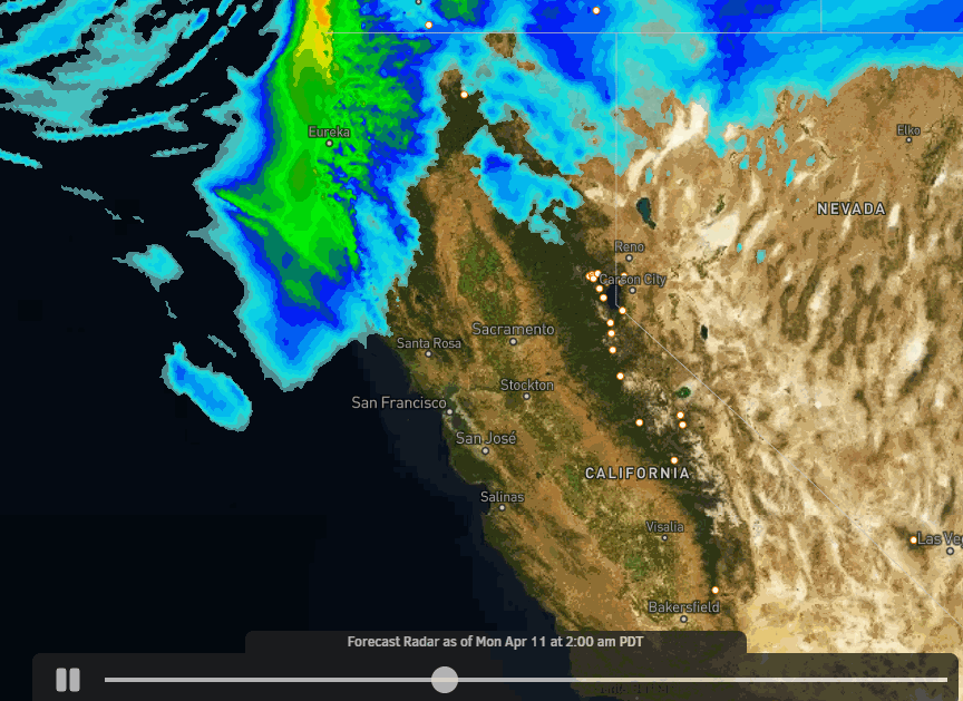
Monday Storm:
A cold trough is over the West through most of the week bringing in colder air and an unsettled pattern. Highs only in the 30s at the base and 20s up top Monday. A storm will dive into CA with snow arriving to the mountain around 4-6 AM Monday morning. The heaviest snow could fall late morning into the early afternoon Monday with the cold front with snow showers lingering into the evening before clearing later in the evening.
We could see winds gusting up to 120+ mph up top which should close several lifts on the mountain for Monday. The snow levels should start near to below the base and then continue to fall into Monday night with the snow becoming powdery on the upper mountain. The strong winds will be blowing the snow around and make it feel even colder than the air temperatures.
The latest model runs continue to trend up with the snowfall forecasts. By Tuesday morning we could see 5-9 inches of fresh snow at the base, and 9-16 inches on the mountain!
Tuesday – Wednesday:
We stay cold with highs in the 30s at the base and 20s up top. There’s a chance for weak systems to keep a few clouds & isolated snow showers around Tue – Wed. Ridgetop winds could still be breezy with gusts from the west up to 40+ mph up top Tuesday & 50+ mph later in the day Wednesday ahead of the next storm.
Wednesday Night – Thursday Storm:
The next storm moves in Wednesday night into Thursday with more snow for the mountain. The snow should move in during the evening with snow overnight into Thursday, and snow showers could linger until Thursday evening before clearing Thursday night.
It stays cold with highs only in the 30s at the base and 20s up top. The winds crank up again for Thursday with gusts from the southwest up to 90+ mph up top. That will likely close some lifts again. The snow levels should start out well below the base. They could approach the base or just above as some warmer air works in Thursday and then fall again towards the end.
We could see an additional 2-6 inches at the base and 5-10 inches on the mountain by Thursday evening. That would bring totals for the week to around 7-15 inches at the base and 15-30+ inches on the mountain. A nice refresh of the slopes if the forecast holds!
Long-Range:
The latest model runs are now suggesting a 3rd storm could bring some snow to the mountain Friday into Friday night. This system looks weaker than the first two right now, but we’ll continue to watch the trends as we get closer. Definitely and cold and wintry week ahead, especially by April standards.
The pattern could start to become warmer & drier again the weekend of the 16th into the week of the 18th. That should bring nicer weather for Easter Sunday.
The pattern could become more unsettled later in the month with systems possibly tracking far enough south to bring more rain & snow to the area. We’ll continue to watch the trends for the last week of April.
BA
