

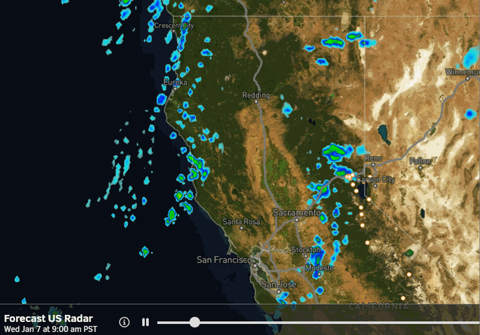
Wednesday – Wednesday Night Snow Showers:
The first very weak system is moving into northern CA Wednesday morning, trying to push some snow showers into the northern Sierra. We are not expecting much snow during the day on Wednesday, with maybe a dusting at the base up to 2 inches up top.
Highs in the 30s for the lower elevations and 20s for the higher elevations. We aren’t expecting strong winds during the day, but they increase later in the afternoon into Wednesday night ahead of the next system, with gusts from the west up to 60-70+ mph over the ridges overnight.
The cold front sweeping through on Wednesday night will bring a better chance for steadier snow showers moving through. That will bring higher snow ratios, up to 16:1 or better above 8k’, which can fluff up snowfall amounts from the small amount of precipitation that falls.
My snowfall forecast hasn’t changed much from yesterday. Still expecting around 1-4 inches at the base and 3-6 inches on the upper mountain by Thursday morning.
Thursday Weather:
This will be a quick shot of a small amount of powdery snow on Wednesday night, with the snow showers clearing out Thursday morning. Highs only in the 20s on Thursday behind the front, as the sun returns. The winds also drop into Thursday.
It might be a good morning to get some fresh tracks, as it has stayed fairly cold on the upper mountain since the weekend storms, and I don’t think it will be that firm under the fresh snow.
Drier and Warming:
As high pressure strengthens over the region into the Weekend, and anchors there into next week, we expect sunny days to continue and highs to warm into the 30s on Friday & Saturday, and 40s for the lower elevations by Sunday into next week.
Long-Range Outlook:
The high-pressure ridge is still forecast to start shifting NW between the 15th and 20th of January. Through the 20th, it looks to stay close enough to the West Coast to continue blocking storms, but we will start to see some colder air work in from the north.
If the latest ensemble mean model forecasts, for the center of the ridge to be near the Aleutians by the 21st, verify, it could be far enough west going into the 4th week of January to allow storms to dig down from the north into the western trough.
This is only IF the ridge shifts far enough NW, it may take a bit longer than the models are suggesting. But it’s interesting for sure. As we go through the last 7 days of January, the longer-range models continue to show the ridge/trough pattern backing up far enough for storms to return to CA.
We will continue to hope that the current long-range model forecasts are onto something with the pattern change during the last 10 days of January. But we won’t get too excited yet, as the forecast models tend to struggle beyond 7-10 days.
BA
