

Final Week of Dry Weather?
We will continue to be in the same pattern through the end of the week and at least into the start of the weekend, with high pressure dominating the weather pattern over the West, and the cold trough over the East. Most sunny days continue with highs in the 40s on the mountain to near 50 degrees at the base.
The latest European model run shows precipitation from the first storm possibly showing up as early as Sunday afternoon, but most models still hold off until Monday, so I’ll keep that beyond the 7-day forecast period. But we’ll also keep an eye on the trends all week.
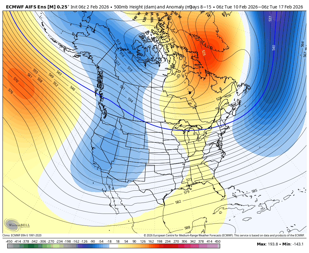
Week 2 Pattern Change?
We’ve been talking for quite a while about the pattern starting to shift during the week of the 9th, and it’s finally only a week away. The latest model runs continue to consistently show the ridge over the West weakening and sliding east, being replaced by a trough early next week. The initial trough may shift east by the end of next week, but is forecast to be quickly replaced by Valentine’s Day weekend.
That pattern is not the best for big wet storms to spin up off the West Coast, pulling in lots of Pacific moisture. The ridge is too close to the coast. But the trough is forecast to be far enough west for some colder air next week, with highs dropping into the 30s, maybe even 20s for the higher elevations, and far enough west to bring a wetter pattern back to the Pacific NW. But likely smaller storms from the NW for northern CA.
The latest forecast model runs suggest that we could see the door opening to a couple of small storms from the NW next week, between Mon – Wed, a break Thu – Fri, and then another storm moving through over Valentine’s Day weekend.
The OpenSnow PEAKS model shows up to 1.5″ of total precipitation over Palisades over the 7-day period, only an average of around 5 tenths of an inch per storm, so not big storms. But after over a month of a dry pattern, it’s a welcome sight to see a more active week possibly setting up for next week, even if we only measure the snow in inches.
We’ll continue to watch the trends closely over the next week, and if we keep storms in the forecast for early next week, I’ll dig into the potential snowfall by elevation by the end of this week. I’ll also be posting daily again as we have potential storms within a week.
BA
