

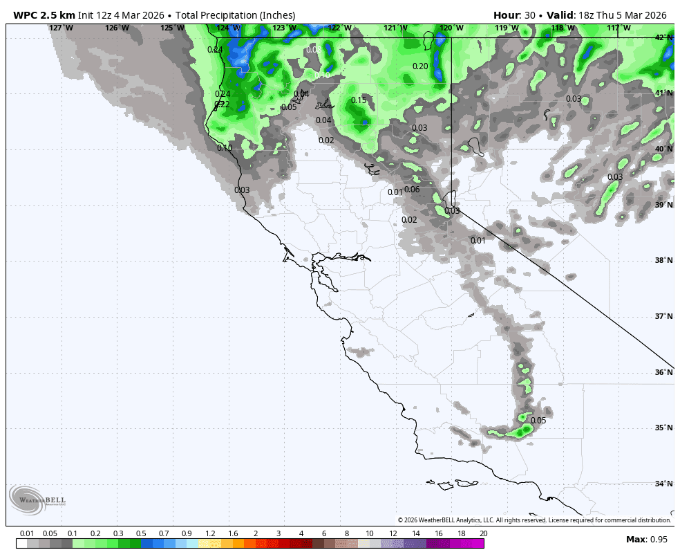
Wednesday Front:
We have precipitation moving through northern CA on Wednesday with a front that may bring a few showers as far south as the Tahoe Basin Wednesday afternoon.
Total precipitation forecasts remain very low, around a tenth of an inch near the crest on the high-end. Highs in the 40s for the lower elevations and 30s for the upper mountain. Ridgetop winds from the SW gusting up to 60-70+ mph during the day, which could affect some lift operations.
The snow levels start high on Wednesday morning but fall below the base by evening. That could bring a few snow showers to the mountain, with maybe a dusting to a coating of snow by evening.
Thursday – Sunday:
Mostly sunny skies are expected for Thursday into the weekend, but staying cool with highs in the 40s for the lower elevations and 30s for the higher elevations. Northeast winds will be breezy, making it feel a bit colder. Ridgetop gusts up to 30-40+ mph on Thursday and increasing up to 50-60+ mph by Saturday.
By Sunday, we do expect some milder temperatures with highs into the 50s along with lighter winds.
Next Week:
Next week, we should see a cold trough dig south into the West, but mainly to the east of CA, with a high-pressure ridge sitting near the West Coast. That could still cool our temperatures slightly with highs dropping back down into the 40s.
The storm track looks to be to our north into the Pacific NW and then south through the Rockies. Some models show a storm getting close to us, but just about all of them keep the precipitation to our north and east with a dry pattern through the 2nd week of March.
Long-Range Outlook:
Going through the 3rd week of March, the GFS ensemble mean model this morning is showing a trough pushing in close to the West Coast, close enough that the GFS operational model is showing a storm pushing into the West Coast around the 18th-19th.
I’m not buying into the eastern Pacific trough pushing that close to the West Coast, with the ridge expected to shift east from off to the coast to over the West during this period, and a cold trough possible for the eastern U.S. after a taste of spring. This is shown by most long-range models, including the GFS’s AI ensemble mean.
I would prefer the GFS model’s idea of a storm possible that week, but that doesn’t seem likely as of today, and we are likely stuck in this drier pattern for the next 2+ weeks. But we’ll watch closely for any changes.
BA
