Skip to content
Palisades Tahoe Logo Palisades Tahoe Logo Palisades Tahoe Logo
Explore
Main Menu
  • Explore Palisades Tahoe
  • Base to Base Gondola
  • Our New Name
  • Explore Legendary Lifts
  • Palisades Tahoe Blog
  • About Lake Tahoe
  • About Us
Plan Your Visit
Main Menu
  • Tickets & Passes
  • Lodging
  • Lessons & Guides
  • Deals & Packages
  • Rentals & Demos
  • Travel Here
  • Getting Around
Mountain Information
Main Menu
  • Snow and Weather
  • Lift and Grooming Status
  • Webcams
  • Hours of Operation
  • Trail Maps
  • Parking & Road Conditions
  • Snowfall Tracker
Events & Activities
Main Menu
  • Events Calendar
  • Activities
  • Dining & Apres
  • Shopping
  • Things To Do In Lake Tahoe
  • Groups, Meetings & Weddings
  • Ski & Snowboard Teams
IKON PASS HOLDER LODGING DISCOUNT

Ikon Pass holders save up to 20% on slopeside lodging at The Village at Palisades Tahoe.

SLOPESIDE LODGING
Icon / FlashCreated with Sketch.
View All Offers
  • Weather

8″ So Far, The Main Storm Moves in Mon Night

  • Nov 7, 2022
  • 10:28 am

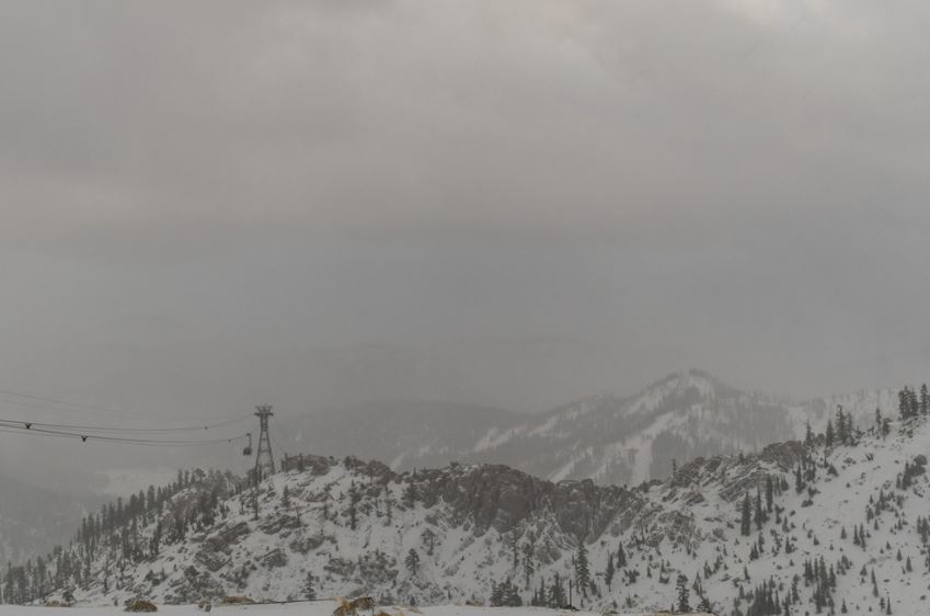
The cold front swept through during the early morning hours with high winds and a band of heavy snow. Wind gusts up to 161 mph were recorded by the sensor at the top of the mountain! The mountain picked up 8 inches of new snow overnight and 7 inches at the base.

Monday Lull:

We were expecting a lull in the snow Monday between the cold front early Monday and the cold low moving in Monday night. Snow showers are still firing Monday morning to the south of the Tahoe basin, and that is where most of the snow showers will likely be during the day. We will see some sun and clouds with scattered snow showers. 

It will be a cold day with highs into the 30s at the base and 20s for the mountain. The winds have come down some with ridgetop gusts only to 30+ mph, but the winds are expected to increase again ahead of the main low with gusts increasing up to 50-60+ mph from the southwest.

The Main Storm:

The cold low off the coast still looks impressive this morning. It will pull in moisture as it moves into CA and the air associated with it is cold. That will bring high snow ratios where the snow will pile up faster than with a warmer system. The snow showers are expected to increase again Tuesday evening and heavy snow moves in overnight into Tuesday.

The snow showers are expected to continue Tuesday night into Wednesday morning and then wane through the day, and clear out by Wednesday night. No changes to the forecast for storm totals. We are only 12 hours into this 60-hour storm system as of Monday morning. We are still expecting an additional 1-2 ft. at the base and 2-3+ ft. on the mountain through Wednesday.

It will be cold through Wednesday with highs in the 20s. Winds will still be gusty for Tuesday with ridgetop gusts up to 50-60+ mph at times. Then lighter winds are expected for Wednesday.

Thursday – Friday:

Mostly sunny but cold for both days. Highs into the 30s with lighter winds expected.

Long-Range:

The latest trends continue to show a drier pattern continuing next weekend through the week of the 14th. Any storms trying to come under the ridge in the north Pacific into the West Coast should weaken and fall apart. We’ll continue to watch the long-range for signs of a return to a more active pattern and the next snowstorm.

BA

lake tahoe weather palisades tahoe weather forecast snowfall forecast
Bryan Allegretto
Bryan Allegretto

Share this article:

Recent Posts

  • Weather ·
  • March 29, 2023·

Partly Sunny Wed-Sun w/ Snow Showers Possible

Snowfall Reports: 12 inches of new snow fell on the mountain in the past 24 hours as of 5 AM…
Read more
  • Weather ·
  • March 28, 2023·

Snow & Strong Winds Tuesday

Tuesday  – Wednesday Storm: Snow showers are pushing in Tuesday morning, with heavier snow expected later in the morning into…
Read more
  • Weather ·
  • March 27, 2023·

Snowstorm Tuesday, Snow Showers Wed-Sun

Monday: Monday will start out sunny with highs in the 30s at the base and 20s up top. Some high…
Read more

Social

Instagram Twitter Facebook Youtube

Contact

   Email Us
   1.800.403.0206

Our Partners

U.S. Forest Service Logo
1960 Olympic Valley Road
Olympic Valley, CA 96146

©2022 Palisades Tahoe

Alterra Mountain Company
  • Privacy Policy
  • Terms of Service
  • Photo Upload Terms of Use
  • Accessibility
  • Do Not Sell My Personal Information
  • Privacy Policy
  • Terms of Service
  • Photo Upload Terms of Use
  • Accessibility
  • Do Not Sell My Personal Information