

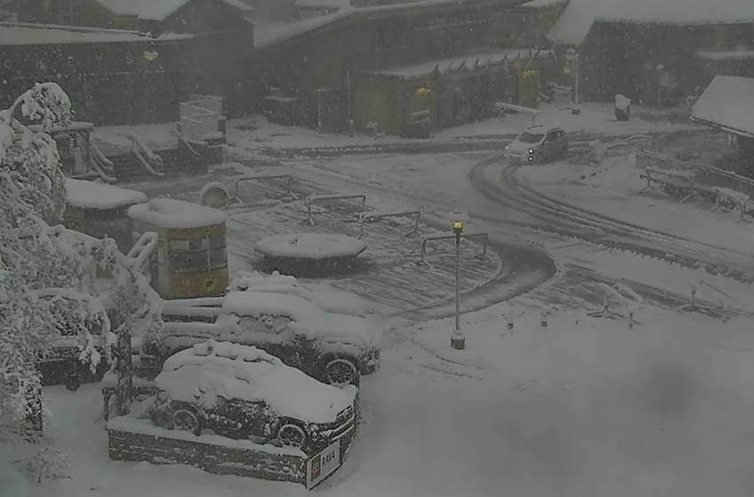
Snowfall Report:
So far the storm has dropped 5 inches at the base and 8 inches on the upper mountain as of 5 AM. Likely another 2-4+” will fall by the time the mountain opens as the heavy snow continues to fall Thursday morning.
That 8 inches brings the April total to 58 inches of snow so far, which is more than we saw during Nov, Jan, Feb, & Mar combined! It also brings the season total to 366″ so far which is around 92% of the total season average.
Thursday – Friday Storm:
Heavy snow continues Thursday with highs in the 30s. Winds gusting up to 80+ mph up top Thursday morning and falling to 40-50+ mph by the end of the day, which should delay some upper mountain lift openings. Snow levels falling below 5000 ft. Thursday night as snow showers continue.
Friday lighter scattered showers could continue into Friday afternoon before clearing out by evening. Snow levels could rise back up to 6000-7000 ft. by afternoon with a few rain showers possible at the base at the end of the storm. Highs in the 30s with lighter winds expected for Friday.
We could see an additional 10-20 inches of snow by Friday.
The Weekend:
The weather will be nicer over the weekend as high pressure builds in. We should see sunny skies and highs warming into the 40s Saturday and then 50s at the base for Sunday. We should have lighter winds as well.
Long-Range:
The nice weather should continue next week.
The storm track could be just to our north by the end of the month into early May, so we will have to watch for any possible storms trying to dip into northern CA.
BA
