Wednesday Weather:
We have one last day of sun and mild temperatures on Wednesday. Highs into the 40s. Ridgetop winds from the southwest will start to increase through the day, gusting up to 40-50+ mph by late afternoon. This is your day to get prepared for the big snowfall.
Thursday – Saturday Storm:
It was pretty amazing this morning to wake up and see all the models trending wetter and colder with the storm after it was already looking like a big storm. There is pretty remarkable consistency and agreement among the models, which is lending to confidence in the snowfall forecasts.
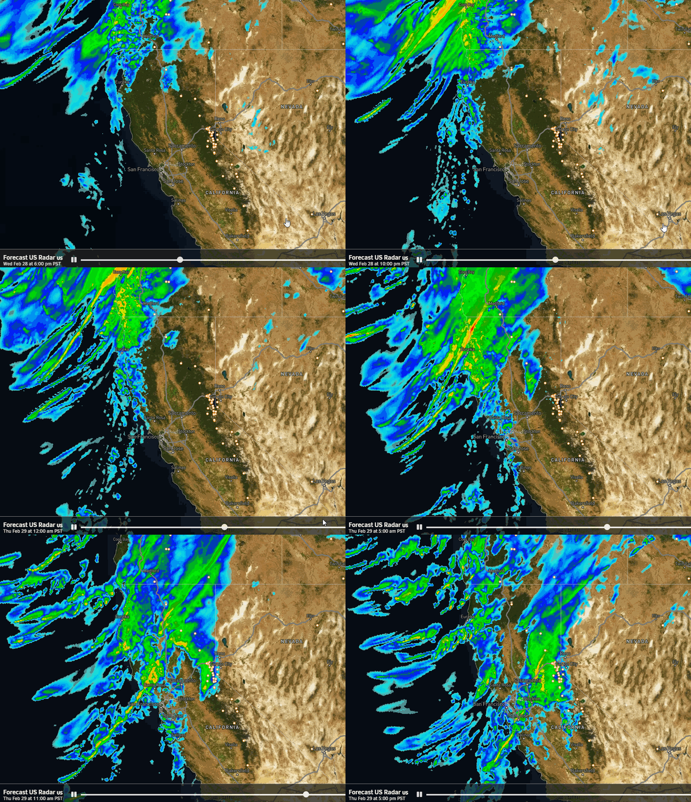
The latest model runs show snow showers reaching the mountain around 4-7 AM Thursday morning. The snow starts off lighter and increases in intensity through Thursday afternoon, with the heavier snow pushing in Thursday night. The heaviest snow looks to fall Thursday night and Friday night, and Saturday we could see moderate-heavy bands of snow moving through that could diminish down to lighter showers Saturday night into Sunday morning.
Winds will be gusting over 100 mph up top through Friday closing several ski lifts and blowing the snow creating blizzard conditions. The mountain could close on Friday to deal with the heavy snow and high winds. Highs in the 30s Thursday and then 20s for the upper mountain Friday. Saturday the winds could still be gusting up to 60-70+ mph over the ridges for much of the day. Highs drop into the 20s.
We are less than 24 hours from the start of the storm and the trend is wetter and colder for the storm. Snow levels look to start near the base and then drop lower through the storm. That will start us with denser snow that becomes more powdery through the end of the storm. The heavy precipitation & cold temperatures will combine to bring up to:
- 5-6 feet of snow near the base
- 6-7 feet near mid-mountain
- 7-8+ feet up top by Sunday morning!
Sunday – Monday Weather:
Sunday should be the best day of the weekend for skiing as the strong winds finally come down and we could see some clearing with partly sunny skies and scattered snow showers with highs in the 20s. Moisture from the next storm could reach us by Monday. It could be similar to Sunday with partly sunny skies and scattered snow showers. Highs warming into the 30s for the lower elevations.
Long-Range Forecast:
The long-range models continue to show troughs digging into the West Coast through the 11th-12th. That would keep the storm door open. The latest model runs have sped up the arrival of the next possible storm to Tuesday with another storm possible by next Thursday the 7th and snow showers in between Wednesday. Some models hold that second storm off until next Friday the 8th.
The long-range models still show a final trough and storm digging into northern CA around the 10th-11th. The pattern should start to change by mid-month or slightly earlier. Not necessarily to a dry pattern, but it could be drier. If we see storms we could be heading back toward milder storms. But that is way off in the long range and we have a BIG snowstorm inbound to watch.
BA
Last chance for the 4-Day Lift Pack


