Snowfall Report:
The warm part of the storm moved through overnight with rain to start for the base and now snow as of 7 AM Thursday. Only an inch of wet snow at the base so far, with 4 inches of new snow falling overnight on the upper mountain.
Thursday – Friday Snow:
The snow levels are now below the base and the snow showers will continue through Friday and into Friday night for some areas. Highs will be in the low 30s at the base and 20s for the upper mountain. The winds are coming down on Thursday. They could increase a bit Friday as another wave of steadier precipitation moves through, with ridgetop gusts from the west up to 50-60+ mph.
The steadiest snow showers are expected Thursday morning and again on Friday, with more scattered showers later Thursday and Friday night. The snow levels will stay below the base, with snow ratios averaging around 10-16:1 between the base and 9000 ft. over the 2-day period, which means some drier lighter-density snow for the upper mountain.
We could see an additional 5-10 inches of snow at the base, 8-13 inches near mid-mountain, and 10-15 inches on the upper mountain by Saturday morning.
Saturday:
Some models show some scattered snow showers for Saturday. But we should see some sun with partly sunny skies expected. Highs in the 20s for the upper mountain and 30s near the base.
Sunday – Monday Storm:
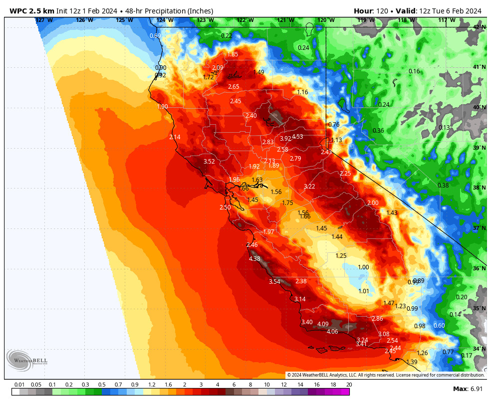
Snow from the next storm could move in between 5-9 AM on Sunday morning, and then increasing through the day with heavier snow expected through Monday, and snow showers into Monday night.
Highs in the 20s up on the mountain for both days and near freezing down at the base. Warmer air will try to surge north on Sunday night, but the latest model runs max snow levels out around 6000-6500 ft. briefly early Monday morning before falling, so we could stay all snow at the base due to the heavy precipitation rates helping to drag the snow levels down.
Ridgetop winds are not forecast to be that strong on Sunday but could increase from the south-southwest on Monday with gusts up to 60-70+ mph now, which could close some upper mountain lifts. Then dropping off on Tuesday for what should be a great powder day.
Snow ratios could average around 10-17:1 for the 2-day storm, which will start us out with powdery snow and back to powdery snow later Monday. We could see some impressive 2-day storm totals by early Tuesday morning of around 23-29 inches at the base, 30-37 inches near mid-mountain, and 35-43 inches on the upper mountain!
Long-Range Forecast:
The trough will hang around over CA through around the 9th. That will keep temperatures on the colder side through the period, and it will keep the door open to additional storms dropping into the trough through CA.
We could see snow showers Tuesday from the lingering low-pressure system. Then the models are mixed on how many weaker systems could move through Wed-Fri, but we could see additional waves with some snow showers.
By the weekend of the 10th-11th high pressure is still forecast to start building in over the West Coast starting a drier pattern. That pattern could last through mid-month. So if you want some powder days, get up on the mountains over the next week.
We are watching the long-range closely to see when the next active pattern could arrive later in the month.
BA


