

Wednesday – Thursday Rain:
A warm subtropical storm is spinning up off the SoCal coast on Wednesday morning. That will be drawing up subtropical moisture with rain showers arriving later in the day on Wednesday, and continuing through Thursday evening.
Highs will remain in the 40s for the lower elevations, with 30s for the upper mountain. The southerly flow and winds from the south with this system will be fairly weak for a storm, which will limit the amount of precipitation that spills over the Sierra crest across the Tahoe Basin.
Warm air will be flowing north with this system, along with a lack of heavy precipitation to help drag snow levels down. They may start up above 9500 ft. Wednesday evening before falling near 8500-9000 ft. by Thursday morning, and possibly dipping as low as 7000-7500 ft. by the end Thursday evening only due to some colder air near the center of the low as it moves north through the region.
By the time the snow levels fall, most of the precipitation will be done, so not expecting more than a coating below 8000 ft. by early Friday morning as the precipitation clears out. Above 8k’ we could see a 1-4 inches of wet snow, with the highest amounts on the peaks.
Friday Break:
One of the changes this morning among the models is to speed up the departure of the Wed-Thu storm, and to slow the arrival of the next storm until Saturday morning. That means we could see a break with partly-mostly cloudy skies on Friday. Highs in the 40s for the lower elevations and 30s for the higher elevations.
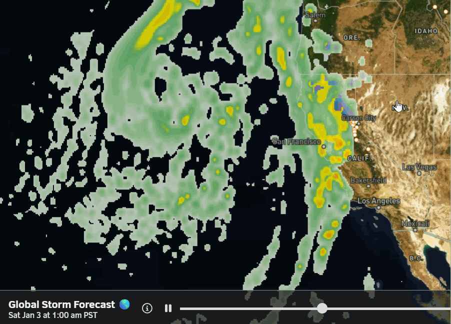
Saturday – Monday Storms:
The last couple of days, the models were showing a storm moving through from west to east through northern CA Friday night and Saturday, bringing a shot of heavy snow and falling snow levels. Now, they show the center of low pressure spinning off the Pacific NW coast and moving north, with another low dropping in off the coast and not moving inland until Monday.
That will help to send multiple waves into northern CA and to draw in some subtropical moisture with each. This scenario means a longer storm series with rain and snow moving in by Saturday morning, and possibly lasting into Monday night, bringing us a 3-day storm. But a lack of colder air moving in until Monday, with marginal snow levels for the lower mountain down to the base through Sunday.
The good news is that these storms are colder than the Wed-Thu storm, so the upper mountain looks to have some appreciable snowfall coming. Snow levels on the latest model runs start near 7500-8000 ft. Saturday morning, fall to around 7200-7700 ft. by evening, and then fluctuate between 6500-7000 ft. through Sunday. That means possibly all rain at the base through Sunday.
Then Sunday night into Monday, the snow levels are forecast to drop to 6000-6500 ft. and 5500-6000 ft. by Monday evening. That is when we could see wet snow start to accumulate down to the base. There are some lower snow level forecasts on some models, but be wary, as the trend is warmer this morning. Hopefully, we trend a little colder as the storms get closer.
Based on this morning’s model run average for precipitation and snow levels, we could see 6-11 inches of snow at the base by Monday night, mostly falling on Monday. We should see a big jump above 7000 ft. if we stay mostly all snow down to 7k’, with 22-28 inches of snow possible near mid-mountain, and 28-35 inches up top over the 3-day period.
Highs drop into the 30s down to the lower elevations over the weekend, with 20s above 8k’ on Monday. The ridgetop winds could be quite strong during the 3-day storm series, possibly affecting upper mountain lift operations through the weekend.
Long-Range Outlook:
The long-range models continue to show the trough hanging around the West Coast through the 8th of January. But they disagree on whether or not we will see another storm beyond Monday, the 5th. Some model runs show a wetter system possibly moving in from the west, others suggest a weaker system from the north, and a few show nothing. We’ll continue to watch the trends.
By day 10 through the 15th of January, the longer-range models continue to show high pressure building in over the West Coast, with the highest heights to the north towards the Gulf of Alaska. Some of the previous scenarios of storms possibly undercutting that ridge into CA beyond the 8th have mostly faded, with the ridge centered a bit farther south.
Most of the ensemble mean models are showing us going into a drier pattern. That doesn’t mean a storm doesn’t reach CA at some point, but after being beaten up as it encounters high pressure, and likely to be weak if anything. We’ll continue to watch the trends to see if this drier pattern will be a lock by mid-month.
BA
