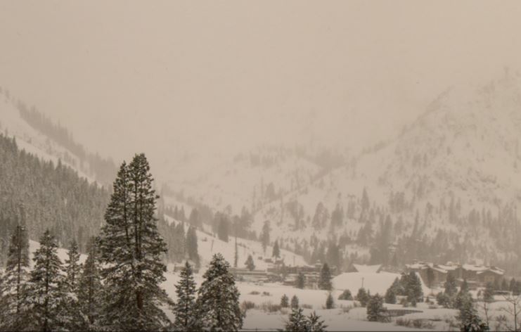
Palisades Tahoe Logo Palisades Tahoe Logo Palisades Tahoe Logo
Explore
  • Explore Palisades Tahoe
  • Our New Name
  • Explore Legendary Lifts
  • Palisades Tahoe Blog
  • About Lake Tahoe
  • About Us
Plan Your Visit
  • Tickets & Passes
  • Lodging
  • Lessons & Guides
  • Deals & Packages
  • Rentals & Demos
  • Travel Here
  • Getting Around
Mountain Information
  • Snow and Weather
  • Lift and Grooming Status
  • Webcams
  • Hours of Operation
  • Trail Maps
  • Parking & Road Conditions
  • Snowfall Tracker
Events & Activities
  • Events Calendar
  • Activities
  • Dining & Apres
  • Shopping
  • Things To Do In Lake Tahoe
  • Groups, Meetings & Weddings
  • Ski & Snowboard Teams
IKON PASS HOLDER LODGING DISCOUNT

Ikon Pass holders save up to 25% on slopeside lodging at The Village at Palisades Tahoe.

SLOPESIDE LODGING
Icon / FlashCreated with Sketch.
View All Offers
  • Weather

2-Day Total of 20 Inches, Snow Showers Continue

  • Feb 13, 2021
  • 8:22 am

Snowfall Report:

5-6 inches of new snow fell on the upper mountain Friday night and 3-4 inches at the base. That brings the 2-day total to 20-21 inches on the upper mountain!

Saturday System:

Snow showers continue Saturday morning with a final 1-3 inches of snow possible before the storm clears out by midday. Partly sunny skies for the afternoon with highs in the 30s. The ridgetop winds in the morning are gusting over 100 mph closing some upper mtn lifts. The winds will come down some through the day.

Sunday:

Expecting mostly sunny skies for most of the day on Sunday with lighter winds in the morning and highs in the 30s on the mountain. Winds could pick up some in the afternoon with ridgetop gusts to 40-50+ mph by the end of the day, as well as some increasing clouds as the next system approaches.

Sunday Night – Monday Storm:

Another storm will move in Sunday evening. This storm looks to be a little warmer. We could start as snow at the base Sunday night but then turning to rain at the base by Monday morning with snow levels rising to around 6500-7000 ft. and possibly sitting in that range through most of the day Monday and not falling until the system ends Monday evening.

This storm will also bring gusty winds for Monday with ridgetop gusts of 60-70+mph from the southwest, likely affecting some of the upper mountain lift operations Monday. Highs in the 30s. We could see an additional 0-1 inches at the base before a change to rain, and 3-7 inches of wet snow on the mountain by Monday evening.

Long-Range:

The long-range models show mostly sunny skies for Tuesday – Wednesday, but the winds up top could still be gusting with northwest winds possibly gusting 40-50+ mph Tuesday and turning northeast for Wednesday gusting 50-60+ mph.

We could see increasing clouds by Thursday ahead of another storm that could move in by later Thursday into next Friday, with another storm possible for Saturday the 20th. We will be tracking those systems all week.

BA

lake tahoe weather snowfall forecast Squaw Weather Forecast
Bryan Allegretto
Bryan Allegretto

Share this article:

Recent Posts

  • Weather ·
  • May 26, 2022·

Colder with Unsettled Weather for Memorial Day Weekend

It’s the last weekend of the season and we could see a few flakes fall on the mountain! Thursday –…
Read more
  • Weather ·
  • May 17, 2022·

Quick Cooldown Thu-Fri, Then Milder Weather

A cool trough moves through Thursday – Friday. Highs dip down into the 60s at the base Thursday and 50s…
Read more
  • Weather ·
  • May 11, 2022·

After 15″ of Snow, A Return to Spring

Snowfall Report: We have had a cold and wintry first half of the week with several systems that rotated through…
Read more

Social

Instagram Twitter Facebook Youtube

Contact

   Email Us
   1.800.403.0206

Our Partners

U.S. Forest Service Logo
1960 Squaw Valley Road
Olympic Valley, CA 96146

©2022 Palisades Tahoe

Alterra Mountain Company
  • Privacy Policy
  • Terms of Service
  • Photo Upload Terms of Use
  • Accessibility
Menu
  • Privacy Policy
  • Terms of Service
  • Photo Upload Terms of Use
  • Accessibility