Snowfall Report:
The forecast models over-forecast the precipitation with the front that moved through Friday night. They showed an average of 2 inches falling over the mountain, which I used in my snowfall forecast, but only around 1.2 inches of liquid fell over the mountain.
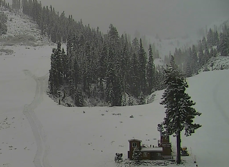
That delivered 9 inches of new snow above 8k’ on the mountain, 3 inches at the base of Alpine, and just a coating of snow at the base of Palisades as of 5 AM. That brings the 3-day total on the upper mountain to 19 inches and the season total to 44 inches, which is right near average for the date.
Saturday Snow Showers:
Behind the front, we have a lack of heavier and solid bands of precipitation moving through the northern Sierra Saturday morning. We have some snow showers firing up over the mountains as the moist air blows up and over the mountains. That will continue through the day on Saturday.
We have ridgetops winds gusting up to 60-70+ mph which will slowly come down through the end of the day. Highs in the 30s for the lower elevations and 20s for the higher elevations. The snow levels will hover near to just below the base.
The snow showers taper off Saturday night. We could see an additional 1-5 inches of snow on the mountain by Saturday night.
Sunday Sun:
We will see a break in the snow showers on Sunday. We should see partly sunny skies with lighter winds and highs into the 30s.
Monday – Tuesday Snow:
The two cyclones that spun up off the coast this week are much weakened but will stay off the coast before moving inland finally by Tuesday. Between that and additional moisture trying to stream underneath into CA, we are expecting another round of precipitation Monday into Tuesday, but this time the heaviest precipitation could be aimed to our south.
Several factors will make a precipitation and snowfall forecast complicated. One of the main ones is how far south the lows track as they move inland, which will determine how much precipitation falls in the northern Sierra. The other main one is how far north is the next moisture plume taking aim at CA. Farther north and we get more, farther south and we get much less.
We expect highs into the 30s for both days. Ridgetop winds gusting up to 40-50+ mph on Monday and 50-60+ mph on Tuesday. Snow levels start low Monday morning but rise as milder air flows in with the next surge of moisture into CA. Possible up to around 6300-6800 ft. by Monday evening, and hovering near to just above the base into Tuesday before falling later Tuesday.
All I can do is take the average of that big range of solutions among the forecast models and fine-tune the forecast over the next two days. Snowfall totals for Monday – Tuesday, using the latest averages, could be around 4-8 inches at the base, 8-12 inches near mid-mountain, and 12-16 inches up top by Tuesday night.
Thanksgiving Holiday Weather:
The latest model runs continue to show high-pressure building in the northeast Pacific with a low to the south off of the CA coast for Wednesday – Friday. Almost a Rex Block type pattern with the low likely stuck under the ridge and not moving inland. Eventually dissipating or very weak by the time it approaches the coast.
Some models show some moisture and showers reaching the Sierra on Black Friday, but most still keep us dry through the holiday period. We should see mostly sunny skies each day. We will start out cold with highs in the 30s, but we could see highs into the 40s for the lower elevations by the end of the week.
Long-Range Forecast:
The long-range models continue to show a strong high-pressure ridge building in over the West during the 1st week of December. That would continue the dry pattern, and we would likely see a milder pattern as well.
The long-range models don’t show any signs of a big pattern change going into the 2nd week of December. We’ll continue to watch the trends and we will look for any signs of a pattern change back toward a storm pattern in the long-range.
BA


