

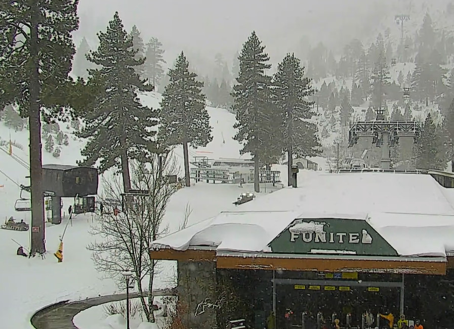
Snowfall Report:
The snow showers Thursday night delivered the boost the last-minute model runs suggested. We were expecting 4-8 inches of snow at the base and 6-11 inches on the upper mountain from the Thursday storm, and we picked up 4 inches at the base and 13 inches up top, so a bit more than expected!
Friday – Saturday Storm:
The trend with the next storm is for the heavier preciptiation to push in sooner Saturday morning, which will help with keeping colder air over the Tahoe basin as well keeping snow levels a bit lower than previously forecast.
The snow showers will increase throughout the day on Friday. Precipitation rates are expected to be lower for Friday as the heaviest precipitation falls to the NW of over northern CA. Highs in the 30s. Ridgetop winds increasing with gusty up to 50-70+ mph from the west during the afternoon, likely affecting some exposed upper mountain lift operations.
Friday night the moisture plume is now forecast to shift south faster, bringing in both steadier precipitation rates and keep the air a bit colder with lower snow levels. Snow levels Friday should stay below the base, and may only peak around 6000-6500 ft. now around 10 PM – midnight Friday night before falling below base again by Saturday morning.
The upper mountain could see 6-12+ inches of new snow by Saturday morning with several inches possible at the base. Then on Saturday we now expect the heaviest snow during the day from morning through the afternoon as the front moves south through the Sierra. Highs in the 30s near the base and 20s for the higher elevations. Ridgetop winds gusting up to 80-100+ mph, so expect a lot of lift closures.
With the faster shift south with the moisture plume Friday night through Saturday, the latest model runs diminish the precipitation to snow showers faster by Saturday evening and clear out the storm Saturday night. Snow levels could try to push up to 6000-7000 ft. Saturday but the heavy precipitation could hold them to the base, then they fall below 5000 ft. by the end.
Based on the wetter trend with the forecast and a bit colder, the snowfall forecasts have increased for the storm this morning. If the precipitation remains all snow at the base we could see totals of around 14-20 inches in total by Sunday morning reports. For the mountain, we could see around 19-25 inches in total near mid-mountain and 23-30 inches up top for the 2-day storm.
Sunday Weather:
Sunday is still expected to be a beautiful day. Mostly sunny skies with the storm clearing out faster, highs in the 30s, and the winds dropping off.
Monday Wimpy System:
The final system of the series is still forecast to move through Monday, but the trend is for it to be weaker and farther north, with only light showers expected during the day before the storm clears out Monday night.
Unfortunately, the winds are forecast to increase quite a bit on Monday with ridgetop gusts up to 60-80+ mph from the southwest, which will likely affect some upper mountain lift operations on Monday. Highs in the 30s.
The snow levels could stay higher with the lighter preciptiation and farther north track as well. Maybe up around 7500-8000 ft. to start and only falling to around 6500-7000 ft. by the end. That could bring scattered rain showers near the base and maybe a dusting up to a couple of inches of snow to the upper mountain.
Tuesday – Friday Weather:
High pressure builds in over the region by the middle of next week. That will likely bring us mostly sunny skies during the day along with highs into the 40s through next Friday.
Long-Range Forecast:
The long-range models continue to show a broad and deep Pacific trough pushing in very close to the West Coast by the 21st through the 22nd-23rd. That puts us right between the strong high-pressure ridge over the West and the strong storms spinning up into the Pacific trough.
Storms will try to push inland but will get eaten up by that ridge which will greatly weaken and block most storms from reaching the northern Sierra. Some model runs still show a weakened system possibly reaching us with some light preciptiation around the 22nd, so we’ll keep an eye on that.
Beyond the 23rd, the long-range models show the trough pulling away from the West Coast but the ridge over the West weakening a bit as well. Storms will be trying to push into the West Coast. If the ridge weakens at all we will likely see a weakened storm or two try to reach us before the end of the month, so we’ll keep an eye on that as well.
BA
