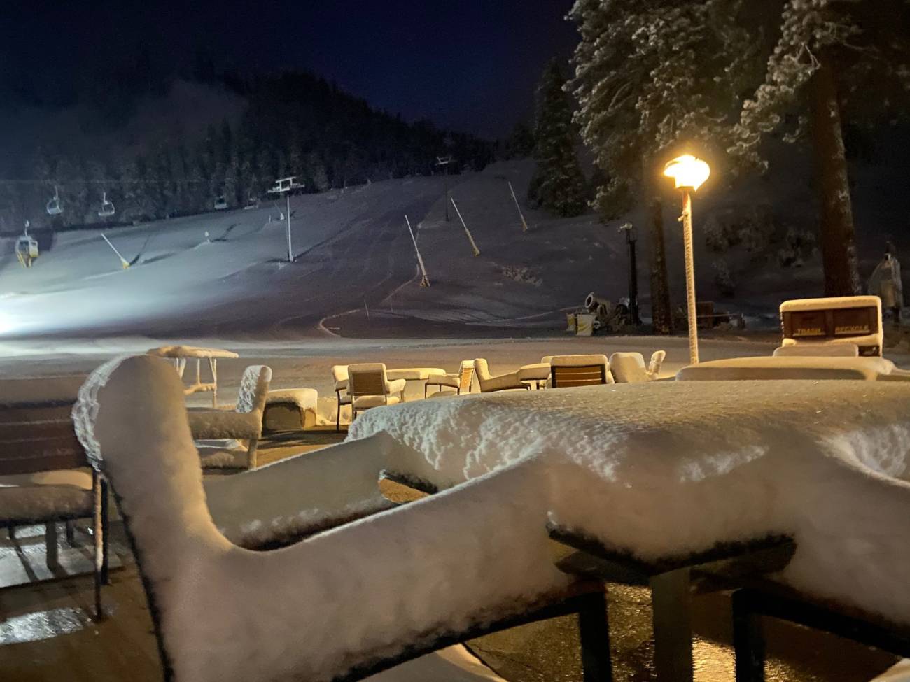
Skip to content
palisades tahoe
Explore
Main Menu
  • Explore Palisades Tahoe
  • Discover Palisades Tahoe
  • Our Name Change
  • Explore Legendary Lifts
  • Palisades Tahoe Blog
  • About Lake Tahoe
  • Mountain Safety
Plan Your Visit
Main Menu
  • Lodging
  • Tickets & Passes
  • Lessons & Guides
  • Deals & Packages
  • Rentals & Demos
  • Travel Here
  • Ikon Pass Benefits
Mountain Information
Main Menu
  • Mountain Report
  • Webcams
  • Hours of Operation
  • Trail Maps
  • Parking & Road Conditions
  • Snowfall Tracker
Events & Activities
Main Menu
  • Aerial Tram
  • Events Calendar
  • Activities
  • Dining & Apres
  • Shopping
  • Groups, Meetings & Weddings
  • Ski & Snowboard Teams
Summer High Camp Tram with wildflowers.
Basecamp for Lake Tahoe
Palisades Tahoe is the beating heart of Lake Tahoe adventure. Plan your trip with us today.
PLAN YOUR VISIT
Icon / FlashCreated with Sketch.
View All Offers

13 Inches of Fresh Snow, More Wednesday Night

  • By Bryan Allegretto
  • Weather
  • Dec 14, 2020

Snowfall Report:

The upper mountain picked up 13 inches of snow and 10 inches at the base. We did see a little rain mix in at the base Sunday and back to snow in the afternoon. This was a nice base building snow on the lower mountain. The season total is now 56-59 inches.

Monday – Wednesday:

Clearing skies Monday with lighter winds. Highs in the 20s on the mountain and 30s at the base. Mostly sunny Tuesday and increasing clouds Wednesday as the next storm approaches. Highs in the 30s on the mountain and low 40s at the base.

Wednesday Night – Thursday Storm:

The next storm moves in Wednesday evening with heavy snow with the cold front, and then snow showers lingering into Thursday before clearing later in the day. Snow levels may start out above the base around 7000 ft. Wednesday evening, but fall below the base overnight with all snow into Thursday.

The latest model runs suggest this system could be similar to the Sunday storm with snowfall amounts. The updated forecast is for 3-7 inches at the base and 8-15 inches on the mountain. We will continue to fine-tune the forecast over the next two days.

The Weekend:

We should see mostly sunny skies Friday through Sunday. Maybe a few clouds from storms passing to our north. Highs in the 40s at the base and 30s on the mountain.

Long-Range:

The next chance for a storm is next Tuesday the 22nd. That system may split apart before reaching the Sierra. We will keep an eye on that over the next week.

We may go into a drier pattern starting around the 23rd through Christmas week. Then possibly transitioning back into an unsettled pattern for the last few days of the month.

BA

Share this article
Picture of Bryan Allegretto
Bryan Allegretto

Recent Posts

Social

Instagram Twitter Facebook Youtube

Contact

   Email Us
   1.800.403.0206

Our Partners

U.S. Forest Service Logo
1960 Olympic Valley Road
Olympic Valley, CA 96146

©2026 Palisades Tahoe

Alterra Mountain Company
  • Privacy Policy
  • Terms of Service
  • Photo Upload Terms of Use
  • Accessibility
  • Do Not Sell My Personal Information
  • Privacy Policy
  • Terms of Service
  • Photo Upload Terms of Use
  • Accessibility
  • Do Not Sell My Personal Information