Snowfall Report:
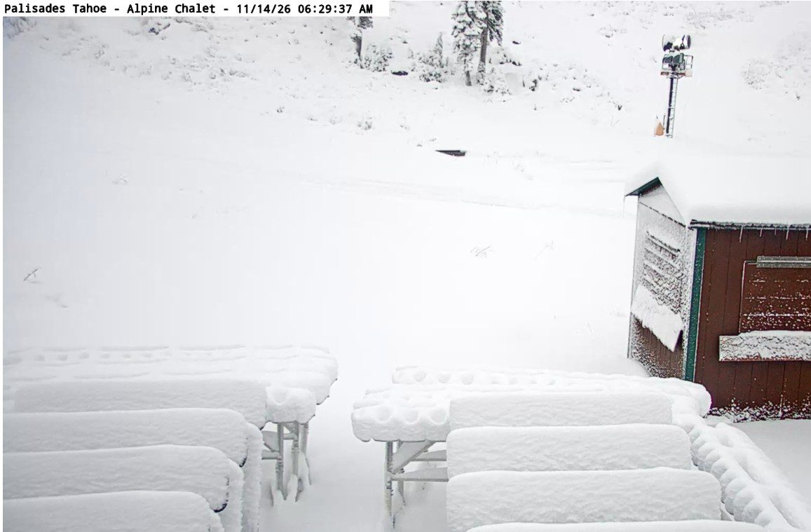
The cold front swept through pretty quickly Friday afternoon/evening. We saw a quick shot of heavy snow for several hours, with snow levels dropping below the base. It’s a beautiful snowy morning in the Tahoe basin!
The storm moved through a bit faster than the forecast models were showing. We saw some post-frontal snow showers into early Saturday morning that added more snow to the mountain. The forecast was for 5-10 inches at the base, and we picked up 5, and 10-16 inches for mid-mountain, and we picked up 10.
So the lower end of the forecast, but we aren’t complaining, as this is just the first of 3 snowstorms we are expecting this week!
Saturday – Sunday:
Behind the 1st storm, we’ll see clearing skies and colder temperatures for the weekend. Partly to mostly sunny skies with highs in the 40s for the lower elevations near the base, and 30s up on the mountain. Ridgetop winds are lighter on Saturday, but increase on Sunday, with gusts up to 50-60+ mph.
Sunday Night – Monday Storm:
The next storm is expected to push precipitation back into the northern Sierra as early as late afternoon on Sunday, with most of it pushing in Sunday evening and overnight, and showers into Monday as the front is slow to move through as it weakens.
The winds drop on Monday, with highs in the 30s. The snow levels start around 6500-7000 ft. Sunday evening, and could sit there for a while before falling to the base by early Monday morning. That means some rain at the start near the base, but mainly all snow on the mountain.
By the end of the storm on Monday, we could see around 2-6 inches of new snow near the base, 5-9 inches near mid-mountain, and 6-11 inches up top.
Tuesday:
Partly-mostly sunny and colder for Tuesday, with highs in the 30s. The good news behind these storms is the colder air, especially at night, for snowmaking on top of the natural snow. That should help to open trails and expand terrain more quickly.
Wednesday – Thursday Storm:
The latest model runs show the next storm moving in Wednesday morning. Ridgetop winds increase to 60-70+ mph from the SW. Temperatures in the 30s for the lower elevations and 20s for the higher elevations. That’s good news, as this storm starts colder than the previous storms.
Most of the latest model runs show the front moving through with heavy snow on Wednesday, and the center of the low behind it moving through as well Wednesday night. The GFS model and its AI version are both slowing the low and extending heavy snow into Thursday, which is doubling the totals that most models are showing.
The winds drop on Thursday but still cold. The snow levels will start below the base with this storm. That means a colder storm with higher snow ratios of up to 15:1 or better on the mountain. That will help to fluff the snowfall totals from the precipitation totals compared to the previous storms.
Looking at the latest forecast model runs, we could see 2-3 feet of snow on the mountain from bottom to top from this storm, if the current forecasts hold!
Next Weekend:
The latest model runs still show the eastern Pacific trough pulling back some by the end of the week, and high pressure over the West. That could bring a break into next weekend. Some models are trying to push a weakened storm into the Sierra next weekend, so we’ll keep an eye on that.
Thanksgiving Week:
The longer-range models have shifted a bit over the last 2 days, and now suggest that the eastern Pacific trough could push in a bit closer to the West Coast for the last week of November. That could help to push the storms spinning up in the trough farther east into the Sierra, as compared to previous forecasts showing them having a harder time pushing in.
We’ll continue to watch the trends on this to see if we will see more storms through the end of the month, continuing to build the early season base. It should stay fairly cold through the end of the month, which is good news for snowmaking as well.
BA