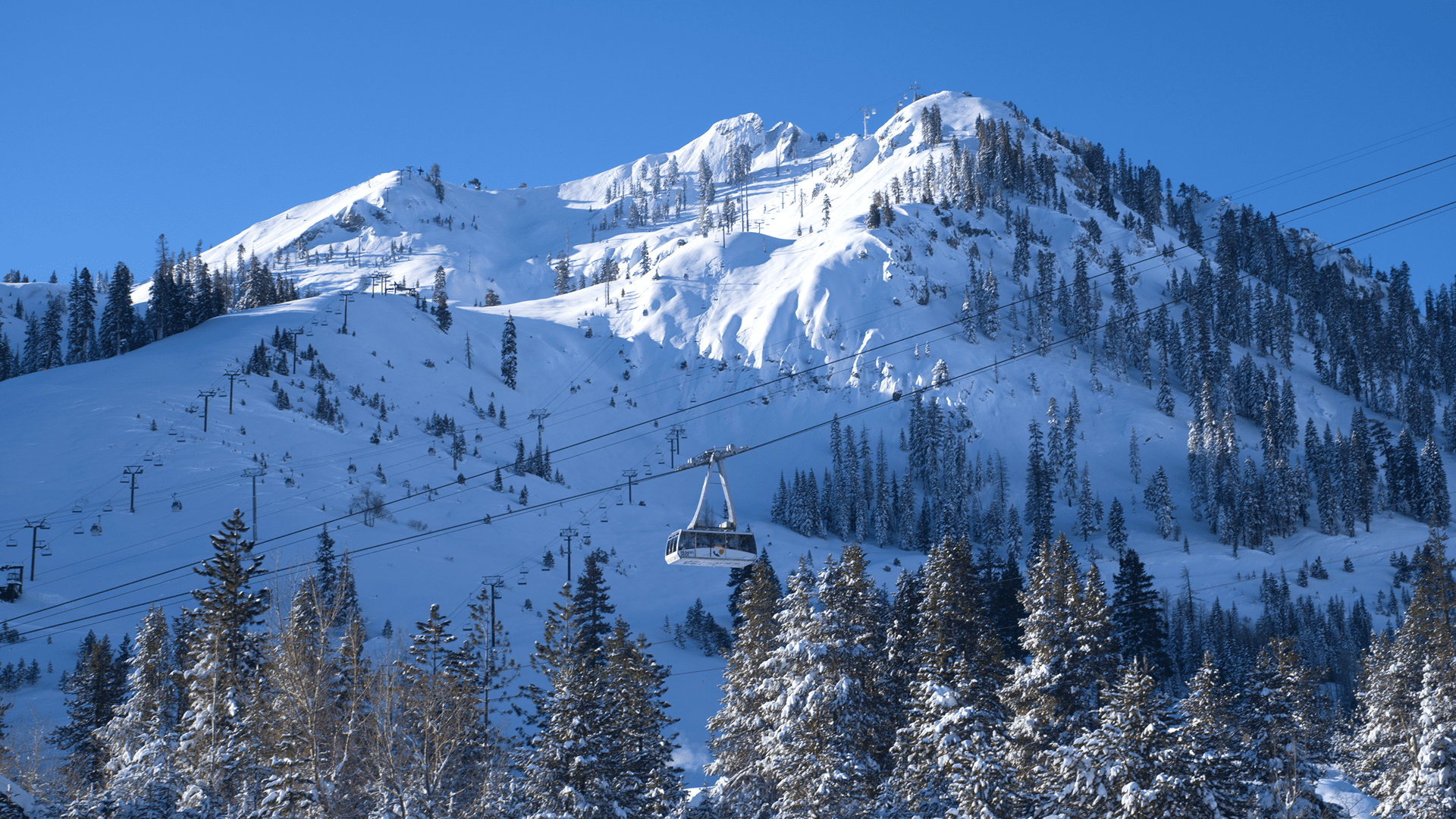
After a long stretch of sunny bluebird days, slushy laps, and expansive spring-like cruising, winter didn’t just return, it roared back.
We knew a storm cycle was coming, but few could have predicted just how much snow would stack up. What followed was one of the most impressive stretches of sustained snowfall we’ve seen in years, resetting the mountain in a way that only Tahoe can.
Our Mountain Operations and Patrol teams have been working around the clock through the night and all throughout the day digging out lifts, performing avalanche mitigation, rebuilding access routes, and moving at the speed of safety to prepare terrain for all of us to enjoy. It’s hard work in tough conditions. If you see someone from Ops or Ski Patrol this weekend, take a moment to say thank you. The conditions we’re about to enjoy are a direct result of their relentless effort.
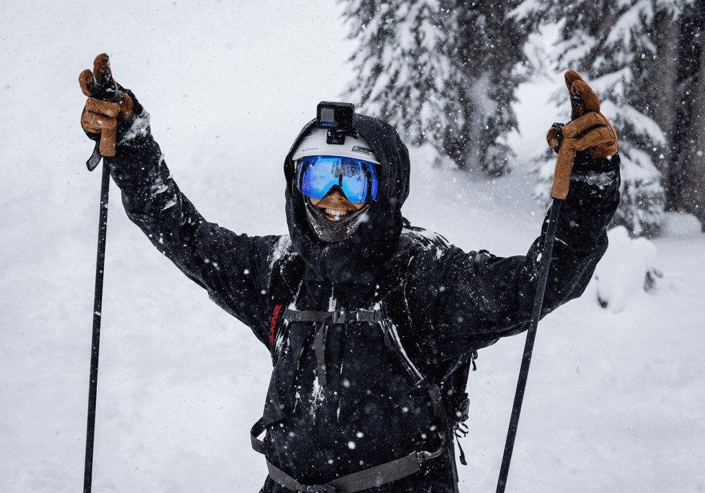
Tahoe has a reputation for “Sierra Cement” when big storms roll through. But if you’ve made turns over the past few days, you know this snow is different. Cold temps and high snow ratios delivered blower powder that’s soft like Utah and deep like Japan.
Weather & Conditions
What a stretch.
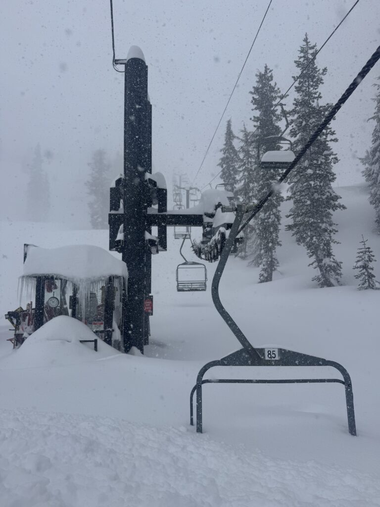
A huge shoutout to our Mountain Operations teams for the incredible work during the storm and the continued effort over the next several days as they dig out, mitigate, and prepare terrain for all of us to enjoy.
We are now sitting at 278 inches for the season, which amazingly puts us at approximately 105% of our average snowfall for this date, along with an incredible 124 inches (over 10 feet) during this storm cycle, including last week’s snowfall.
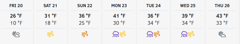
Friday: Bluebird Powder
Friday is calmer with clearing skies and sunshine returning.
- Highs in the 20s
- Cold, preserved powder
- A beautiful day to enjoy all the fresh snow
Weekend Outlook: Warmer & Windier
Saturday and Sunday bring increasing winds and a slight warming trend.
- Highs warming into the 30s
- Ridgetop winds gusting 30–40+ mph Saturday
- Increasing to 50–60+ mph Sunday
Upper mountain lifts could see wind-related impacts at times.
Early Next Week: AR Watch
Looking ahead to Monday – Wednesday, models are trending toward an Atmospheric River event pushing into the northern Sierra.
- Milder air moving in
- Snow levels potentially rising to 7,500–8,000 feet
- Rain possible at lower elevations
- Strong winds possible (60–80+ mph ridgetop gusts)
Details will be refined over the coming days, but it’s shaping up to be another dynamic weather period.
For a deeper dive into the forecast and long-range trends, visit our Weather Blogs, written by Bryan Allegretto of OpenSnow.
Safety Remains Top of Mind
With over 10 feet of snow during this storm cycle, conditions across the mountain are deep, dynamic, and constantly changing. While the powder is incredible, this is also when deep snow risks are at their highest.
Guests should remain mindful of snow-covered obstacles and changing terrain features. Rocks, stumps, tree wells, and buried hazards may not be visible even in areas that look smooth and untouched.
As we move into this post-storm window, deep snow safety must be top of mind.
Deep Snow & Tree Well Safety
Skiing and riding in deep powder is one of the most exciting parts of our sport. However, leaving groomed terrain means voluntarily accepting additional risk, including the risk of deep snow immersion or tree well accidents.
A deep snow immersion accident can occur when a skier or rider falls into deep, unconsolidated snow and becomes immobilized. These incidents can happen quickly and silently.
Always remember:
- Ride with a partner and keep each other in sight at all times
- Avoid the base of trees, where snow accumulates deeply and loosely
- If you fall, try to fall feet-first
- The deeper the snow, the higher the risk
- If venturing into expert terrain, carry proper rescue equipment and know how to use it
Avalanche mitigation work is ongoing, and terrain may close at any time. Closed terrain is closed. Please respect rope lines, signage, and all posted closures.
For more information, please visit our Deep Snow Safety page and take time to refresh your knowledge before heading into ungroomed terrain.
Lift & Terrain Operations
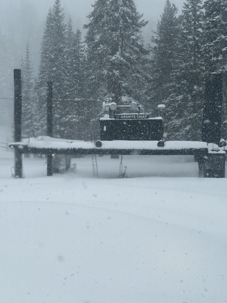
After a historic storm cycle that delivered over 10 feet of snow, our teams remain in full recovery and re-establishment mode.
Friday, February 20 will continue to reflect storm recovery operations, with lift access primarily focused on lower-mountain terrain while crews complete avalanche mitigation, rebuild access routes, dig out lift ramps, and assess upper mountain conditions. Guests should expect a phased start and the potential for limited terrain access as work continues.
This week required multiple days of full avalanche mitigation, slow travel conditions, and extensive digging across both mountains. Accessing and preparing upper mountain terrain after nearly 100 inches of snowfall takes time, coordination, and patience.
The goal is to progressively expand lift and terrain access heading into the weekend and beyond, weather permitting.
As winds ease and visibility improves, we are optimistic about continued terrain expansion Saturday and Sunday, with hopes of bringing more of the mountain online as conditions allow.
Please keep in mind:
- Delayed lift openings are still possible
- Terrain may open in phases
- Some areas may remain closed while mitigation and assessment continue
- Upper mountain access will remain weather-dependent
Despite short-term operational impacts, this storm cycle has set the stage for outstanding midwinter conditions across the resort.
Lift and terrain status may change throughout the day. For the most up-to-date information, please check the Ikon Pass App or the Mountain Report before and during your visit.
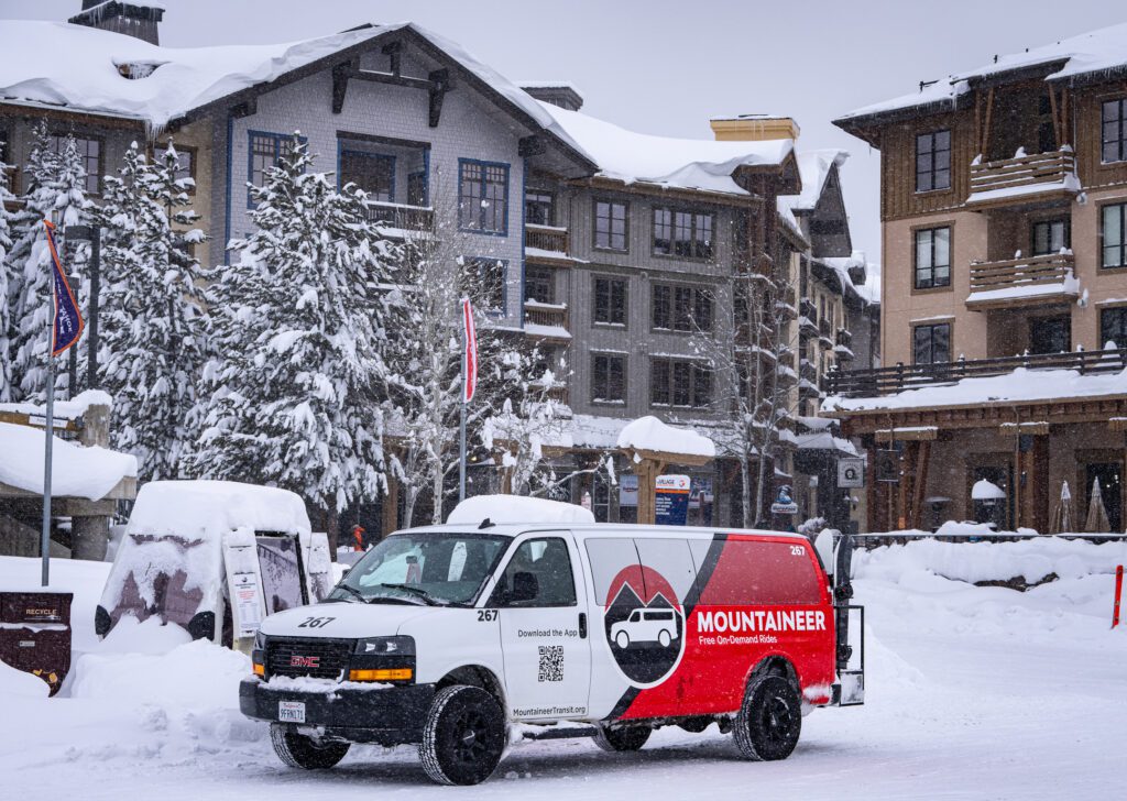
Transportation, Parking & Lodging
With over 10 feet of new snow and bluebird conditions returning, it’s no surprise that this weekend is in high demand.
Parking Reservations
All free and paid parking reservations are currently sold out.
If you do not have a reservation, please plan to utilize alternate transportation options. There are several reliable ways to access the resort without driving directly into Olympic Valley. If you’re unsure what to do when parking reservations sell out, we’ve outlined your options in this helpful guide.
Alternate Transportation Options:
- Park & Ride service is available from Truckee and Tahoe City
- Resort transportation, including the Mountaineer, is available for guests staying in Olympic Valley and Alpine Meadows
- Sherwood Shuttle will be operating for guests traveling from the West Shore
- The Sports Basement Ski Bus offers a convenient, full-service ride to the resort
Carpooling and planning ahead will go a long way this weekend. Please allow extra travel time and check road conditions before departing.
Last Chance to Save on Lodging
With fresh snow stacked across the mountain, now is the perfect time to turn a powder day into a powder trip.
This is your last chance to save up to 20% on slopeside lodging in The Village at Palisades Tahoe.
- Save 20% Sunday – Thursday nights
- Save 10% Friday – Saturday nights
- Book by February 23rd for stays through May 31, 2026
- Use promo code BACK2WINTER
Wake up steps from the lifts, unwind in a hot tub or sauna after a deep day, and skip the drive home altogether.
With winter fully re-established, there’s no better time to stay slopeside and make the most of this historic snow cycle.
Events & Activities

The snow may have stolen the spotlight this week, but the energy across the resort is just as high off the slopes.
With winter fully re-established and bluebird windows returning, the Village and both base areas are buzzing. From live music and après scenes to family-friendly programming and on-mountain activations, there’s something happening from first chair through last call.
Get After It
This is what February in Tahoe is supposed to feel like.
With over 10 feet of snow during this storm cycle, improving weather heading into the weekend, and terrain steadily coming back online, the mountain is primed for an unforgettable stretch.
Expect deep turns, cold smoke, and that unmistakable post-storm energy that only comes after a week like this.
Thank you for your patience as our teams continue recovery and expansion work. Thank you for respecting closures and rope lines. And thank you for being part of this mountain community.