Monday – Friday:
East winds are gusting to 60+ mph up top Monday. Highs in the 40s at the base and 30s on the mountain with the wind making it feel a bit colder. The good news is that the winds have stopped the inversions with top to bottom cold air for snowmaking.
We are expecting the mostly sunny skies to continue through the week. The winds die down Tuesday into Wednesday with high temperatures warming into the 50s at the base and 40s up top. Thursday into Friday we could see gusty winds return from the southwest as colder air begins to filter in. Highs in the 40s at the base and 30s up top.
The Weekend:
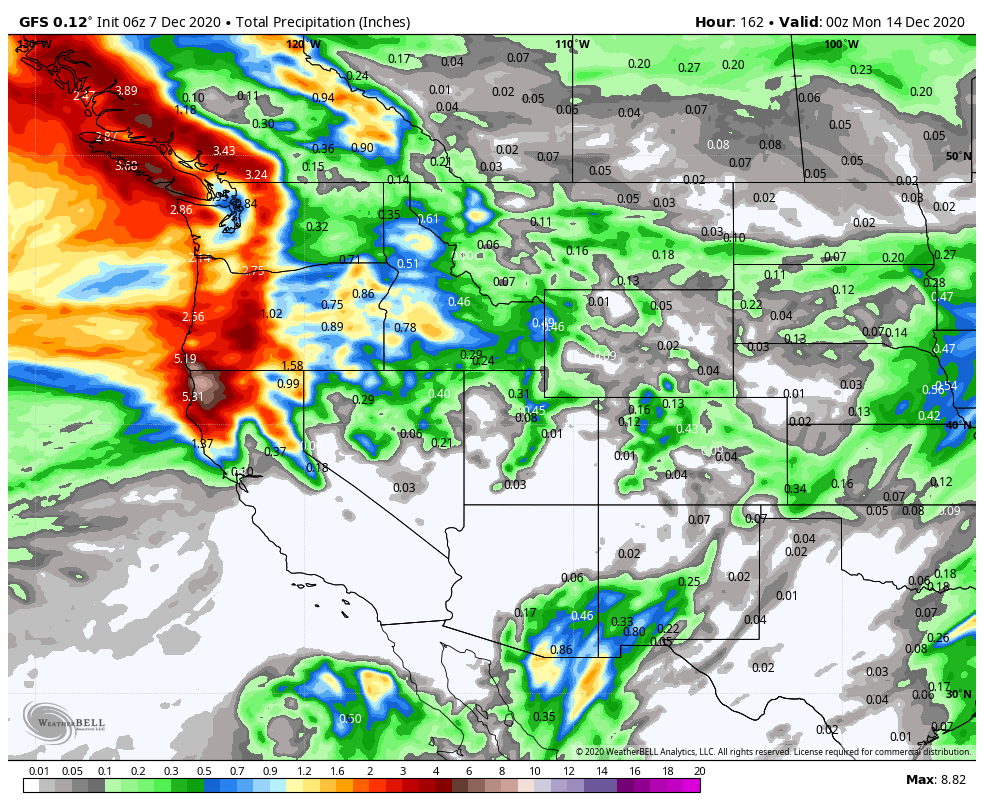
Friday night into Saturday a storm moves into the Pacific NW, with another system moving in Sunday. Most of the forecast models have been showing those systems staying just to the north of our area with a dusting of snow at best.
But a few of the most recent model runs have been showing the possibility of these systems dipping a bit farther south with some accumulating snow on the mountain. We will be watching the track of these systems all week.
Long-Range:
We may see a better chance for some weak/moderate storms to move through northern CA during the 3rd week of December. The long-range models are tracking a storm around the 15th, and a few storms behind that for later next week.
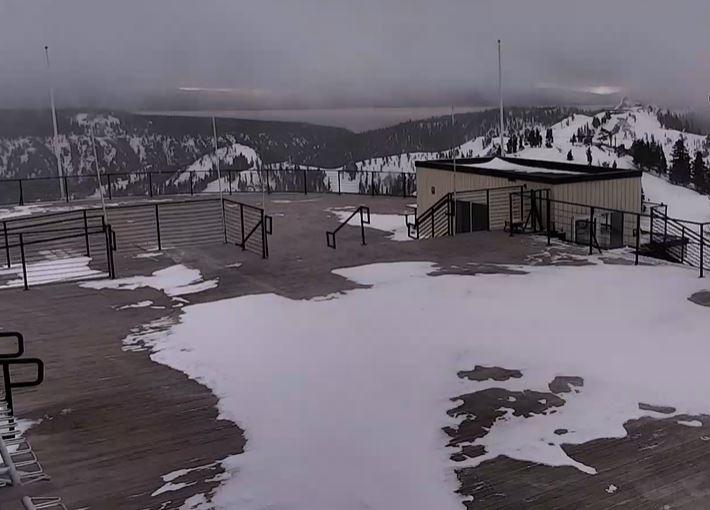
Let’s hope the storm track starts to shift farther south into northern CA this weekend and through next week. We have been able to make a lot of snow with the cold air on top of the natural snow from November, but it will be nice to see more natural snow this month to add to the coverage and terrain expansion.
BA