

Another morning of subfreezing temperatures at the base, with the snowmaking crew able to make snow around the base areas. Much warmer up on the mountain with the overnight inversions continuing. The good news is that we are going to break out of this mild and dry pattern soon. It feels good to be talking about storms again.
Friday – Monday Dry Pattern:
We can just skip over the continued snooze fest of dry and mild weather through the weekend and into Monday.
Tuesday – Friday Unsettled Weather:
The pattern will be shifting as we go into the week of the 15th, with the high-pressure ridge over the West flattening and a zonal storm track from west to east into the Pacific NW and northern CA.
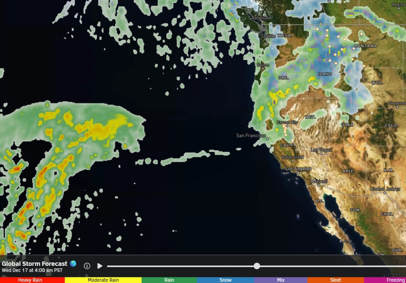
We could see some showers as early as Tuesday, along with slightly cooler temperatures and ridgetop winds starting to pick up from the west. The latest model runs show a wetter system sagging south into the northern Sierra on Wednesday. That will bring the best chance for some steady rain and colder temperatures.
But still not that cold with highs in the 40s for the lower elevations and 30s for the higher elevations. Ridgetop winds gusting up to 70+ mph. The WPC’s total precipitation forecast through Wednesday night shows up to an inch of precipitation falling over the mountain.
The snow levels are still only expected to dip to around 8000-8500 ft. at their lowest point on Wednesday. That would bring mostly rain. Above 8500 ft., several inches of wet snow is possible. We’ll continue to watch the trends as we get closer.
The unsettled pattern with gusty ridgetop winds and similar temperatures are possible through the end of the week on Friday the 19th. Additional rain showers are possible, but the latest model runs don’t show any significant systems. We’ll keep an eye on that as well to see if it changes.
Long-Range Outlook:
While the rain sounds like better news after 3.5 weeks of dry weather, we need cold storms and snow. The long-range models are still looking good for a pattern change towards a deeper trough over the West Coast starting around the 20th into the last week of December. This would open the storm door for CA.
The potential is there for these storms to tap into some deeper Pacific moisture and for ARs (atmospheric rivers), which some of the operational models are showing with storms during this period. The ensemble mean models are showing a wet pattern with above-average precipitation into the last week of December.
Meanwhile, the Temperature forecasts show a downward trend over the next two weeks, with highs dropping into the 30s on the mountain beyond the 18th, and 20s Christmas week. Precipitation up, temperatures down, is what we want!
If this forecasted pattern verifies, we could just get some decent cold storms that move through, dropping several inches each. If a storm taps into warm subtropical moisture, it’s possible that we have higher snow levels. A best-case scenario would be an AR with cold air from the north, keeping snow levels to the base.
We’ll continue to watch the trends. The latest long-range model runs keep this pattern through the 26th, as most only go out two weeks. But no signs of a shift away from this pattern yet, as we go through the last week of December. Let’s hope this holds…
BA
