

The Week Ahead:
Looking out over the next week through next weekend, the only change in the weather looks to be a slight cooldown on Tuesday as a trough digs into the northern West.
Highs only dip into the 40s, and then back into the 50s for the lower elevations through next weekend. 40s for the higher elevations. Overall, a dry and mostly mild week is expected with mostly sunny days.
Week 2 Outlook:
Going through the 3rd week of March, the long-range models continue to show a stronger high-pressure ridge building in over the West. That will keep the storm track to the north and could bring even milder weather when the center of the ridge is over or east of the Sierra.
Looking at the two-week mid-mountain temperature forecast, we see highs near 50 degrees most days over the next two weeks, a bit warmer below that, and a bit cooler higher up. The ridge should keep us dry through at least the 19th/20th.
Long-Range Outlook:
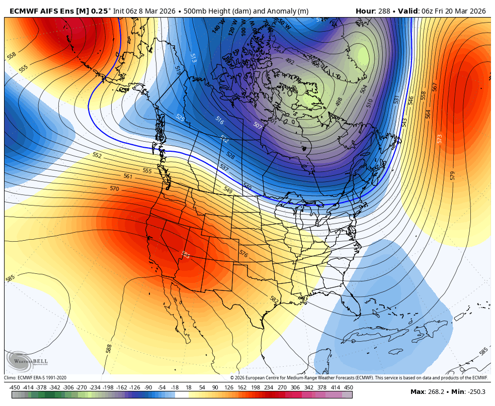
By the time we get towards the end of the 3rd week of March, around the 21st/22nd, the ridge over the West is forecast to weaken, and the longer-range models continue to show it weakening or a trough over the West during the last week of March.
That could allow storms to dig farther south into the Sierra later in the month. We are also going into spring, and the jet stream and storms start to weaken and shift north, but we can still get big storms near the end of March/beginning of April.
For now, we will hope that we will see some precipitation and new snow as the longer-range models continue to suggest. We’ll have to see if that holds as we get closer…
BA
