

Dry Week Ahead:
Not much to talk about here in the short-range over the next week, as high pressure will dominate the weather pattern through at least next Friday.
We start with some colder temperatures on Friday and Saturday with highs in the 30s. Over the weekend, some clouds may be around, but milder with highs breaking into the 40s on Sunday.
Then sunny days and milder temperatures next week as high pressure strengthens over CA. Highs warming into the 40s each day, and maybe breaking into the 50s for the lower elevations.
Long-Range Outlook:
As we go out beyond a week, the only change in the weather may be that slightly colder temperatures start to move in as high pressure starts to weaken a bit and starts to shift a bit west. But over the next 13+ days, we will likely have dry weather.
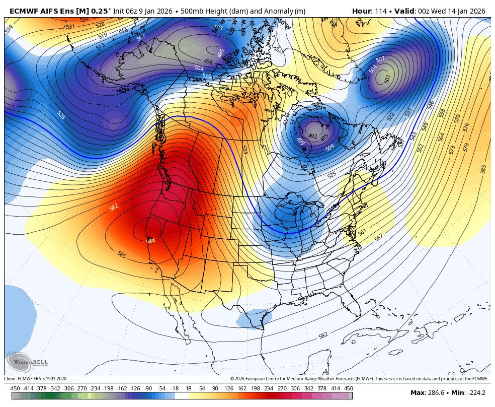
Yesterday, we talked about how the long-range models were trending towards a slower retrogression of the mean ridge center to off of the West Coast and eventually up towards the Aleutian Islands by the last week of January. Most are still showing that, but the AI models are trending back towards the ridge being farther NW by the 23rd.
They are back to showing a trough digging in over the West Coast, opening the door a bit to storms. If they are right, we could see a bit of precipitation starting around the 22nd, but I’m not buying it happening that fast yet.
We’ll continue to watch the trends to see if storms will return later in the month, and I will let you know as soon as I have any confidence that they might, and when.
BA
