It’s Thursday morning, and the Wednesday storm has cleared the region after dropping rain and snow on the northern Sierra. We saw snow as low as 7000 ft. briefly on Wednesday morning, as expected, and a few inches of wet snow accumulated on the upper mountain. But then rain fell on top of the snow by afternoon.
Drier Pattern:
We’ll see drier weather for the next week through Wednesday the 12th. We’ll see partly-mostly sunny days with some clouds from storms to our north. Highs into the 50s near the base through Friday, and then near 60 degrees for the weekend into early next week.
Stormier Pattern by Mid-Month?
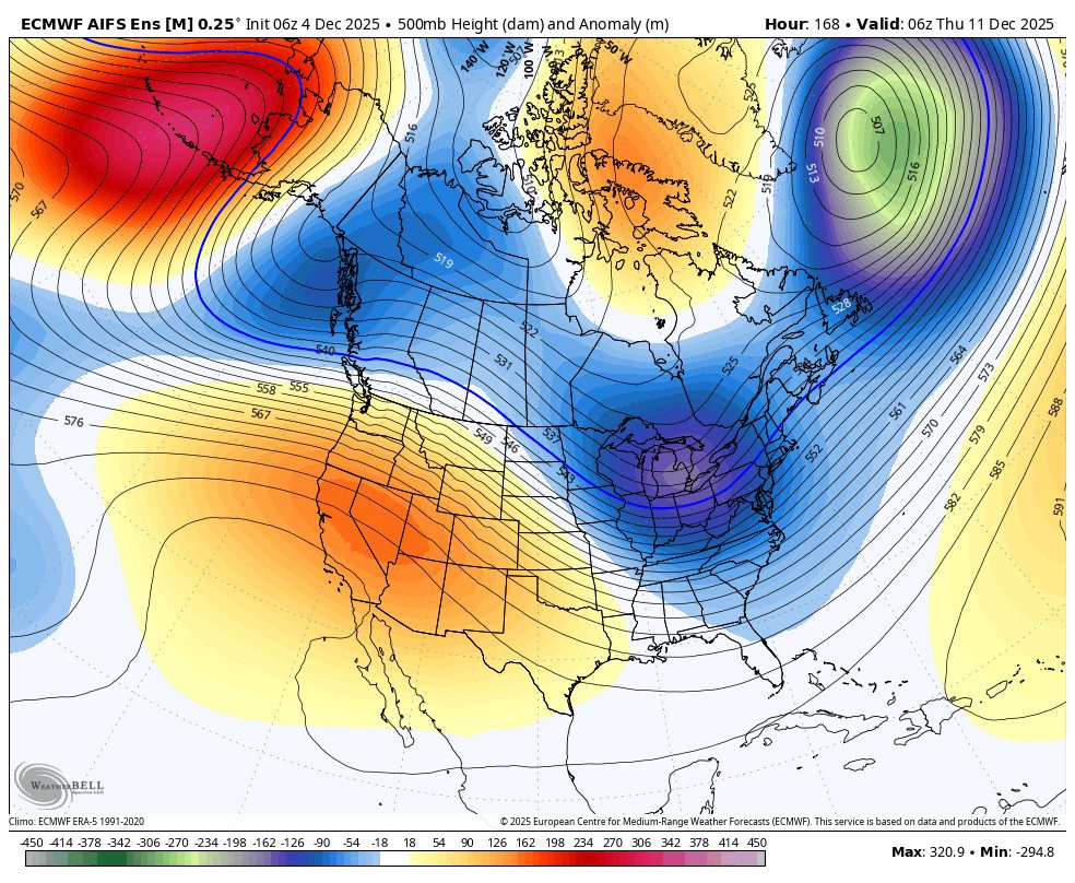
The long-range forecast models continue to show a shift in the pattern starting around the 13th, with troughing forecast to be over the West Coast more than not through the following 7 days. We could see several storms during this period, and possibly colder storms with colder air forecast to push in with these troughs.
The issue will be if the storms dig too far south and tap into subtropical moisture and warmer air, which could bring higher snow levels during some storms. Overall, the ensemble mean models agree that most of CA could see a wetter pattern between the 13th – 20th.
This pattern is still a week+ out, so not guaranteed yet, but it does look promising with the consistency of the long-range models. By early next week, we should have a better idea of when the first storm could arrive, and we will be able to look at more details like potential precipitation totals, snowfall, and snow levels.
BA