Monday:
Monday will start out sunny with highs in the 30s at the base and 20s up top. Some high clouds increase through the afternoon ahead of the next storm.
Tuesday – Wednesday Storm:
The latest model runs show the Tuesday storm pushing snow showers insuring the early morning hours Tuesday, but holding off on heavier snow until later in the morning into the evening as the cold front moves through the Tahoe basin. Ridgetop winds from the southwest gusting up to 90-100+ mph by midday. That will likely close several lifts. Highs into the 30s. Snow levels stay below the base.
Snow showers become more scattered later Tuesday night into Wednesday morning. Then snow showers could increase Wednesday afternoon-evening before finally winding down later Wednesday night. The winds drop on Wednesday with highs in the 20s up top and 30s at the base.
Most of the snow is expected to fall by Wednesday morning, with only 1-2 inches expected to fall with the snow showers later Wednesday. By Thursday morning we could see storm snowfall totals of:
- 12-18 inches at the base.
- 15-21 inches at mid-mountain elevations.
- 18-24 inches up top.
Thursday – Friday:
Partly sunny skies on both days with highs into the 20s up top and 30s for the base. We could see some scattered snow showers each afternoon-evening, but only very light accumulations are expected at best. The winds are expected to be lighter as well.
WinterWonderGrass Weekend:
The latest model runs are trending back to the north with the Saturday system. We could see partly sunny skies with afternoon-evening snow showers. Highs into the 30s. Depending on how far south the Saturday system digs into the Sierra we could see just a dusting to an inch of snow, or several inches of snow through Saturday evening. We’ll continue to fine-tune the forecast all week.
The next system diving into the trough later Sunday into Monday looks to dig farther south with a better chance for snow showers into the Tahoe basin and up to a few inches of snow to fall on the mountains. Highs in the 20s up top and 30s at the base.
Snow levels could be near to just above the base with some rain mixing in both Friday and Saturday afternoons. If the Saturday storm digs farther south that would bring in some colder air and lower snow levels. Snow levels drop well below the base at night and for Sunday-Sunday night.
The low end of the updated snowfall forecast for the weekend would be the drier scenario with the Saturday system farther north. The higher end would be if the Saturday system digs farther south. Some models even show a bit more than my high-end forecast. Here is the updated weekend snowfall forecast taking the model average.
- 1-5 inches at the base.
- 2-6 inches at mid-mountain elevations.
- 3-7 inches up top.
If you are planning to attend the WinterWonderGrass Festival Friday through Sunday at the base, you’ll want to dress warmly and prepare for snow to be falling while you are watching the concerts.
Long-Range:
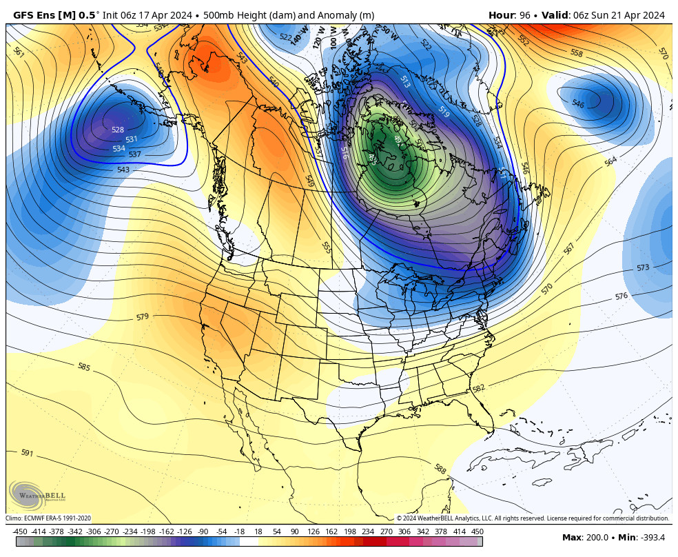
Beyond the weekend, the long-range models are showing the trough remaining over the region with a cold and unsettled pattern through the first week of April. We could see additional weak systems move through bringing more snow to the mountain through the end of next week.
The long-range models suggest that high pressure finally starts to build over the West Coast during the 2nd week of April. We’ll have to see if that holds. It’s April though and the jet stream is weakening and shifting north with time, so we may have a better chance of the models being right with a trend toward a drier pattern with time.
BA

