Snowfall Report:
Happy weekend! A final 2 inches of snow fell on the mountain from the snow showers Friday morning. That brings the final storm total to 45 inches, and the November total to 71 inches, just 1 inch shy of 6 feet already! This is now the snowiest November since we saw 111 inches in 2010.
Weakening System:
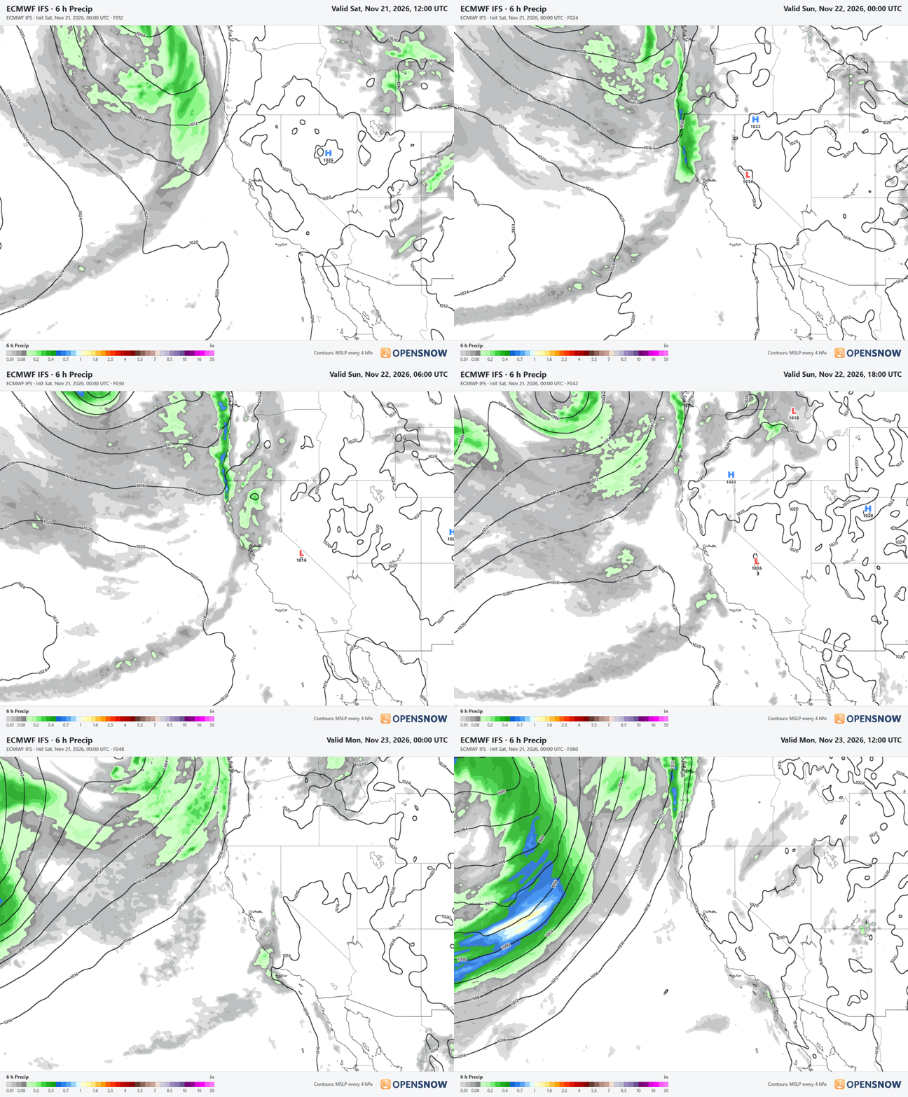
We will start with partly sunny skies on Saturday. The next storm will be moving into northern CA, but the front will weaken, and the precipitation will dry up as it reaches the northern Sierra, with only light snow showers possible Saturday night into Sunday.
We expected this with the front Saturday night, but the latest model runs have lost the secondary wave for Sunday that would have brought a few inches of snow. The model average has dropped from 0.45 inches of precipitation down to only 0.15 inches.
The snow levels will start down around 4000 ft. and rise up to around 5000 ft. by the end Sunday afternoon. With the low precipitation forecasts now, we may only see a dusting to an inch of snow near the base, and 1-3 inches on the mountain through Sunday afternoon.
It stays cold through the weekend, with highs in the 30s for the lower elevations and 20s for the higher elevations.
Monday – Tuesday Weather:
We should see a break between storms with partly sunny skies. Increasing clouds and winds on Tuesday, with SW winds gusting up to 50-60+ mph over the ridges. Cold on Monday and then warming a bit ahead of the next storm, with highs into the 40s for the lower elevations on Tuesday.
Tuesday – Thursday Systems:
Some forecast models like the GFS still only show one weakening system Tuesday night into Wednesday, while others like the European now show a 2nd system possible for Wednesday night into Thanksgiving Day.
The models are struggling with the timing and strength of the storms, with the trough off the coast and high pressure over the West weakening them as they move inland. We will need to keep watching the trends closely to see if these storms will make it into the northern Sierra, and how much moisture they will still have.
The snow levels could fluctuate quite a bit with the two systems if we see 2. Starting as high as 9000 ft. Tuesday night, dropping to as low as 5000 ft. by Wednesday night, and back up as high as 12,000 ft. by the end on Thursday. Highs in the 40s for the lower elevations and 30s for the higher elevations, with gusty winds through Thursday.
That means we could see rain and snow even up to the upper mountain with these systems. Using the snow levels average and precipitation average this morning, here is a very rough idea of what we could see for snowfall: 0-2 inches near the base, 1-4 inches near mid-mountain, and 2-6 inches up top.
Friday Weather:
We are still expecting partly to mostly sunny skies for Friday along with mild temperatures. Highs in the 40s, and up to 50 degrees for the lower elevations near the base.
Long-Range Outlook:
Some of the latest model runs are now trending away from a dry forecast for next weekend, with a possible storm moving through next weekend. We will continue to monitor the trends on that all week to see if the storms will continue.
As we go into the 1st week of December, the longer-range models continue to show the eastern Pacific trough sitting pretty far west, and a weakened jet stream by the time it approaches the West Coast. Storms may continue to try to push into the West Coast, but could have a harder time until the trough shifts farther east and the jet stream strengthens farther east as well.
We expect a wet December, so we will continue to watch the trends to see when stronger storms could return…
BA