Friday – Saturday:
The dry pattern continues through Saturday with mostly sunny skies and breezy winds. Highs into the 30s on the mountain to near 40 degrees at the base. Northwest winds Friday turning west Saturday, with ridgetop gusts up to 30-40+ mph by afternoon.
Sunday Cold & Snow:
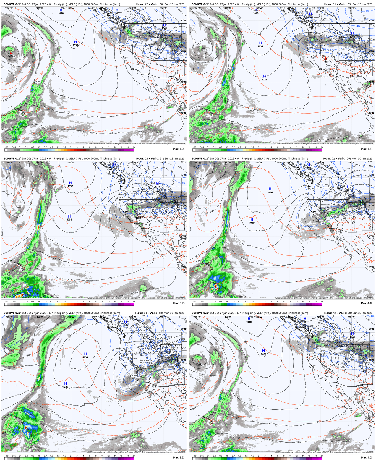
The pattern shifts on Sunday with a cold trough digging into CA from the north. The snow is expected to move in with the front during the early morning hours Sunday. Then scattered snow showers diminish later in the day into Sunday evening. Much colder air pours south into the region with highs dropping into the 20s and the winds dropping off.
Here is a look at the updated snowfall forecast for this storm for totals expected by Monday morning:
- 1-4 inches at the base.
- 2-5 inches at mid-mountain elevations.
- 3-6 inches up top.
Monday – Tuesday:
It stays cold Monday into Tuesday with highs only in the teens on the mountain Monday and 20s for Tuesday. Overnight lows are in the single digits. Mostly sunny skies on both days. Northeast winds increase Monday with gusts up to 40+ mph up top by afternoon, and then breezy still for Tuesday.
Wednesday – Thursday:
High pressure builds over CA through Thursday. We will see the dry weather continue with highs warming into the 30s on the mountain.
Long-Range:
By February 3rd, a trough is forecast to push into the West Coast. That should bring a return of storms to the Pacific NW and we’ll have to see how far south the storms can dig into northern CA. The latest model runs show a weak system possible on the 3rd and another on the 5th.
We’ll continue to watch the trends as we get closer.
BA


