Snowfall Report:
Since the mountain is not open yet we don’t have human-measured snow as of 6 AM each morning yet. Looking at the snow sensor at the top of the mountain it shows 2 inches of new snow in the past 24 hours as of 6 AM Friday morning. The OpenSnow estimated snowfall report shows 2 inches as well. So we likely saw 1-2 inches on the mountain.
Friday Snow:
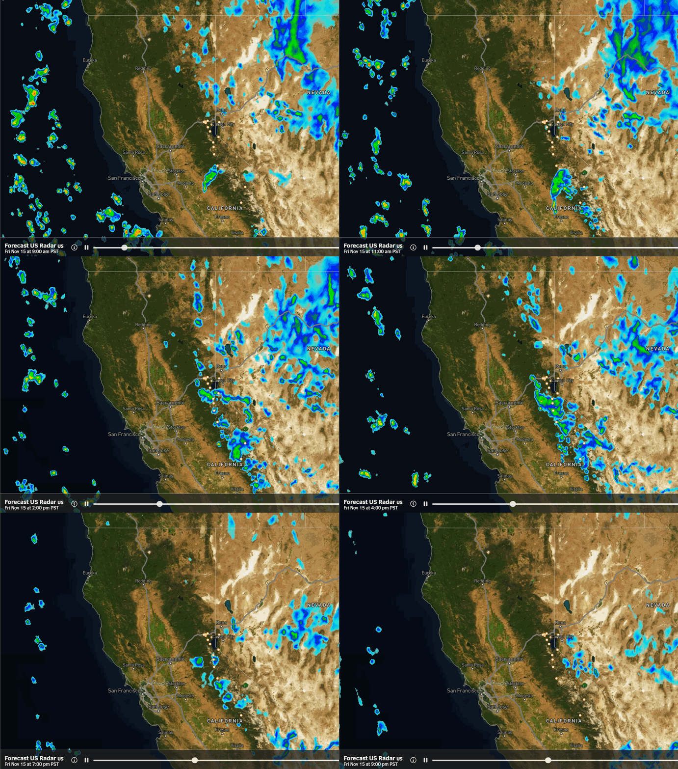
The winds are turning northerly during the day on Friday on the back side of low pressure over Nevada. That will bring orographic snow showers as the cold moist air blows up and over the mountains from north to south. The snow showers during the day will taper off by evening.
Highs only in the 30s for Friday with 20s for the highest peaks. The snow levels will be near 5000 ft. We could see a dusting up to an inch or two down at the base, and a coating up to 3 inches for the upper mountain.
The Weekend:
The storm clears and we will see mostly sunny skies on Saturday but cold with highs only in the 30s.
Some warmer air works in ahead of the next storm on Sunday. Mostly sunny with some clouds possible later in the day ahead of the next storm. Highs into the 40s.
Sunday Night – Monday Storm:
A quick-moving system is forecast to move through to our north Sunday night into Monday morning. The forecast models still disagree on how far south the precipitation will fall. Rain & snow showers look to arrive between 9 PM – Midnight and clear out by late morning on Monday.
The snow levels may start up around 6700 – 7700 ft. and fall to around 5000-6000 ft. by Monday morning as the storm ends. We could see similar amounts of snow as Friday, with a dusting to an inch at the base and a coating up to 3 inches up top by Monday morning.
Becoming partly-mostly sunny by Monday afternoon with highs only in the 30s.
Tuesday:
We will have a break on Tuesday with mostly sunny skies and highs into the 30s.
Wednesday – Friday:
The latest model runs have been changing from previous forecasts beyond Tuesday. They still have a trough and associated low-pressure system digging off the West Coast by midweek, but they now have the ridge building over the West a bit farther east and trough closer to the West Coast.
The setup is perfect for the storm off the coast to direct a moisture feed (AR) at the West Coast Wednesday into Thursday. The latest model runs have it aimed at northern CA Wednesday – Friday with the AR tilting back and keeping the precipitation to our northwest through next Friday.
This setup could just bring us partly – mostly sunny skies but with gusty winds through the period. We will have to watch the trends closely because if they push the AR any farther south we could see heavy rain and snow next week.
Long-Range Forecast:
By the weekend of the 23rd-24th, the long-range models agree that the trough will push inland. That would push the storm spinning off the coast inland and if there is still a decent moisture feed it could bring heavy rain and snow to the Sierra next weekend.
We will be watching this closely as well all week. Snow levels will likely be an issue until the cold front moves through. This is all a change today on the long-range models as up until yesterday they had the trough stuck off the coast keeping us dry.
The long-range models disagree on the pattern for the week of the 25th through Thanksgiving weekend. Some keep troughing over the West Coast keeping the door open to another storm around Thanksgiving, while others show high-pressure building in that week ending the month on a dry note.
BA


