

Weekend Forecast:
Mostly sunny skies Saturday and Sunday with highs in the 40s to near 50 degrees down at the base. Sunday afternoon, SW winds will increase, with ridgetop gusts up to 50+ mph, which could affect some upper mountain lifts later in the day.
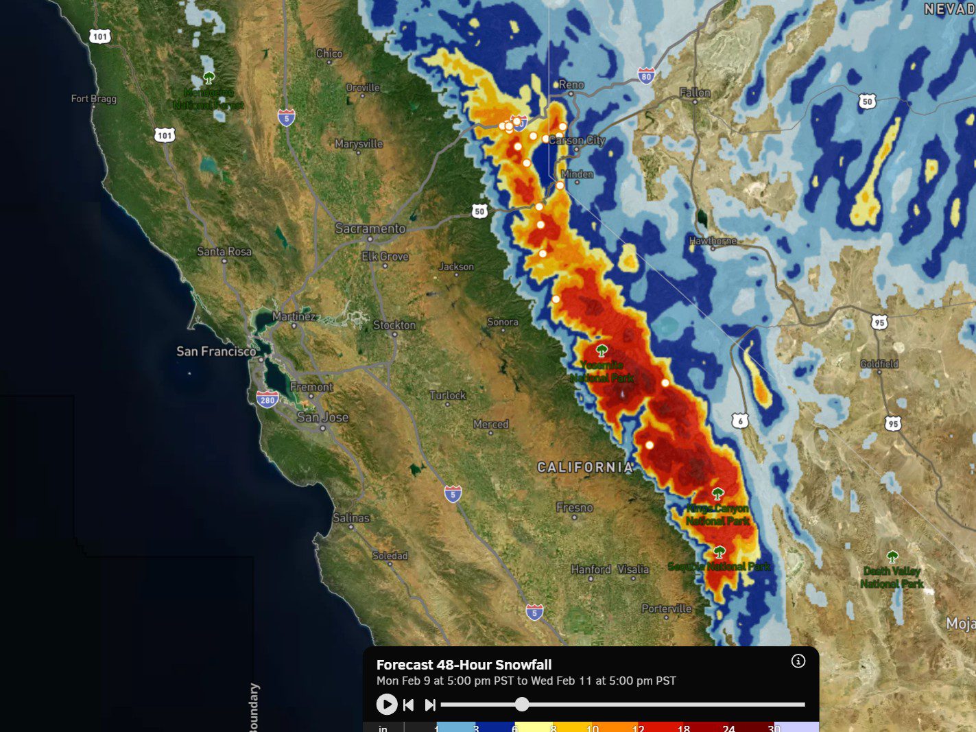
Monday – Wednesday Storm:
During the day on Monday, the cold front will be slowly approaching from the north. We will see an increase in clouds, and temperatures will be a bit colder, with highs in the 30s on the mountain and 40s for the base. We could see a stray snow shower, but not expecting much during the day.
The frontal wave increases precipitation Monday night, with the latest model runs suggesting snow could fall for up to 2 days into Wednesday, before clearing out Wednesday night. The latest model runs, Saturday morning, are almost all wetter than Friday morning’s runs.
Highs in the 30s for the lower elevations and 20s for the higher elevations on Tuesday and Wednesday. The winds don’t look that strong with these systems. The snow levels start high on Monday, up around 8000 ft. in the morning and falling to around 7000 ft. during the evening as the snow starts to increase. Then falling below the base overnight through Wednesday.
Snow ratios increase into Tuesday night with powdery snow expected on the upper mountain into early Wednesday morning. My updated snowfall forecast, which has increased with the model averages for precipitation having increased, is for around 8-13 inches at the base, 11-16 near mid-mountain, and 14-19 inches up top by Wednesday evening.
Thursday – Friday Break:
The initial trough exits the region with brief and weak high pressure building in for Thursday into Friday. We should see mostly sunny skies on Thursday. Friday, we could see clouds start to increase ahead of the next storm, with some models showing snow showers returning as early as Friday night.
Highs in the 30s to near 40 degrees down at the base on both days. Two days to clean up the snow before storms return next weekend.
Colder & Wetter Storms?
Next weekend, the next cold trough digs into the West and will stay there into the 3rd week of February. That will bring in even colder air and open the door to storm spinning up and drawing in moisture as the drop into the western side of the trough. The long-range models continue to suggest that this pattern could bring us wetter storms.
Snow levels don’t look to be an issue over the next two weeks, which is a change from the storms we saw earlier this season. Snow levels should stay below the base starting Monday night through the long-range, and dropping quite low with the colder pattern during week 2.
Cold air combined with moisture tends to work magic for snowfall when it flows over the mountains. We haven’t had a good cold storm pattern yet this season. The colder the air, the more it will boost snow ratios and snowfall from potentially wetter storms. The first storm in the series is expected to move in by next Saturday and continue into the week of the 16th.
We’ll continue to watch the trends with more details on potential snowfall as we get closer.
Long-Range Outlook:
The long-range models continue to show the trough staying over the West Coast through the end of the month, but lifting north a bit beyond the 19th. That could shift the storm track and wettest pattern to our north into the Pacific NW.
We could still see storms that bring us snow through the end of the month in that pattern, but maybe smaller storms and longer breaks between storms. If the trough digs a bit farther south during the period, we could see another decent storm.
We’ll watch the trends closely to see if we can finish out that month in a continued cold and snowy pattern.
BA
