Skip to content
Palisades Tahoe Logo Palisades Tahoe Logo Palisades Tahoe Logo
Explore
Main Menu
  • Explore Palisades Tahoe
  • Base to Base Gondola
  • Our New Name
  • Explore Legendary Lifts
  • Palisades Tahoe Blog
  • About Lake Tahoe
Plan Your Visit
Main Menu
  • Tickets & Passes
  • Lodging
  • Lessons & Guides
  • Deals & Packages
  • Rentals & Demos
  • Travel Here
  • Getting Around
Mountain Information
Main Menu
  • Snow and Weather
  • Lift and Grooming Status
  • Webcams
  • Hours of Operation
  • Trail Maps
  • Parking & Road Conditions
  • Snowfall Tracker
Events & Activities
Main Menu
  • Events Calendar
  • Aerial Tram
  • Activities
  • Dining & Apres
  • Shopping
  • Groups, Meetings & Weddings
  • Ski & Snowboard Teams
Winter Lodging Exteriors of the Village at Palisades Tahoe
Book Winter Early

Ikon Pass holders save up to 25% when you book with The Village at Palisades Tahoe this winter.

SAVE ON LODGING
Icon / FlashCreated with Sketch.
View All Offers
  • Weather

Snow Arrives Sunday Night into Wednesday

  • Nov 6, 2022
  • 9:40 am

We have a bit of a break Sunday into Sunday evening with partly sunny/mostly cloudy skies at times, and maybe a few scattered rain & snow showers. Highs into the 40s at the base and 30s up top. Winds increase through the day and into Sunday night, with gusts up to 60+ mph by afternoon and 100+ mph Sunday night.
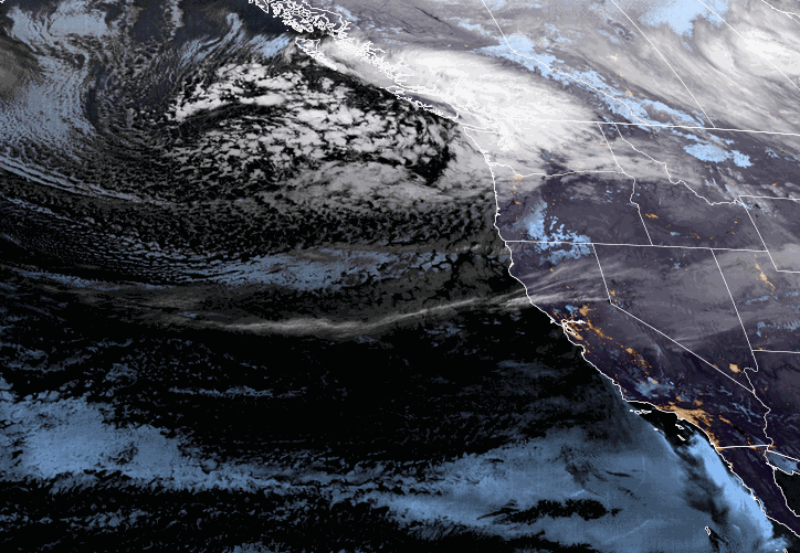
The Storm:

Sunday night into Monday a colder storm moves down the West Coast bringing through a cold front later Sunday night into Monday morning with heavy snow, then more moisture and colder air continuing snow showers Monday afternoon through Monday night. A 2nd wave of heavier snow is expected Tuesday with snow showers continuing Tuesday night, and then waning Wednesday before ending.

Snow levels drop below the base Sunday night, and much colder air moves in by Monday night increasing the snow ratios. That will help the snow to pile up through Tuesday, and the snow becomes more powdery. In total, we could see 2-3 feet of new snow at the base and on the lower mountain, and 3-4 feet of snow on the upper mountain by Wednesday.

The winds are still gusty from the southwest Monday and then should come down some for Tuesday into Wednesday. Highs in the 20s. Now we sit back, watch what happens, and tally up the snowfall numbers each morning!

Thursday – Friday:

We dry out with mostly sunny skies expected for Thursday and Friday. But it stays cold with highs only in the 30s to the base. The winds should be lighter on both days as well.

Long-Range:

A weak system is forecast to fall apart as it moves into CA next weekend. So not expecting more than just some clouds and a few scattered showers at best right now, along with some sun.

We could see a drier pattern to start the week of the 14th. We’ll keep an eye on the long-range patterns to see when storms could return.

BA

lake tahoe weather palisades tahoe weather forecast snowfall forecast
Bryan Allegretto
Bryan Allegretto

Share this article:

Recent Posts

  • Weather ·
  • September 19, 2023·
The predicted El Nino pattern for this winter

2023-24 Palisades Tahoe Winter Forecast Preview…

As we look ahead to the 2023-2024 winter season, it's important to remember that any winter outlook will contain an inherent degree of uncertainty. However, there are a few clues that we can keep an eye on.
Read more
  • Weather ·
  • May 8, 2023·

Final Forecast of the 2022-23 Season

First Week of May Snowfall Report: The first week of May was a cold and snowy one. The upper mountain…
Read more
  • Weather ·
  • May 1, 2023·

Snowy First Week of May

Monday – Friday Snow Shower Chances: A low-pressure system will be making its way south down the coast on Monday…
Read more

Social

Instagram Twitter Facebook Youtube

Contact

   Email Us
   1.800.403.0206

Our Partners

U.S. Forest Service Logo
1960 Olympic Valley Road
Olympic Valley, CA 96146

©2022 Palisades Tahoe

Alterra Mountain Company
  • Privacy Policy
  • Terms of Service
  • Photo Upload Terms of Use
  • Accessibility
  • Do Not Sell My Personal Information
  • Privacy Policy
  • Terms of Service
  • Photo Upload Terms of Use
  • Accessibility
  • Do Not Sell My Personal Information