
Monday System:
We are starting Monday morning with cloudy skies as the next system is moving into CA. Looking at radar this morning the storm looks wetter than what it is going to be by the time it reaches the Sierra. This system is falling apart today as it moves inland. We should see rain showers move in by afternoon and linger through the evening before clearing overnight.
The snow levels look to sit up around 8500-9000+ feet for most of this system, so we are mainly expecting rain showers for most elevations and maybe some wet flakes at the top of the mountain.
Highs in the 40s at the base and 30s up top with ridgetop winds gusting up to 60+ mph. Marginal for closing mountain top lifts. But it will be a breezy and wet day for any skiing. Total precipitation amounts look pretty meager through Monday evening with totals of only up to a tenth of an inch.
Tuesday – Wednesday:
High pressure builds over CA briefly for Tuesday and Wednesday. We will see clearing skies Tuesday becoming mostly sunny, which continues Wednesday. Highs back into the 50s at the base and 40s for the upper mountain. Winds will become lighter as well.
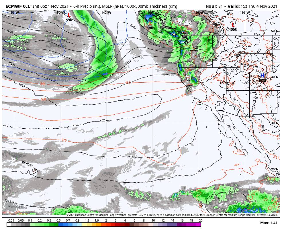
Thursday System:
The next storm pushes into the West Coast Thursday. We are expecting stronger winds with this storm. Ridgetop winds could be gusting up to 90+ mph during the day on Thursday, which would affect some upper mountain lifts.
Another wet and windy day is expected for skiing. The latest model runs suggest snow levels could start out around 11,000 ft. Thursday and only bottom out around 9000 ft. So all rain again for most elevations. Highs in the 40s for the base and 30s for the upper mountain.
Total precipitation amounts are starting to look pretty meager with this system as well. Some of the latest model runs show only another tenth or two of total precipitation.
Friday Into the Weekend:
By Friday into the weekend high pressure builds back in over the southwest, but with a trough in the northeast Pacific. Storms may continue to our north but we should stay dry. A few forecast models try to bring in some precipitation by Sunday, but most still hold off until next Monday.
For now, expecting mostly sunny skies Friday through Sunday with highs in the 50s at the base and 40s for the upper mountain. Gusty winds could continue for the mountain tops.
Early Next Week:
The trough is forecast to shift inland by next Monday through next Wednesday. That would open the door to the storms tracking farther south into northern CA. We could see 2-3 systems over the 3-day period. We will continue to watch these systems over the next week. They have the potential to be wetter and at least slightly colder.
Overall it could be a wet and hopefully snowy few days on the mountains to start next week. We will have to fine-tune the forecast all week to see how wet it could possibly be…
BA


