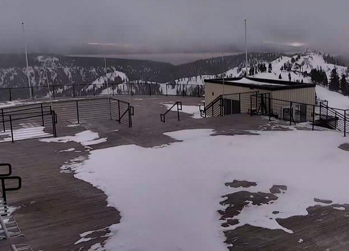
Skip to content
Palisades Tahoe Logo Palisades Tahoe Logo Palisades Tahoe Logo
Explore
Main Menu
  • Explore Palisades Tahoe
  • Base to Base Gondola
  • Our New Name
  • Explore Legendary Lifts
  • Palisades Tahoe Blog
  • About Lake Tahoe
Plan Your Visit
Main Menu
  • Tickets & Passes
  • Lodging
  • Lessons & Guides
  • Deals & Packages
  • Rentals & Demos
  • Travel Here
  • Getting Around
Mountain Information
Main Menu
  • Snow and Weather
  • Lift and Grooming Status
  • Webcams
  • Hours of Operation
  • Trail Maps
  • Parking & Road Conditions
  • Snowfall Tracker
Events & Activities
Main Menu
  • Events Calendar
  • Aerial Tram
  • Activities
  • Dining & Apres
  • Shopping
  • Groups, Meetings & Weddings
  • Ski & Snowboard Teams
Winter Lodging Exteriors of the Village at Palisades Tahoe
Book Winter Early

Ikon Pass holders save up to 25% when you book with The Village at Palisades Tahoe this winter.

SAVE ON LODGING
Icon / FlashCreated with Sketch.
View All Offers

Scattered Snow Showers Continue

  • By Bryan Allegretto
  • Weather
  • Mar 22, 2023

Snowfall Report:

We were expecting 1-4 inches to fall Tuesday-Tuesday night. We picked up the lower end of the forecast with 1 inch of new snow falling on the mountain in the past 24 hours as of 5 AM Tuesday.

Wednesday – Friday Snow Showers:

Additional weak systems move through the region through Friday. We will see mostly cloudy skies with some peeks of sun and scattered snow showers possible all 3 days. The best chance to see some steadier snow showers will be Thursday-Thursday night. Highs into the 20s up top and 30s at the base. Lighter winds are expected through Friday. 

We could see a dusting to an inch of snow every 12 hours or so, with 1-4 inches possible Thursday-Thursday night. Here is the updated snowfall forecast for possible totals over the 3-day period by early Saturday morning.

  • 1-5 inches at the base.
  • 2-6 inches at mid-mountain elevations.
  • 3-7 inches up top.

Weekend Snow Showers:

A mix of sun and clouds continue through the weekend with highs in the 20s up top and 30s at the base, along with lighter winds. We could see scattered snow showers move through at times. Only expecting a dusting to an inch of snow on the mountain on both days at best.

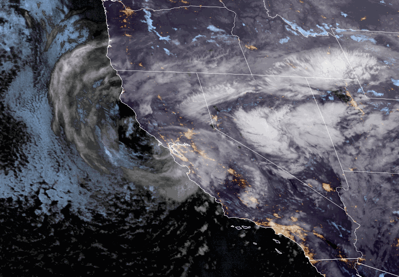
Monday/Tuesday – Wednesday/Thursday Storm:

The latest model runs are speeding up the arrival of a possibly stronger storm next week. Some bring in some heavier snow by Monday now, and others hold off until Tuesday. We could see increasing clouds, winds, and snow Monday, with some heavier snow into Tuesday. Then snow showers Wednesday that could possibly linger into Thursday the 30th.

We’ll continue to watch the trends with this storm over the next few days, with more details as we get closer and the details of the storm become clearer. It looks like a cold storm with snow to the base, and significant totals possible.

Long-Range:

The long-range models over the past 24 hours have been trending towards high-pressure building near the West Coast by the end of the month. They show a weak system with possible snow showers on Friday the 31st, and then drier weather for the weekend of the 1st-2nd, which is the weekend of the WinterWonderGrass Festival.

We’ll continue to watch the trends to see if they continue to be toward a drier pattern going into the first week of April, or if they will backtrack a bit toward the unsettled pattern continuing.

BA

Share this article
lake tahoe weather palisades tahoe weather forecast snowfall forecast
Bryan Allegretto
Bryan Allegretto

Recent Posts

  • Weather ·
  • November 30, 2023·

Snow Thursday, Drier for the Weekend

Thursday Snow: We already have some light snow showers around the area Thursday morning as some moisture is moving in…
Read more
  • Weather ·
  • November 29, 2023·

Snow Showers Thursday, Unsettled Weekend

Wednesday Weather: We have another nice day on Wednesday if you like sunny skies. Highs into the 40s as we…
Read more
  • Weather ·
  • November 28, 2023·

A Little Snow Thursday & Saturday, Hopefully

Tuesday – Wednesday Weather: We will continue the cool and dry pattern through Wednesday with partly-mostly sunny skies each day.…
Read more

Social

Instagram Twitter Facebook Youtube

Contact

   Email Us
   1.800.403.0206

Our Partners

U.S. Forest Service Logo
1960 Olympic Valley Road
Olympic Valley, CA 96146

©2022 Palisades Tahoe

Alterra Mountain Company
  • Privacy Policy
  • Terms of Service
  • Photo Upload Terms of Use
  • Accessibility
  • Do Not Sell My Personal Information
  • Privacy Policy
  • Terms of Service
  • Photo Upload Terms of Use
  • Accessibility
  • Do Not Sell My Personal Information