

Monday Weather:
The dry and mild weather is finally ending, as clouds and moisture begin to stream towards CA. That will bring clouds and sun for Monday, with highs in the 50s for the lower elevations and 40s for the upper mountain. Ridgetop winds are increasing from the WSW with gusts up to 40-50+ mph by afternoon.
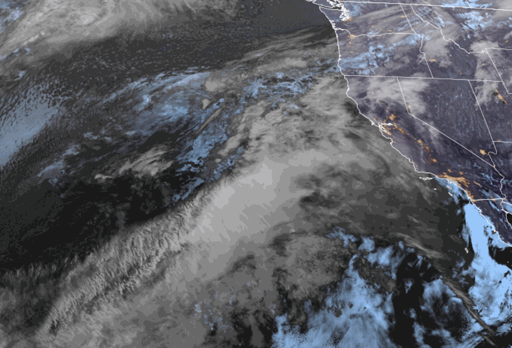
Tuesday – Thursday Storms:
The moisture begins to stream into the northern Sierra by early Tuesday morning, with rain and snow showers possible through Wednesday. Then the cold front from the 2nd system sweeps through Wednesday night, with snow showers into Thursday morning before clearing later in the day.
The biggest model discrepancy is still with the first system. Some forecast models have trended back north with the heaviest precipitation, while others are still aimed farther south. The snow levels during this period will be fluctuating between 7000-8000 ft., maybe a bit lower under any heavier bands of precipitation, especially later Tuesday night into Wednesday morning.
Highs in the 30s on the mountain and 40s near the base. The ridgetop winds could continue to gust up to 40-50+ mph through Wednesday morning, but then increase into Wednesday night ahead of the cold front, up to 100 mph overnight before falling on Thursday. That could affect some upper mountain ski lifts.
The cold front with the next system sweeps through Wednesday night with showers into Thursday morning. That will drop the temperatures and snow levels, down below the base by later Wednesday night into Thursday morning, before rising a bit again on Thursday as the storm clears.
The model average for total precipitation, averaging in both Tue – Wed scenarios, is back up near where it was on Friday, with up to 1.6 inches. The wetter models split the totals fairly evenly between the Tuesday – Wednesday showers, and the cold front moving through Wednesday night into Thursday morning.
Looking at my updated snowfall forecast before the storms move in, taking the average forecasts for precipitation and snow levels, we could see around 1-4 inches of wet snow near the base, mainly at the end Wednesday night into Thursday morning, 7-12 inches near mid-mountain with a mix Tue – Wed, and 10-16 inches of snow up top where we expect mainly all snow.
The Weekend:
High pressure starts to build back in on Friday, but it’s still cool. We should see mostly sunny skies with highs into the 40s for the lower elevations and 30s for the higher elevations.
The latest model runs now show the high-pressure ridge centered more over the West Coast over the weekend. If that trend continues, we could see highs near 60 degrees in the village by Sunday. For lower mountain elevations, we still expect highs in the 50s, with 40s for the upper mountain above 8000 ft.
Long-Range Outlook:
Going into the week of the 6th, the long-range models continue to show the ridge a bit off the coast with some lower heights and slight troughing over the West.
That should keep high temperatures more seasonal in the 50s. We will likely not see any bigger storms in that pattern, but weaker systems with showers could sneak in during the 2nd week of April. The long-range models show some light precipitation totals possible between the 7th – 14th.
BA
