There is not much change to the forecast this morning other than the trend of the Monday storm being a bit weaker.
We have nice weather through the weekend with mostly sunny skies each day. Highs into the 50s for the lower elevations and 40s for the higher elevations.
Monday System:
The latest trend on the forecast models is for the Monday system to stay a bit farther north with less precipitation falling farther south over the northern Sierra. The storm is still expected to bring rain and high-elevation snow Monday afternoon into Monday night with snow levels falling Monday night before the storm tapers off by early Tuesday morning.
We will see strong winds over the ridges on Monday. Highs into the 40s for the lower elevations and 30s for the higher elevations. The snow levels will start high, up around 7000-8000 ft. Monday afternoon. Then falling slowly to around 6500-7000 ft. by evening. Monday night as the storm is winding down and clearing snow levels drop down near the base.
That means we are expecting mostly rain down near the base and some wet snow on the mountain. We could see totals around 0-1 inches at the base, 1-4 inches near mid-mountain, and 2-5 inches up top.
Midweek Ridge:
Behind the storm on Tuesday, the sun comes out, the winds drop off, and highs warm into the 40s for the lower elevations with 30s for the higher elevations. High pressure builds in over CA Tuesday into Wednesday with the nicer weather continuing. Highs warming into the 40s and 50s on Wednesday with mostly sunny skies.
Late Week Trough:
The next upstream trough pushes into the West Coast next Thursday – Friday. That will bring in another shot of colder air and the chance for some showers as the next system moves inland. But the front looks to fall apart and is disorganized as it moves inland. We could see some rain and mountain snow showers both days, but as of right now, it looks minor.
Long-Range Forecast:
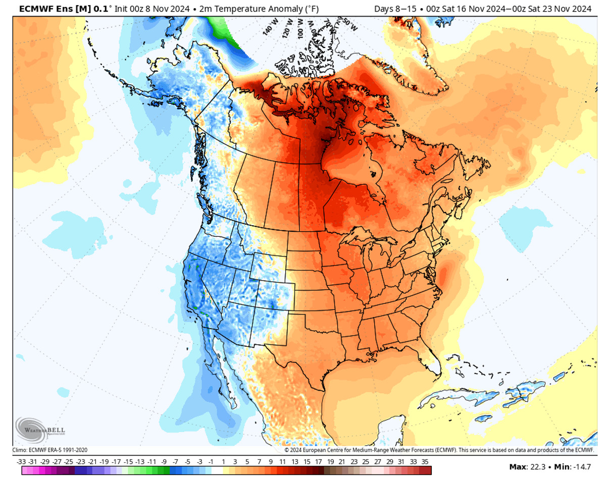
We could see another break in the storms for the 3rd weekend in November. The week of the 18th another trough is forecast to dig into the West and possibly stick around into the last week of November. That would keep the storm door open through the end of the month. That is not a guarantee of any big snowstorms, but more storms would be possible into the last week of November.
It will also keep the colder air over the West, with below-average temperatures expected based on the latest forecasts. That would keep the nights cold for snowmaking as the snowmaking team works to increase the base and terrain with man-made snow.
Hopefully, a big snowstorm will show up before the end of the month to give that effort a boost. We’ll see…
BA


