Calm Weather:
We will start off the week with gusty ridgetop winds on Monday, with gusts up to 60+ mph. We have mostly sunny and dry days to start the week, with highs in the 50s near the base. There’s a chance for scattered showers by Thursday, but not expecting much if anything.
Pattern Change:
By Friday into Saturday, a trough is forecast to dig into the West Coast, opening the storm door. The forecast models have been all over the place, but most runs today show storms trying to move through CA by Friday into Saturday, and some again on Sunday. They vary on the storm track. Here is our Global Storm Forecast map for Friday – Saturday.
There could be another weak system early next week around Tuesday. Overall, the ensemble mean models show the storm track and wettest areas to our south, with the northern Sierra on the northern edge.
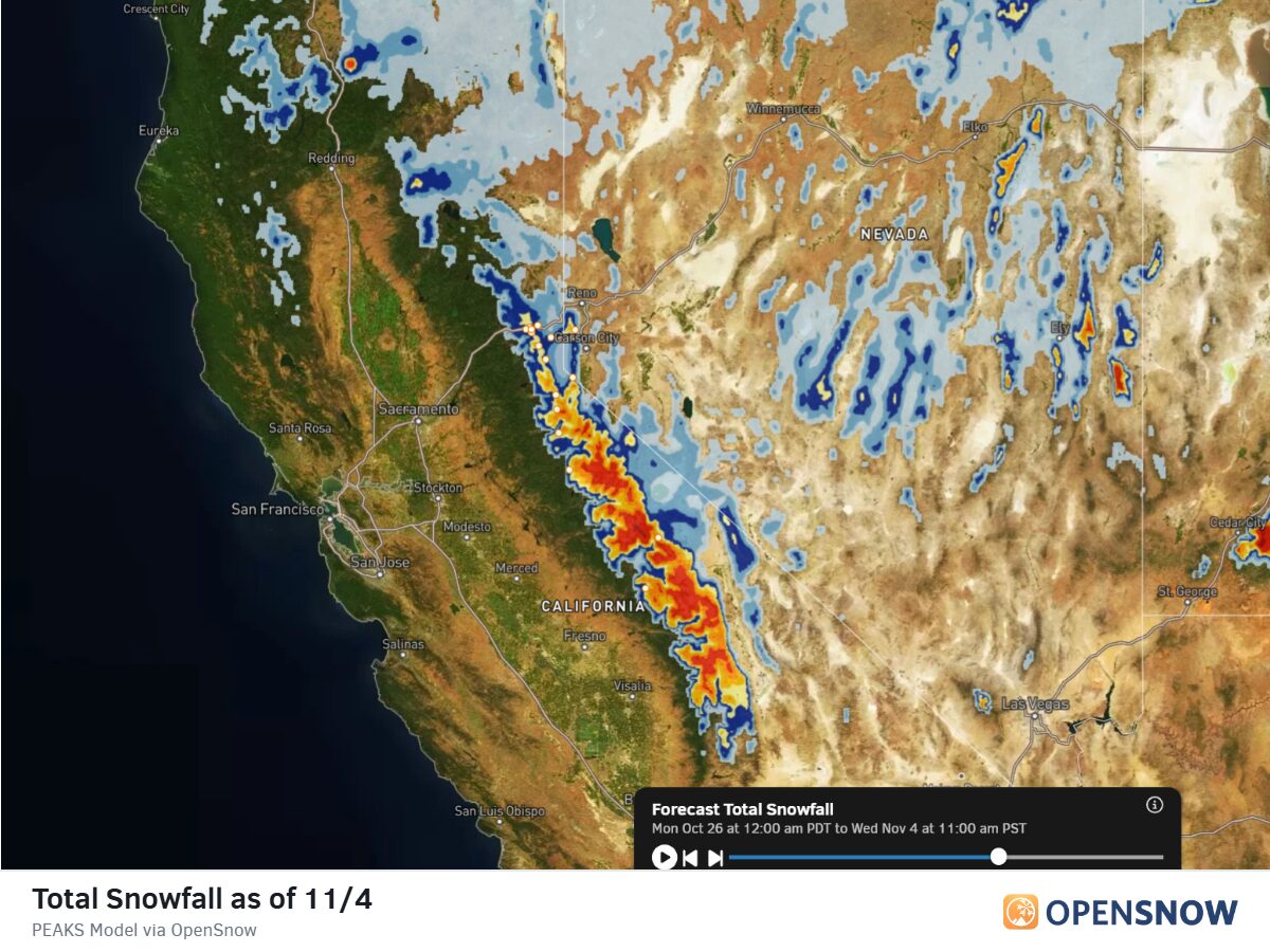
The OpenSnow PEAKS model is showing total precipitation amounts close to 1 inch near the crest by next Wednesday, over the next 10 days, but that’s mainly days 5-9, which could change as the models get a better handle on the storm tracks.
There is some colder air with the weekend storms, so we could see snow levels in the 6000-7000 ft. range Fri-Sat, and maybe falling a bit more by Saturday afternoon/night. That means we should see some snow accumulate on the upper mountain if these storms track through the northern Sierra.
The latest model runs show up to a few inches of snow on the upper mountain by Sunday, and maybe a bit more into early next week. We will need to keep watching the trends on the late-week storms to see if the snowfall forecasts will increase or decrease as we get a better idea of the storm tracks.
Long-Range Outlook:
Looking out beyond a week into the first 10 days or so of November, the long-range models suggest more troughing near the West Coast, which could keep the door open to storms.
The long-range ensemble mean models suggest that pattern could bring the opposite, with the storm track and wettest weather to our north instead of to our south. That still keeps us on the edge of the storm track.
The good news is that the pattern continues to show chances of storms through the long range, just no confidence in how wet or how cold any storms could be, similar to the storms later this week. We’ll continue to watch the trends, and I’ll be posting again before the weekend, looking at the latest on each system.
The El Nino:
This week’s ENSO 3.4 reading was 2.5 degrees above average. That is very warm. We will get the official October and ONI (3-month average) numbers next week. I believe the RONI record was 2.3 degrees, set during the 2015-16 season, so we’ll have to see where we land over the next month or two.
The forecasts suggest that the El Niño strength is peaking either here at the end of October or in November. They create conditions that destroy themselves, so they rarely last more than a year or so.
We are still expecting strong El Niño conditions through the middle of winter, when it matters most in affecting the weather patterns. We’ll have to see how other weather patterns will try to interfere with it. For now, we are expecting a fairly active storm pattern for CA for most of the winter, and the odds lean towards above-average snowfall as well.
We’ll see…
BA