

The Week Ahead:
The only change in the pattern between this Monday and next Monday will be the chance for temperatures to cool a few degrees over the weekend. Outside of that, highs are mainly in the 40s to near 50 degrees for lower elevations near the base, along with sunny days and no storms.
There is a chance for a low-pressure system to move through far southern CA over the weekend, and a cold front to our NE, but we should stay precipitation-free.
Long-Range Outlook:
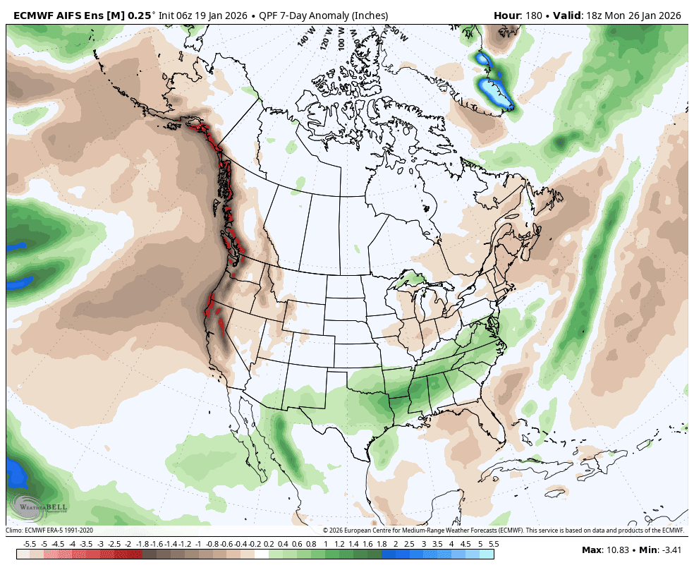
Dry through the 27th, so let’s get out to day 10, the 28th, where we were watching for a possible pattern change. The models were showing a strong Pacific jet stream extending close to the West Coast between the 28th – 1st, with a trough and storms spinning up near the West Coast.
This is what I have been calling “the hard way” to get storms, as the jet has to extend just far enough to push storms into the back side of the high-pressure ridge over the West. I was 50/50 in believing it because if it pulls back slightly, we go from a chance of a wet storm or two to a weak system or nothing.
Well, the latest trends have pulled back slightly, which quickly diminishes our chances of seeing a storm near the end of the month. Maybe a weak system with a few showers at best. That is the trend on most of the latest forecast model runs this morning.
If we don’t see a storm push far enough east to reach us near the end of the month, the trough near the West Coast may retreat beyond the 2nd, and we could go into a more solid dry pattern during the 1st week of February, as the latest ensemble mean models suggest.
Looking at the extended range models, they don’t show near to above normal precipitation until the 3rd week of February, with storms starting around mid-February. Hopefully it’s much sooner than that. Things can change quickly in the long-range, so we’ll be watching closely, and I’ll let you know as soon as it looks like storms could return. Pray for another miracle to arrive sooner than later…
BA
