Palisades Tahoe Logo Palisades Tahoe Logo Palisades Tahoe Logo
Explore
  • Explore Palisades Tahoe
  • Our New Name
  • Explore Legendary Lifts
  • Palisades Tahoe Blog
  • About Lake Tahoe
  • About Us
Plan Your Visit
  • Tickets & Passes
  • Lodging
  • Lessons & Guides
  • Deals & Packages
  • Rentals & Demos
  • Travel Here
  • Getting Around
Mountain Information
  • Snow and Weather
  • Lift and Grooming Status
  • Webcams
  • Hours of Operation
  • Trail Maps
  • Parking & Road Conditions
  • Snowfall Tracker
Events & Activities
  • Events Calendar
  • Activities
  • Dining & Apres
  • Shopping
  • Things To Do In Lake Tahoe
  • Groups, Meetings & Weddings
  • Ski & Snowboard Teams
IKON PASS HOLDER LODGING DISCOUNT

Ikon Pass holders save up to 25% on slopeside lodging at The Village at Palisades Tahoe.

SLOPESIDE LODGING
Icon / FlashCreated with Sketch.
View All Offers
  • Weather

Nice Weekend, Colder Week Ahead

  • Jan 29, 2022
  • 8:23 am

Saturday – Monday:

Thursday through Monday we should see mostly sunny skies and highs into the 40s.
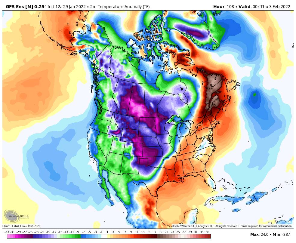
Colder Pattern:

A cold trough digs into the West by Monday night into Tuesday and it could remain through Thursday. Most of the precipitation with the cold front stays to our east, but a few clouds and a stray snow shower are possible Tuesday. Then mostly sunny Wednesday into Thursday.

Highs drop into the 30s at the base and 20s up top Tuesday into Wednesday. Then we start to slowly warm Thursday but highs may remain in the 30s.

Ridgetop winds increase from the north Tuesday gusting up to 40+ mph by afternoon. Then to 80+ mph Wednesday possibly closing some upper mountain lifts & making it feel even colder! Then coming down later Wednesday into Thursday.

Long-Range:

High pressure is forecast to move closer to the West coast by the end of next week into the 2nd week of February. That could bring back slightly warmer high temperatures, and that should also keep us in a drier pattern for now.

There are some signs that things could start to shift in a positive direction for storms around mid-month into the 2nd half of February. We’ll let you know at the first sign of any storms headed our way!

BA

lake tahoe weather palisades tahoe weather forecast snowfall forecast
Bryan Allegretto
Bryan Allegretto

Share this article:

Recent Posts

  • Weather ·
  • May 26, 2022·

Colder with Unsettled Weather for Memorial Day Weekend

It’s the last weekend of the season and we could see a few flakes fall on the mountain! Thursday –…
Read more
  • Weather ·
  • May 17, 2022·

Quick Cooldown Thu-Fri, Then Milder Weather

A cool trough moves through Thursday – Friday. Highs dip down into the 60s at the base Thursday and 50s…
Read more
  • Weather ·
  • May 11, 2022·

After 15″ of Snow, A Return to Spring

Snowfall Report: We have had a cold and wintry first half of the week with several systems that rotated through…
Read more

Social

Instagram Twitter Facebook Youtube

Contact

   Email Us
   1.800.403.0206

Our Partners

U.S. Forest Service Logo
1960 Squaw Valley Road
Olympic Valley, CA 96146

©2022 Palisades Tahoe

Alterra Mountain Company
  • Privacy Policy
  • Terms of Service
  • Photo Upload Terms of Use
  • Accessibility
Menu
  • Privacy Policy
  • Terms of Service
  • Photo Upload Terms of Use
  • Accessibility