Snowfall Report:
An additional 3 inches of snow fell on the upper mountain from the snow showers Saturday. That brought the 2-day storm totals to a foot of new snow, and the 4-day totals to 22 inches.
Sunday Weather:
We have a brief break between storms on Sunday. We will see mostly sunny skies, lighter winds, and highs into the 30s.
Monday – Tuesday Storms:
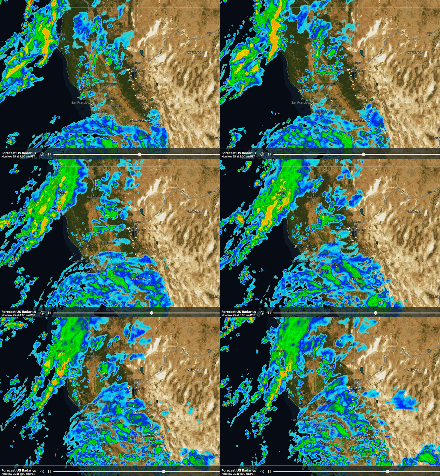
Low pressure spinning off of the Pacific NW will work its way southeast towards northeast CA Monday pushing precipition back into the northern Sierra. It will also help to draw in moisture that is being pulled up by a low well off of the CA coast and will direct an AR at central CA for Monday and Tuesday. We will be on the northern edge of that.
The Tahoe basin is in the middle with the northern energy bringing in lighter precipitation to the northern Sierra and the AR bringing heavier precipitation to the central and southern Sierra. The forecast models are still struggling with how far north the heavier precipitation to the south will push, and how fast it shifts away from the area on Tuesday.
What we do know is that we will see gusty winds on both days, with gusts up to 40-50+ mph over the ridges on Monday and 50-60+ mph on Tuesday. Highs into the 30s both days for the lower elevations and 20s for the peaks.
Snow levels will start low Monday morning as precipitation starts to push back in by late morning. Down near the base to start before rising to around 6000-6500 ft. by afternoon. Then dropping below the base Monday night as colder air from the northern system moves inland. But then rising Tuesday as milder air from the AR flows in, up to around 6300-6800 ft.
If the precipitation is lighter they could be a bit higher and if heavier a bit lower on Tuesday. In total for the 2-day period, using the model average, we could see around 6-11 inches of new snow on the lower mountain and 12-17 inches on the upper mountain.
We have one more morning to adjust this forecast based on the latest model trends…
Wednesday – Thanksgiving Weekend:
We clear out Wednesday with mostly sunny skies expected and highs in the 30s. Similar weather is expected for Thanksgiving Day. There is still an outside chance of a shower on Black Friday as the low off the CA coast approaches, but the ridge building in the northeast Pacific will try to suppress it to the south.
The weather looks dry for next weekend and starting to warm a little, with highs into the 40s for the lower elevations near the base.
Long-Range Forecast:
Going through the 1st week of December the long-range models continue to show a strong high-pressure ridge anchoring over the West, with a deep trough over the East. We look to get stuck in that pattern for at least a week. That should keep us bone dry through the 1st week of December with milder temperatures as well.
The longer-range models continue to suggest that the pattern we see the first week of December could get stuck into the 2nd week of the month or even longer. Hopefully not… We’ll continue to watch the trends to see when the pattern could break down allowing storms back into northern CA.
BA


