
Sunny & Mild thru The Weekend:
The nice weather continues through the weekend as high pressure continues to build over the West Coast. Mostly sunny days and lighter winds through Saturday. Highs into the 60s on the mountain and 70s at the base.
Sunday we’ll see mostly sunny skies, but we’ll start to feel the effects of the coming pattern change. Southwest winds will increase through the day with ridgetop gusts up to 40-50+ mph by afternoon. That could affect a few upper mountain lifts by later in the day. Highs cool slightly into the 50s on the mountain and 60s at the base.
Rain & Snow Showers Next Week:
The next trough and associated cut-off/closed low-pressure system continue to move south down the West Coast Monday. The latest model runs show both hanging around through at least next Thursday, May 4th. Highs look to be in the 40s on the mountain and 50s at the base Monday, with partly-mostly sunny skies ahead of the showers that are possible by evening.
The latest model runs agree that a cut-off/closed low will stall out and wobble somewhere near/over CA, but possibly just west of the Sierra Monday night thru Thursday night next week. Moisture is expected to flow into the Sierra and afternoon heating will help with lift and showers developing over the mountain. If the low is close enough a band of steadier precipitation could form on the eastern side over the Sierra.
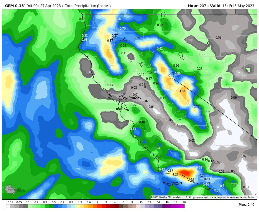
The latest model runs are showing up to 1+ inches of total precipitation over the mountain over the 3-4 day period. Mild air will be in place ahead of the approaching low-pressure system. The coldest air will be at the center of the low-pressure rotation which is expected to be to our west closer to the coast. The snow levels over the 3-4 day period will depend on the exact track of the center of the low with the coldest air.
The latest model runs suggest snow levels could start around 6500-7500 ft. Monday afternoon/evening as showers move in, and then drop below the base Monday night. Then fluctuating between the base and 7000 ft. into Wednesday morning. As the low pulls away from the northern Sierra snow levels could rise to between 7000-8000 ft. Wednesday afternoon through Thursday night.
We could see up to a few inches of snow on the mountain each day Monday night through Thursday night. Based on the latest trends, here is an early estimate of possible snowfall next week if the latest model runs verified with the forecasted storm track. These are 4-day totals by early Friday morning the 5th.
- 1-5 inches at the base.
- 4-8 inches at mid-mountain elevations.
- 8-13 inches up top.
At the base, it will be hard for snow to accumulate on warmer surfaces, especially during the day. But if we see a steadier band set up Monday night or Tuesday night we could see some light accumulations of snow. Highs into the 30s on the mountain and 40s at the base Tuesday-Thursday. Colder under any heavier showers. Lows in the 20s at night when the best chance for light snowfall accumulations will occur.
Long-Range Weather:
The long-range models suggest that troughing could hang around California through the weekend of the 6th-7th, and possibly into the first few days of the week of the 8th. That pattern could keep the cooler temperatures around with highs in the 40s and 50s which is below average for May.
The latest model runs show another cut-off low forming off the coast by next Friday the 5th, but they keep it well off the coast. We could see enough moisture around to see some afternoon showers pop up over the mountains through the 9th-10th.
Beyond the 10th, it looks like we could see high pressure begin to build back in over the region with a better chance for a drier pattern and warmer temperatures.
BA
P.S. I have now shifted to staggered posts, and I plan to wrap up forecasting for the season on May 1st. I may do a bonus post after/if we see accumulating snowfall in May to recap the totals and season totals.


