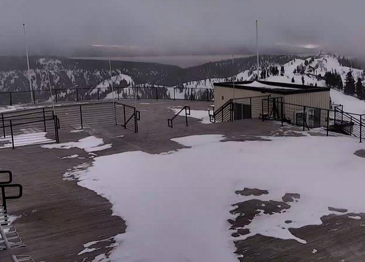
Christmas Day:
Strong high pressure is over CA for Christmas Day. We will see partly-mostly sunny skies, lighter winds, & mild temperatures. Highs in the 40s on the mountain and near 50 degrees at the base.
Monday:
Highs in the 40s for Monday with increasing clouds and winds. Ridgetop gusts from the southwest up to 40-50+ mph to start the day and increasing up to 70-80+ mph during the afternoon, which could affect some upper mountain lift operations.
Monday Night – Tuesday Night Storm:
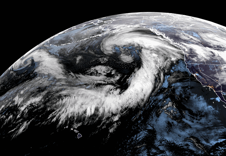
The first storm is expected to move in with light rain showers as early as Monday evening. This storm will be tapping into quite a bit of subtropical moisture with heavy rain moving in after midnight into early Tuesday morning from top to bottom.
For Tuesday, temperatures will be in the 30s, and ridgetop winds will be gusting in excess of 100+ mph over the ridges. Those winds should close down quite a few ski lifts. The tricky part of the forecast will be how fast do the snow levels fall with the cold front through the day on Tuesday as the heaviest precipitation shifts south of the area.
Snow levels could drop fairly quickly down to 8,000 ft by mid-morning and 7000 ft. by early afternoon. Then down to between 6200-6700 ft. by late afternoon. That is near to just above the base at Palisades and below the base on the Alpine Meadows side. Heavy wet snow will fall on the mountain as the rain turns to snow through the day from top to bottom, with several inches up to a foot+ possible on the upper mountain.
Tuesday night snow levels fall below the base but with lighter snow showers expected. Several more inches of drier snow is possible overnight. It’s very hard to forecast total snowfall with the rain, but looking at the model average for snow levels & precip, we could see 4-10 inches at the base & lower mountain, 10-17 inches at mid-mountain, and 17-23 inches on the upper mountain by Wednesday morning.
Wednesday – Thursday Night:
We have a storm departing Wednesday and another moving through Wednesday night into Thursday, with a 3rd system moving in Thursday night.
We should see clouds with maybe some breaks of sun and scattered snow showers for Wednesday. The winds come down with ridgetop gusts to 30+ mph. It should be a decent day for skiing.
Wednesday night into Thursday the next system is weaker and snow levels stay below the base. Ridgetop winds could increase to 40+-50+ mph Thursday which is marginal for affecting the upper mountain lifts. Highs in the 30s Wed-Thu. Snow showers are expected through the period through Thursday night.
We could see an additional 2-5 inches on the mountain by Thursday morning and 6-12 inches by Friday morning. That’s 8-17 inches from bottom to top on top of the snow that falls by Wednesday morning.
Storms Continue into New Year’s Eve:
The next storm could move in Friday night into New Year’s Eve. This storm could be a bit stronger with gustier winds, heavier snow, and snow levels possibly jumping up to around 7000 ft. to start. Some models have the heaviest precip going south of the Tahoe region and other have a direct hit.
We’ll be fine-tuning the forecast for this and all of the storms every day. We could pile up quite a bit of snow through the period on the mountain. Winds could affect lift operations several days. The base and lower elevations could see some rain at times and back to snow. Overall a stormy week ahead.
Long-Range:
There is fairly good agreement among the forecast models that we could see a break between storms and a fairly nice ski day on New Year’s Day. But that could change as we get closer. That could also be the window to drive home as another strong storm could move in next Sunday night into Monday the 2nd.
The active pattern could continue through the first week of January. You’ll want to stay tuned to the forecast as we iron out the details on timing for each storm, especially if you plan to travel through the Sierra or ski through the holiday period.
BA