

Saturday – Sunday (daytime):
Partly sunny for Saturday and Sunday with clouds streaming in ahead of the next storm. Ridgetop gusts from the south up to 40-50+ mph Saturday afternoon, then a bit lighter but breezy on Sunday. Highs in the 40s for the lower elevations and 30s for the upper mountains.
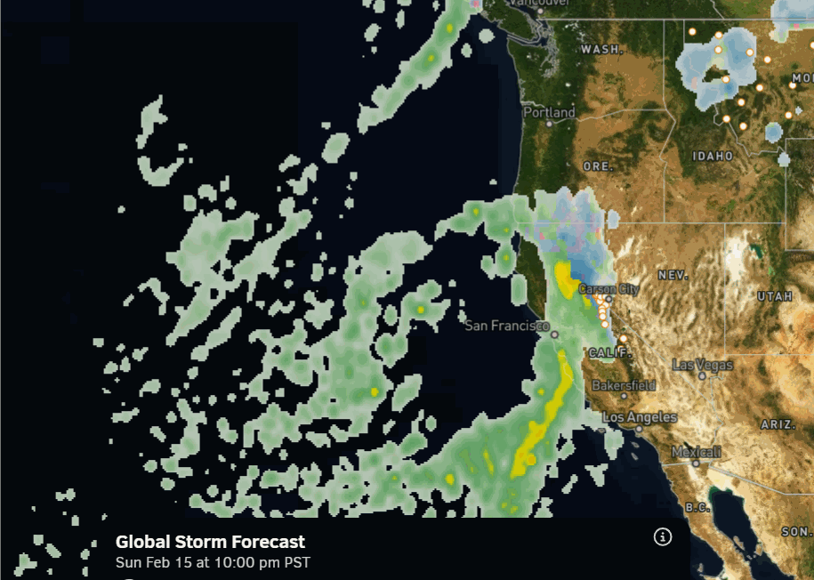
On Sunday, the leading edge of the precipitation with the next storm will be streaming from south to north through CA just west of the Sierra through the afternoon. Close enough that a few stray showers are possible near the crest. Snow levels will be around 6500 – 7000 ft. through Sunday afternoon with any showers.
Sunday Night – Tuesday Night Dump:
The leading edge of the precipitation is still expected to push in over the mountain around 7-10 PM. Snow levels starting near the base and then continuing to fall very low by Tuesday night. Highs in the 30s for the lower elevations and 20s for the upper mountain. The winds are forecast to increase later in the day on Monday, so the morning hours could be ok for upper mountain skiing.
Tuesday into Tuesday night, the cold storm from the NW drops in with even colder air, strong winds, and lots of moisture. Highs drop into the 20s for the lower elevations and teens up top. Ridgetop winds could gust up to 80-90+ mph on Tuesday, bringing blizzard conditions and likely closing a lot of upper mountain ski lifts.
In a normal storm with 10-12:1 snow ratios, totals would be around 3-5 feet by Wednesday morning. But snow ratios could exceed 20:1 on the upper mountain by Tuesday night, with an average near 8k’ of around 17:1 over the 2 days, which could boost the snowfall totals by up to a foot by Wednesday morning. The only thing is that strong winds can drop snow ratios as snowflakes break apart.
Wednesday – Thursday Snow Showers:
Lingering snow showers for Wednesday, and a trend back towards a final wave possible on Thursday on several of the models this morning. With the snow showers possibly lingering through Thursday, I’m going to extend my 3-day snowfall forecast out to 4 days this morning, and look at potential totals from Sunday night through Thursday.
The OpenSnow PEAKS model has shown 5″ over Palisades all week. The snow levels stay very low through Thursday, with high snow ratios of 15-20:1 continuing. The good news about Wednesday and Thursday is that the winds drop off, making for much better skiing conditions and fluffier snow.
Adding in an additional several inches up to a foot of additional snowfall Wednesday – Thursday, on top of the 3.5 – 6 feet on the mountain by Wednesday morning, we could see totals of 4 – 7 feet of snow by Friday morning, from bottom to top, as we tally up the storm totals from the 3 back-to-back storms!
We’ll continue to watch the trends closely, especially for Wed – Thu, to see if several more inches could be added on top. If not, totals could be less than forecast, but some models show more. Cold storms tend to overproduce vs warm storms that tend to underproduce snowfall, as cold, moist air flowing over mountains tends to work magic for big powder dumps.
Long-Range Outlook:
The latest model runs are in better agreement that we will still see a break in the storms near the end of the week into next weekend, as the trough and storm track shift east a bit.
The long-range model runs are all over the place with the track and timing of storms beyond Friday. But they do show storms possibly returning by the 22nd/23rd as that trough shifts back west off the coast in a more favorable pattern for storms to dig south into northern CA, with additional storms possible through about the 26th.
The pattern stays fairly cold into the week of the 23rd, with low snow levels with any storms. But not quite as cold as this upcoming week, with highs into the 30s for the lower elevations and 20s for the upper mountain.
The long-range models continue to show the trough lifting north by the end of the month, with the pattern becoming drier through the first week of March. The storm track is still active to the north in the Pacific NW, and it would still be possible for storms to push far enough south to try and reach the northern Sierra, but likely much weaker by the time they do IF they do.
BA
