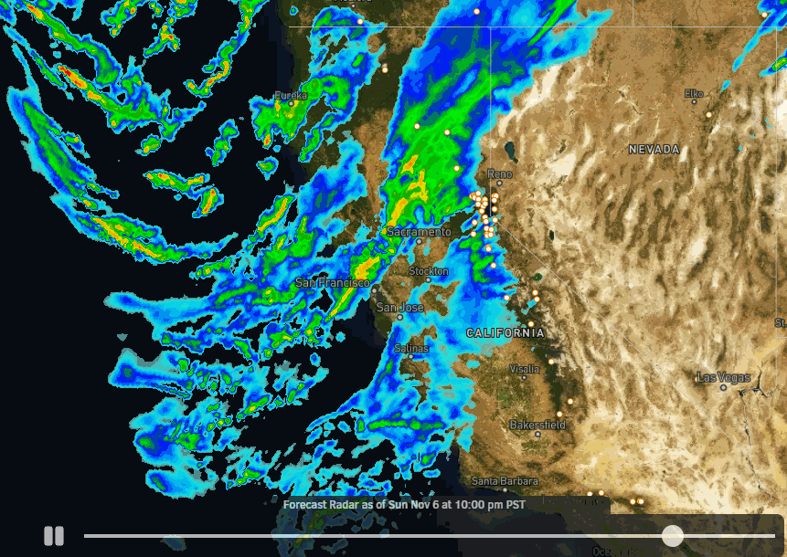
Skip to content
Palisades Tahoe Logo Palisades Tahoe Logo Palisades Tahoe Logo
Explore
Main Menu
  • Explore Palisades Tahoe
  • Base to Base Gondola
  • Our New Name
  • Explore Legendary Lifts
  • Palisades Tahoe Blog
  • About Lake Tahoe
  • About Us
Plan Your Visit
Main Menu
  • Tickets & Passes
  • Lodging
  • Lessons & Guides
  • Deals & Packages
  • Rentals & Demos
  • Travel Here
  • Getting Around
Mountain Information
Main Menu
  • Snow and Weather
  • Lift and Grooming Status
  • Webcams
  • Hours of Operation
  • Trail Maps
  • Parking & Road Conditions
  • Snowfall Tracker
Events & Activities
Main Menu
  • Events Calendar
  • Activities
  • Dining & Apres
  • Shopping
  • Things To Do In Lake Tahoe
  • Groups, Meetings & Weddings
  • Ski & Snowboard Teams
IKON PASS HOLDER LODGING DISCOUNT

Ikon Pass holders save up to 20% on slopeside lodging at The Village at Palisades Tahoe.

SLOPESIDE LODGING
Icon / FlashCreated with Sketch.
View All Offers
  • Weather

Continuing to Track the Big Early Season Storm

  • Nov 5, 2022
  • 10:44 am

Warmer Storm:

Saturday we have increasing clouds and winds with rain showers developing by the afternoon. Ridgetop winds could be gusting up to 70+ mph from the west/southwest by later in the day. Highs in the 40s at the base and 30s on the upper mountain.

Rain showers continue into Sunday. Snow levels above 9000 ft. Saturday and possibly staying above 8000 ft. into Sunday morning. Then lowering through the day down to around 7000 ft. by evening. 1-4″ of wet snow is possible above 8000 ft. Ridgetop winds increasing to 90+ mph Sunday evening. Highs in the 30s.

Colder Storm:

Sunday night into Monday a colder storm moves down the West Coast bringing through a cold front later Sunday night into Monday morning with heavy snow, then more moisture and colder air continuing snow showers Monday afternoon through Tuesday night, and possibly into Wednesday morning before clearing out.

Snow levels drop below the base Sunday night, and much colder air moves in by Monday night increasing the snow ratios. That will help the snow to pile up through Tuesday, and the snow becomes more powdery. In total, we could see 2-3 feet of new snow at the base and on the lower mountain, and 3-4 feet of snow on the upper mountain by Wednesday.

The winds are still gusty from the southwest Monday and then should come down some for Tuesday into Wednesday. Highs in the low 30s at the base and 20s on the mountain each day.

Thursday – Friday:

We dry out with mostly sunny skies expected for Thursday and Friday. But it stays cold with highs only in the 30s to the base.

Long-Range:

A weak system is forecast to fall apart as it moves into CA next weekend. So not expecting more than just some clouds and a few scattered showers at best right now, along with some sun.

We could see a drier pattern to start the week of the 14th, but then some of the long-range models suggest that a more active pattern could return by the end of the week.

BA

lake tahoe weather palisades tahoe weather forecast snowfall forecast
Bryan Allegretto
Bryan Allegretto

Share this article:

Recent Posts

  • Weather ·
  • March 21, 2023·

Weak Systems & Snow Showers thru Sunday

Tuesday Storm: The next storm pushes snow showers back in by later Tuesday morning, with steadier snow through Tuesday afternoon.…
Read more
  • Weather ·
  • March 20, 2023·

More Weak Systems Tuesday-Friday

Snowfall Reports: No real surprises with the weak storm that moved through on Sunday. We were expecting 3-11 inches from…
Read more
  • Weather ·
  • March 19, 2023·

Two More Storms Sun & Tue

Sunday Storm: Snow showers are moving in Sunday morning, and will continue through the day before becoming more scattered Sunday…
Read more

Social

Instagram Twitter Facebook Youtube

Contact

   Email Us
   1.800.403.0206

Our Partners

U.S. Forest Service Logo
1960 Olympic Valley Road
Olympic Valley, CA 96146

©2022 Palisades Tahoe

Alterra Mountain Company
  • Privacy Policy
  • Terms of Service
  • Photo Upload Terms of Use
  • Accessibility
  • Do Not Sell My Personal Information
  • Privacy Policy
  • Terms of Service
  • Photo Upload Terms of Use
  • Accessibility
  • Do Not Sell My Personal Information