

The Next Week+:
We still have some good news as the lowest valleys continue to see cold air overnight for snowmaking near the base. But temperatures remain in the 40s on the upper mountain with the inversions.
We have high pressure stuck over CA with dry and mild weather this week. We will see a bit of a change in the pattern over North America as we go into next week. The ridge over Greenland dissipates, and the ridge over CA spreads east into the central U.S. But for us, we should be stuck in a dry and mild pattern through the middle of next week, or at least the 18th.
Partly-mostly sunny skies most days with some clouds at times from the storms pounding the Pacific NW to our north. A storm on Monday – Tuesday could get closer than the others, but we should stay dry.
Long-Range Outlook:
Like a broken record, “beyond 10 days, the long-range models are suggesting that we could see some storms.” That trend continues with the high-pressure ridge over CA weakening and flattening some by the end of next week, and centered a bit to our east.
That’s not a good pattern for the big storms we need, but it could allow storms to try and dig a bit farther south. But some models keep the ridge more amplified or the storms staying just to our north through the long-range, with the dry pattern continuing through the next two weeks.
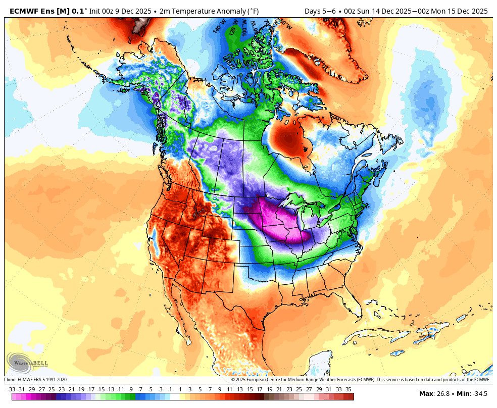
So we are stuck with the same forecast of a 50/50 chance of some precipitation reaching us beyond day 10. One of the things I believe has been messing with the long-range models’ accuracy is the disruption of the Polar Vortex that has been creating very cold air over Alaska and Western Canada that has been sliding south to the east of the Rockies and into the Eastern U.S.
Once that cold, dense air locks in over the East, the ridge gets stuck over the West for long periods of time. The long-range models underestimate the influence of the cold and have it leaving and the western ridge shifting east beyond 10 days. But then, more cold keeps unloading south, and that never happens.
The very cold air is still forming up there two weeks from now, and if it continues to plunge southeast every few days or so, I don’t know that it won’t keep doing that and messing with the long-range forecasts. Any forecast for the ridge in the West to shift east or a trough into the West Coast should be looked at with caution for now IMO.
We can hope that the ridge does weaken enough beyond 10 days to allow storms to track farther south into CA. But that has been the forecast in the long-range for the last couple of weeks and keeps getting pushed out. I’ll continue to watch closely for any signs that cold or storms or both will be returning within 7-10 days.
BA
