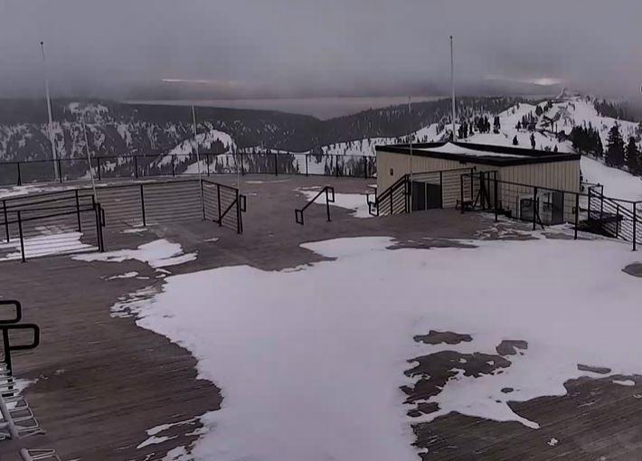
Skip to content
Palisades Tahoe Logo Palisades Tahoe Logo Palisades Tahoe Logo
Explore
Main Menu
  • Explore Palisades Tahoe
  • Base to Base Gondola
  • Our New Name
  • Explore Legendary Lifts
  • Palisades Tahoe Blog
  • About Lake Tahoe
  • About Us
Plan Your Visit
Main Menu
  • Tickets & Passes
  • Lodging
  • Lessons & Guides
  • Deals & Packages
  • Rentals & Demos
  • Travel Here
  • Getting Around
Mountain Information
Main Menu
  • Snow and Weather
  • Lift and Grooming Status
  • Webcams
  • Hours of Operation
  • Trail Maps
  • Parking & Road Conditions
  • Snowfall Tracker
Events & Activities
Main Menu
  • Events Calendar
  • Activities
  • Dining & Apres
  • Shopping
  • Things To Do In Lake Tahoe
  • Groups, Meetings & Weddings
  • Ski & Snowboard Teams
IKON PASS HOLDER LODGING DISCOUNT

Ikon Pass holders save up to 20% on slopeside lodging at The Village at Palisades Tahoe.

SLOPESIDE LODGING
Icon / FlashCreated with Sketch.
View All Offers
  • Weather

Cold & Snowy Pattern Starting Tuesday

  • Feb 20, 2023
  • 8:32 am

President’s Day:

We will see mostly sunny skies Monday with highs into the 40s as high pressure sits near the West Coast.

Tuesday Pattern Change:

Tuesday starts dry with highs hitting the 30s in the morning, but with increasing clouds and winds from the west as a cold front approaches from the north. Ridgetop winds could be gusting up to 80-90+ mph by midday, which will close some upper mountain lifts.

Snow showers could break out by 1 PM and fill in through the afternoon. A band of steadier snow is expected later in the afternoon/evening as the cold front moves through, with snow showers behind the front Tuesday night. Snow levels could start near the base but fall quickly. Powdery snow is expected to fall Tuesday night.

By Wednesday morning we could see 24-hour snowfall totals of:

  • 2-5 inches at the base.
  • 3-6 inches at mid-mountain elevations.
  • 4-7 inches up top.

Wednesday – Friday Snow:

Highs will only be in the teens on the upper mountain and 20s at the base through Friday. Ridgetop winds drop with gusts only up to 30-40+ mph up top Wednesday & Friday, and a possible a bit higher Thursday up to 50-60+ mph. Any wind will make the cold air feel even colder.

We may only see an additional inch or two during the day Wednesday as a weaker wave moves through with scattered snow showers. Then Wednesday night through Friday a slow-moving low moves down the CA coast with steadier snow showers possible, and scattered snow showers into Friday night.

With the very cold air in place, the snow ratios will be high with powdery snow continuing through the period. By Saturday morning we could see 3-day additional snowfall totals of:

  • 12-17 inches at the base.
  • 14-20 inches at mid-mountain elevations.
  • 17-23 inches up top.

World Cup Weekend:

The latest model runs show the low sitting over southern CA into Sunday, with Tahoe on the northern edge or just to the north. We’ll have to watch the trends over the next few days to see if we could see partly sunny skies with highs warming into the 30s, or if clouds and scattered snow showers stick around with slightly colder temps.

We could see the winds increase later Sunday ahead of the next storm moving in Sunday night. This system is expected to be weaker with light snow possible into Monday morning.
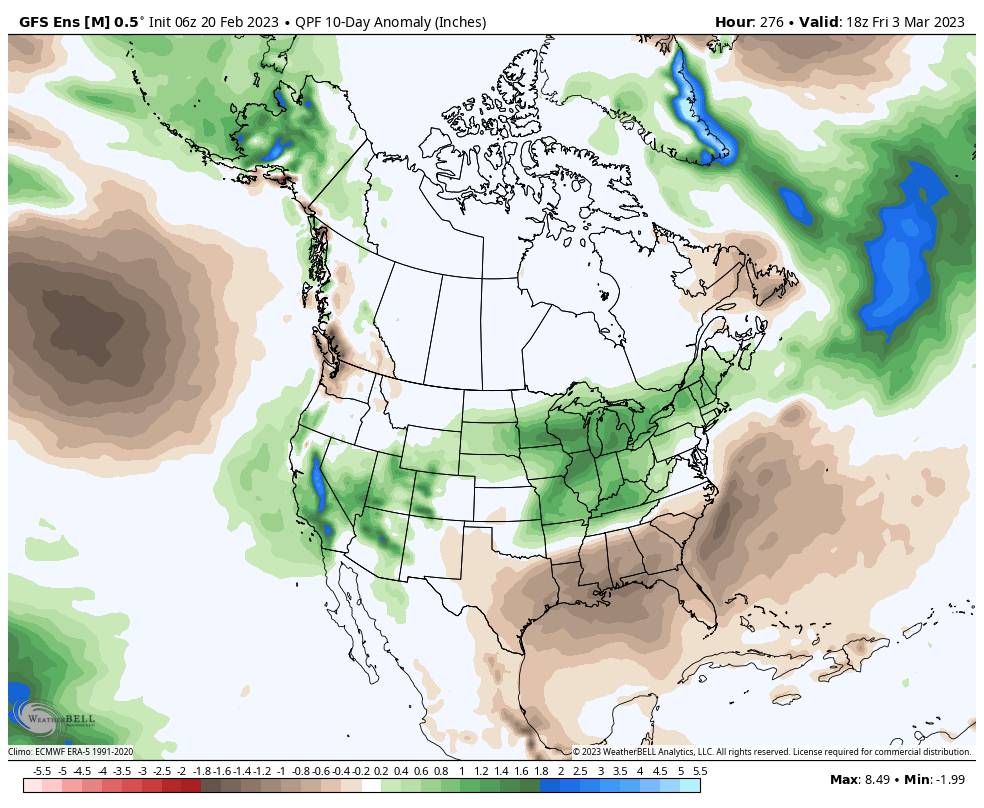
Long-Range:

The long-range models continue to show a wetter storm spinning up off the coast by Monday the 27th that could bring some heavier snow to the northern Sierra through Tuesday the 28th. This storm could drop significant snowfall on the region if the current trends continue.

We could see a brief break later next week, but overall the below-average temperatures and active storm pattern could continue through the 1st week of March into the 2nd. We’ll continue to watch the trends…

BA

lake tahoe weather palisades tahoe weather forecast snowfall forecast
Bryan Allegretto
Bryan Allegretto

Share this article:

Recent Posts

  • Weather ·
  • March 24, 2023·

Drier w/ Spotty Snow Showers thru Sunday

Snowfall Report: 3-5 inches of new snow fell on the mountain, from the base to the upper mountain, in the…
Read more
  • Weather ·
  • March 23, 2023·

Snow Thursday, Drier for the Weekend

Snowfall Report: An additional 2 inches of snow fell on the mountain in the past 24 hours as of 5…
Read more
  • Weather ·
  • March 22, 2023·

Scattered Snow Showers Continue

Snowfall Report: We were expecting 1-4 inches to fall Tuesday-Tuesday night. We picked up the lower end of the forecast…
Read more

Social

Instagram Twitter Facebook Youtube

Contact

   Email Us
   1.800.403.0206

Our Partners

U.S. Forest Service Logo
1960 Olympic Valley Road
Olympic Valley, CA 96146

©2022 Palisades Tahoe

Alterra Mountain Company
  • Privacy Policy
  • Terms of Service
  • Photo Upload Terms of Use
  • Accessibility
  • Do Not Sell My Personal Information
  • Privacy Policy
  • Terms of Service
  • Photo Upload Terms of Use
  • Accessibility
  • Do Not Sell My Personal Information