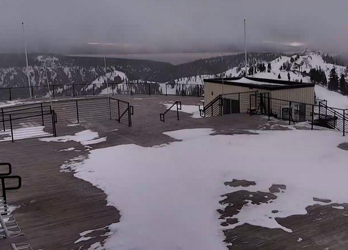
Snowfall Report
Overnight the snow levels stayed on the lower side of the forecast thankfully. We saw mainly snow on the upper half of the mountain. Mountain ops are reporting 5″ of new snow up top as of 6 AM with just rain down at the base and village.
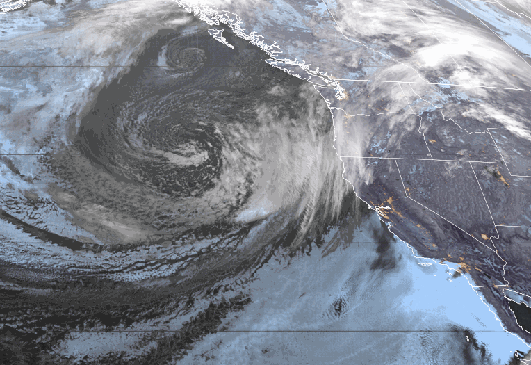
Tuesday – Tuesday Night Storm:
For Tuesday, we have temperatures in the 30s and ridgetop winds gusting up to 100+ mph up top. Those winds should close down quite a few ski lifts. The tricky part of the forecast will be how fast the snow levels fall with the cold front through the day on Tuesday as the heaviest precipitation shifts south of the area by the end of the day.
Snow levels are between 7000-7500 ft. Tuesday morning. They could fall to around 6500-7000 by midday, and below the base during the afternoon. Tuesday night snow levels fall below 5000 ft. as we transition to lighter snow showers that become more scattered overnight and end sometime Wednesday morning. A few to several inches of drier snow is expected Tuesday night.
In total, we are still expecting total snowfall by Wednesday morning of:
- 1-2 feet on the upper mountain.
- 4-12 inches from the base up to mid-mountain.
Wednesday – Wednesday Night:
We have a storm departing Wednesday with some scattered snow showers possible. We will see partly-mostly sunny skies. Highs into the 30s at the base and 20s up top. Lighter winds with ridgetop gusts only up to 40-50+ mph in the morning dropping to 20-30+ mph during the afternoon.
Wednesday should be a fairly decent ski day but the fresh snow on the mountain could be pretty thick under the drier snow on top.
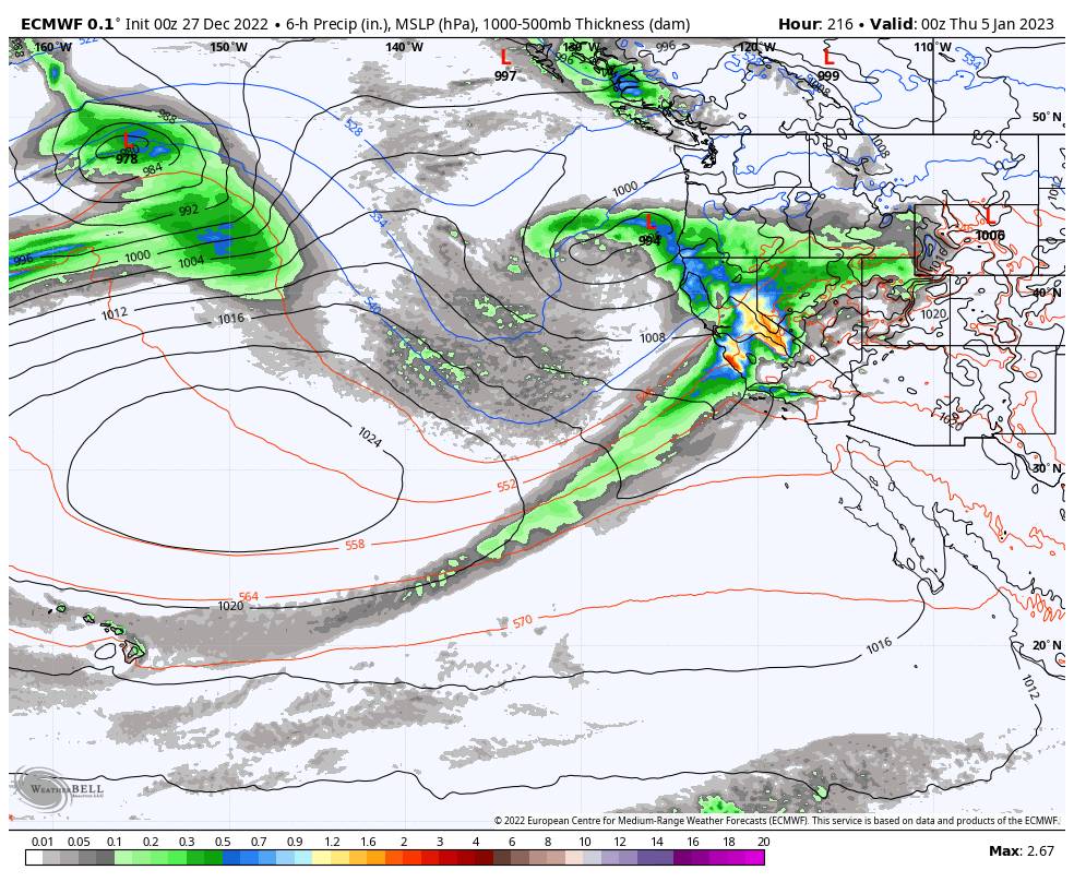
Thursday Storm:
After the break on Wednesday, 3 more storms move through the region back to back Thursday through Saturday night (New Year’s Eve) with little to no breaks expected in between each. Another wild weather pattern is expected with rain & snow, fluctuating snow levels, and gusty winds.
Thursday the next system moving in is colder and weaker and snow levels stay below the base. We should see light snow throughout the day. Ridgetop winds could increase to 50-60+ mph Thursday which could affect some upper mountain lifts. Highs in the 30s at the base and 20s up top.
Snow showers continue into Thursday night. Snow levels stay below the base. By Friday morning we could see an additional:
- 3-6 inches of new snow at the base.
- 5-10 inches of snow on the mountain.
Friday – New Year’s Eve Storms:
The next storm moves in Friday and is wetter and warmer than the Thursday system. We will see steady-heavy precipitation with snow levels rising to around 6200-6700 ft. Friday morning, and then up to around 7200-7700 ft. midday through the afternoon. That means snow turning to rain on the lower mountain again. Highs in the 30s.
The next storm will be even wetter as it moves in Friday night into New Year’s Eve. We should see heavy rain & snow through Saturday. Snow levels rise to around 7900-8400 ft. Friday night. Then snow levels fall to around 7300-7800 ft. Saturday morning and down to 6000-7000 ft. during the afternoon. They continue to fall into Saturday night.
Ridgetop winds gusting up to 80-90+ mph Friday and up to 100+ mph Saturday. Then coming down to 60-70+ mph by Saturday evening. That should close quite a few lifts again for Friday & Saturday. Highs in the 30s.
The storm winds down later Saturday night and the snow intensity could be lighter by the time the New Year’s Eve festivities are going on. Most of the storm is expected to be rain at the base with a few to several inches possible at the end Saturday afternoon/evening.
By Sunday morning we could see additional snowfall amounts of:
- 7-17 inches from the base up to mid-mountain.
- 17-43 inches at the mid-mountain elevations.
- 43-52 inches up top.
There will be a dramatic increase in snowfall amounts on the upper mountain as you go up above 8000 ft. where we should mostly snow.
New Year’s Day:
We have a break between storms for Sunday/New Year’s Day. We should see mostly sunny skies and lighter/breezy winds. Highs into the 30s at the base and 20s up top.
Long-Range:
The next storm could move in sometime on Monday the 2nd into the 3rd. This storm is trending weaker on the latest forecast model runs. Another strong storm is still possible for the 4th-5th, so we’ll keep watching the trends on that one as it gets closer.
We could transition into a somewhat drier pattern with weaker storms as we go into th 2nd week of January. We’ll continue to watch the trends on that as well.
BA