

We have a little good news on Sunday morning as some colder air has settled into some of the lower valleys with the overnight inversions. Temperatures as of 5 AM are in the 20s at the base, while in the upper 30s on the upper mountain. That has allowed the snowmaking team to make some snow on the lower mountain overnight.
Week 1 Forecast:
We continue to be stuck in a dry and mild pattern through next weekend, with the high-pressure ridge anchored over the West and the trough over the East. A strong ridge up in the Bering Sea is helping with the northerly flow into Western Canada, where Arctic air is pooling, and then sliding southeast into the eastern U.S., helping to reinforce the eastern trough.
Over the next week, we can continue to hope for cold enough air in the valleys at night to make some snow, but overall, we will be in a dry and mild pattern. Partly-mostly sunny days with highs into the 40s and 50s up on the mountain, and near 60 degrees at the base later in the week into next weekend.
Week 2 Forecast:
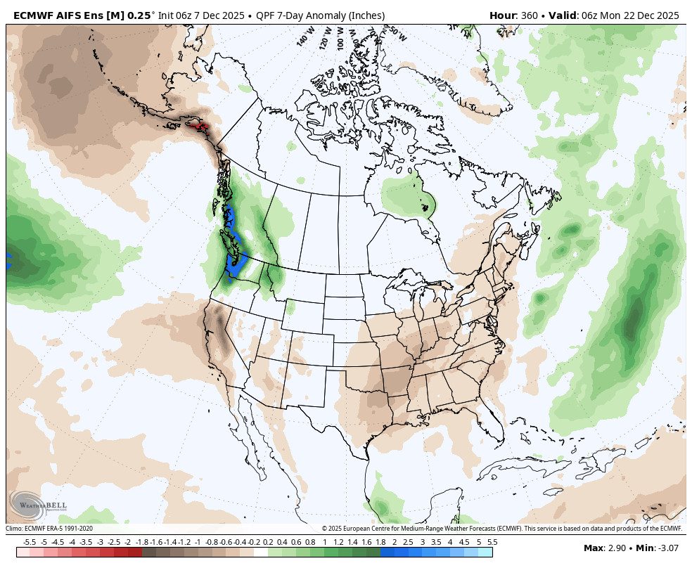
The pattern starts to change a little the week of the 15th. Over the last day or two, the European model has been the most aggressive in showing storms reaching the northern Sierra around the 15th – 17th. The ensemble mean model shows the ridge shifting east a bit and flattening, with a trough digging into the Pacific NW.
Other models show this shift, but have the trough staying farther off the coast with high pressure remaining over CA. The Canadian and European ensemble mean models are flatter with the ridge through week 2, which goes through the weekend of the 20th-21st. That would suggest that the storm track could dig just far enough south to bring back storms to the northern Sierra.
But the GFS and the European AI ensemble mean model are more amplified with the high-pressure ridge over the West during the same period. That is more similar to the pattern we’ve been seeing and will see this week, with the storm track into B.C. and the Pacific NW, but farther north, and continued dry for northern CA.
With the continued disruption of the polar vortex and very cold Arctic air pooling over Canada, which will continue to try and slide down east of the Rockies into the eastern U.S. through mid-December, the long-range models may continue the trend of amplifying the western ridge as we get closer to periods beyond a week.
No matter the outcome, any of the current pattern forecasts would limit colder air to any storms, with the overall pattern keeping mild air over the West through the next two weeks. For now, we’ll hope that the storms can track far enough south to bring us some snow in week 2, but our confidence remains low.
Long-Range Outlook:
The longer-range models are similarly split during week 3, with about half showing the ridge flat enough for the storm track to reach northern CA, and the other half with a more amplified ridge keeping us dry through Christmas. Let’s hope this pattern breaks sooner rather than later.
BA
