The Weekend:
High pressure over the area continues to bring sunny skies and mild temperatures. Highs near 60 degrees at the base Friday and 50s on the mountain. We cool a few degrees for Saturday and Sunday, but highs still into the 50s at the base and maybe dipping into the 40s up top by Sunday.
We should see mostly sunny skies through the weekend. By Sunday afternoon we could see a few clouds and breezy west winds up top. Gusts up to 30+ by afternoon as a dry system swings through the region. It should be a beautiful weekend for the Winter Wondergrass Festival happening at the base all weekend. I’ll see you there!
Next Week:
The trough swings through Sunday into Monday with a shot of slightly cooler air. As high pressure starts to build back into the region Monday the pressure gradient could bring strong gusty winds. We could see gusts from the west up to 70+ mph Monday morning and even strong into the afternoon. That could/should close a few upper mountain lifts.
Then high pressure continues to build in over the region through the end of the week. that will continue the sunny skies and will bring a warm-up. Highs into the 60s at the base by Wednesday through Friday, and 50s on the upper mountain. We may even approach 70 degrees at the base Thursday.
Long-Range:
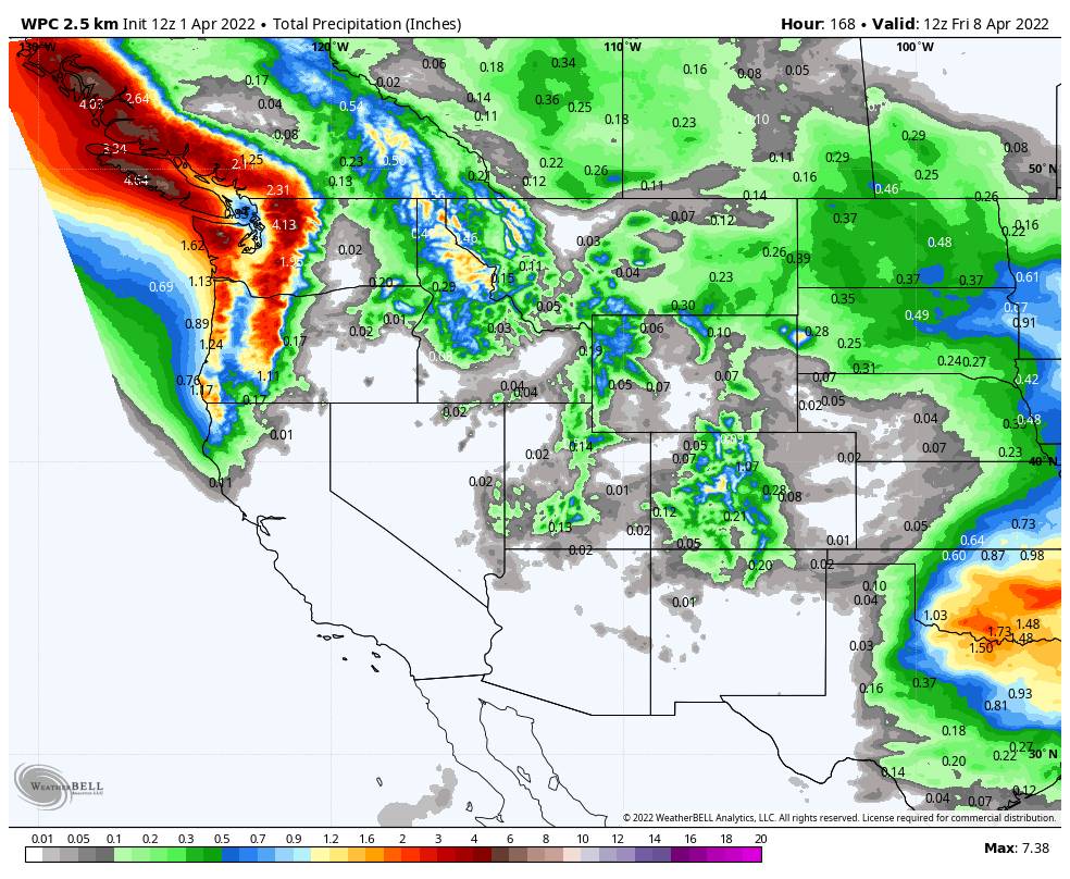
Another trough could push in starting Saturday the 9th into the week of the 11th. This time the trough could hang around through the week and could be deeper than the ones we’ve been seeing. That could bring cooler air and breezy winds again along with the storm track dipping into the northern Sierra.
The long-range models are not sure if the storm track stays mainly to our north through the week of the 11th with only lighter precipitation possible with each system, or if a few could dig farther south and bring us some heavier rain & snow that week. We will continue to watch the trends and will keep you updated as we get closer.
BA