Dry Weather thru Sunday:
The dry pattern will continue into the weekend. Temperatures will warm with highs into the 50s for the lower elevations and 40s for the higher elevations. Mostly sunny skies are expected each day through Sunday.
Monday Storm:
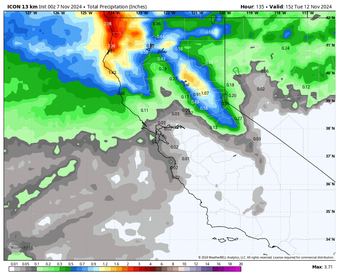
The winds and clouds will be increasing Monday morning, with ridgetop gusts up to 100+ mph possible during the day on Monday. The latest model runs don’t agree on the timing of the arrival of the precipitation ahead of the front. The average seems to point at precipitation moving in by the afternoon and continuing into Monday night.
It’s a fast-moving system and we should see the precipitation end by Tuesday morning. The latest model runs show a range of 0.3 – 0.9 inches of total precipitation falling near the mountain. The snow levels are going to start pretty high, likely above 8000 ft. to start, and only falling to around 6500-7000 ft. by Monday evening. Then dropping below the base Monday night.
The snow levels will likely be the limiting factor for snowfall, especially for the lower elevations. We will see some rain for the lower elevations near the base to start and then some snow Monday night. By Tuesday morning we could see around 1-3 inches near the base, 2-5 inches near mid-mountain, and 3-6 inches up top.
Behind the Storm:
Tuesday we will see clearing with the winds coming down, but colder air behind the front with highs only in the 30s on the mountains to near 40 degrees down near the base. We may only have a short break on Wednesday with the cooler air hanging around before the next trough pushes into the West by Thursday – Friday.
The Next Storm:
With the ridge to the northwest building east and trying to pinch off the trough to the north, we may see a cut-off low scenario with the next storm dropping south down the CA coast. That means it will be hard to predict the track and how far inland precipitation may push next Thu-Fri. We’ll be watching this setup closely over the next week to see if we could see more rain and snow for the Sierra.
Long-Range Forecast:
We may see a break for a few days after that storm finally moves through or around us. Then long-range models continue to show more troughing along the West Coast during the 3rd week of November, and possibly into the last week of the month.
That would lead us to believe that the door will be open to more storms later in the month. That pattern would also keep shots of colder air moving south into northern CA as well to aid with snowmaking.
BA


