The First Week of December:
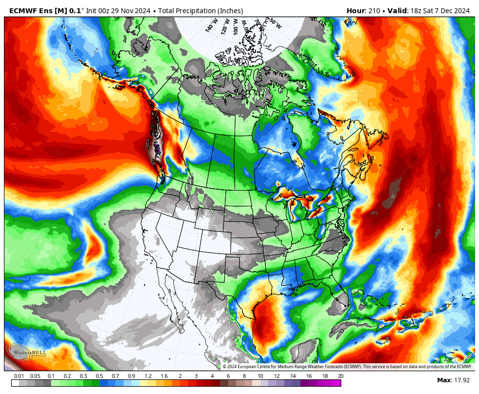
We will be stuck in a dry pattern through the first week of December. High pressure will be stuck over the West through at least the 7th. We will have mostly sunny – sunny skies each day and clear nights.
Highs in the 40s to around 50 degrees down at the base. Overnight lows are in the 20s, but inversions are possible as we go through the week.
The Second Week of December:
Going through the second week of December, the long-range models start to slowly shift the ridge off the West Coast. That could be far enough to get a little bit more northerly flow by mid-month, which could bring in some cooler air.
The position of the ridge would still keep the storm track bumped to the north but maybe a bit farther south. The ensemble mean models show a wetter Pattern for the Pacific NW during the second week of the month, and some light precipitation possibly reaching the northern Sierra.
No signs of a wet storm or anything significant as of now through the 2nd week of December. Maybe just not as mild and maybe a few snow showers before mid-month. Hopefully, some storms will be able to dig far enough south to start bringing snow again with the ridge off the coast.. I’ll be watching closely and will be posting about the latest trends as we go into December…
BA


