
The Weekend:
High pressure has a firm grip on the region through the weekend. Sunny with highs into the 50s and near 60 degrees at the base by Sunday. We are in a stagnant pattern with light winds. Great if you like nice weather, not great if you are trying to make snow. The coldest air is stuck in the valleys with overnight lows above freezing and even 40s up on the mountain.
This is expected to continue through the weekend. The humidity is also rising at night. We will start to see fog layers develop and the higher humidity makes snowmaking even harder with the marginal temperatures. Any snowmaking is limited to the bottom of the mountain if even possible at all some nights.
Next Week:
We are stuck in a pattern that is not a good pattern for cold or snow. The ridge is forecast to be stuck through next week with the dry and mild pattern with sunny days continuing through next Friday. Highs in the 50s for most elevations.
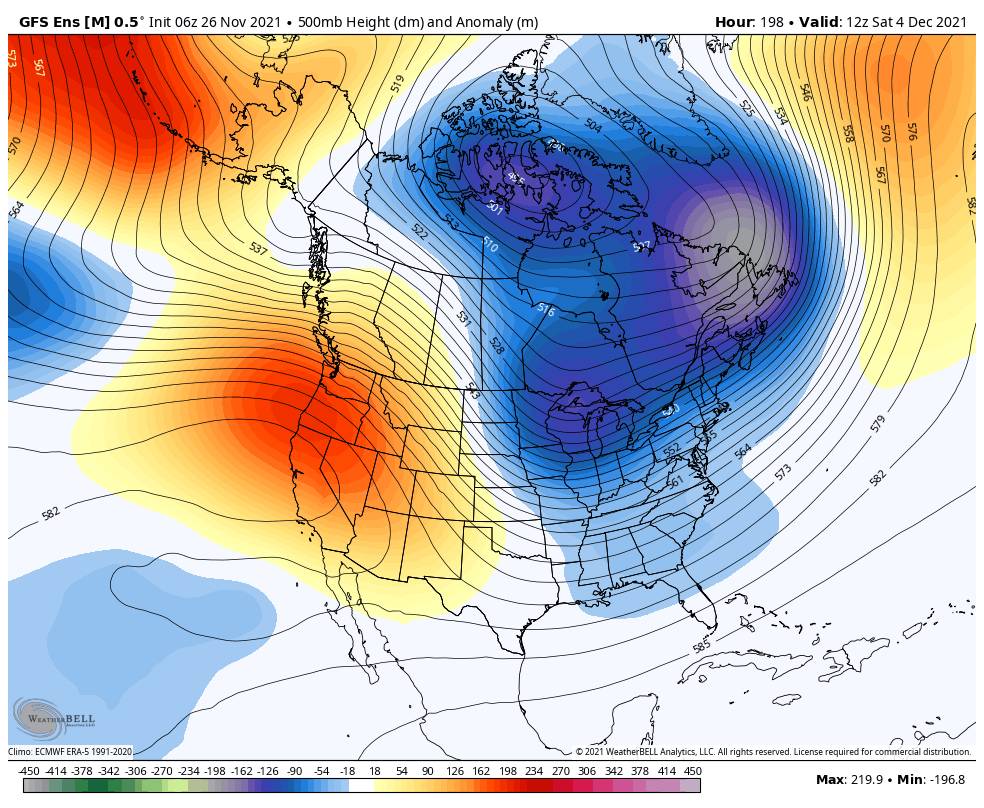
Long-Range:
By the weekend of the 4th, we have been looking at the pattern possibly starting to shift. The long-range models are still showing the ridge weakening and shifting east, but not as far east and without a deep trough digging south don’t the West Coast in the latest model runs. We may just transition from one dry pattern to another, albeit possibly a cooler pattern with colder nights for snowmaking.
The latest long-range models show West Coast troughing by the 8th-10th. They have a dry pattern through the 6th and then are showing weak systems bringing light precip through the 2nd week of December. Let’s hope that turns out to be true. Some colder air and hopefully some natural snow.
I’ll let you know as soon as we have any confidence in a storm that will bring snow to the mountain.
BA


