Skip to content
Palisades Tahoe Logo Palisades Tahoe Logo Palisades Tahoe Logo
Explore
Main Menu
  • Explore Palisades Tahoe
  • Base to Base Gondola
  • Our New Name
  • Explore Legendary Lifts
  • Palisades Tahoe Blog
  • About Lake Tahoe
Plan Your Visit
Main Menu
  • Tickets & Passes
  • Lodging
  • Lessons & Guides
  • Deals & Packages
  • Rentals & Demos
  • Travel Here
  • Getting Around
Mountain Information
Main Menu
  • Snow and Weather
  • Lift and Grooming Status
  • Webcams
  • Hours of Operation
  • Trail Maps
  • Parking & Road Conditions
  • Snowfall Tracker
Events & Activities
Main Menu
  • Events Calendar
  • Aerial Tram
  • Activities
  • Dining & Apres
  • Shopping
  • Groups, Meetings & Weddings
  • Ski & Snowboard Teams
The Village at Palisades Tahoe on a sunny summer day.
BOOK SUMMER EARLY

Book lodging now to save 25% on Sunday-Thursday lodging this summer and fall.

SAVE ON LODGING
Icon / FlashCreated with Sketch.
View All Offers
  • Weather

A Drier & Milder Pattern thru Monday

  • Nov 10, 2021
  • 11:00 am

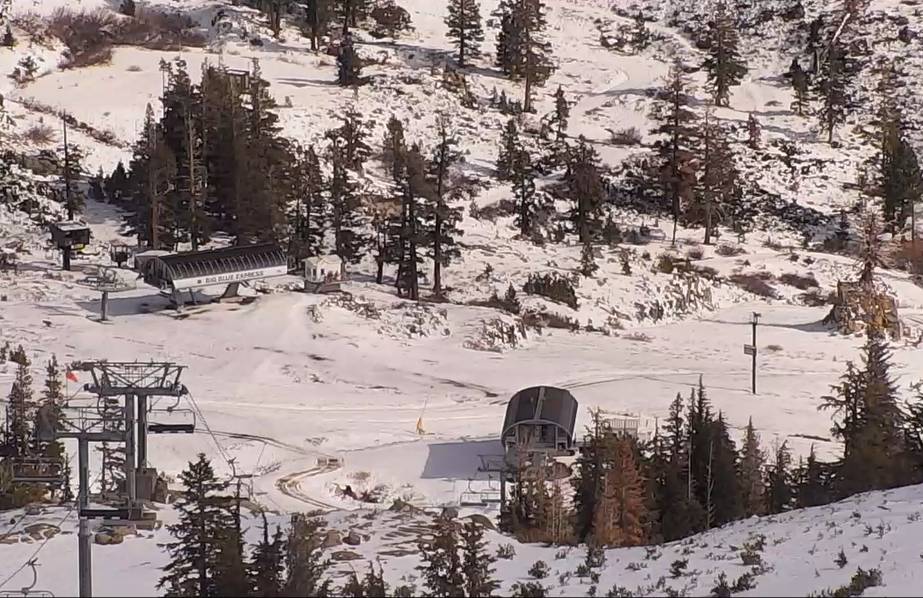
The storm that moved through Monday night into Tuesday brought 7 inches of new snow to the upper mountain and rain to the base. Then a change to rain occurred Tuesday on the upper mountain before the storm moved out.

Wednesday Into the Weekend:

High pressure builds in starting Wednesday with a drier pattern through the weekend and into Monday. Highs in the 50s at the base & 40s up top Wednesday with NW winds gusting to 50+ mph up top. Then lighter winds and warming into the 60s at the base & 50s up top Thursday through Monday with mostly sunny skies.

Cool Down:

A cold front is expected to move through Tuesday – Wednesday of next week. Highs will drop into the 40s at the base and maybe 30s up top. We could see gusty winds and a few snow showers, but some models keep any moisture to our north and east.

Long-Range:

For now, the extended outlook doesn’t show any bigger storms arriving until at least the last week of November.

We will continue to keep an eye on that and let you know as soon as we see a storm on the way that could bring fresh snow to the mountain. In the meantime, we will see colder nights next week for better snowmaking.

BA

lake tahoe weather palisades tahoe weather forecast snowfall forecast
Bryan Allegretto
Bryan Allegretto

Share this article:

Recent Posts

  • Weather ·
  • May 8, 2023·

Final Forecast of the 2022-23 Season

First Week of May Snowfall Report: The first week of May was a cold and snowy one. The upper mountain…
Read more
  • Weather ·
  • May 1, 2023·

Snowy First Week of May

Monday – Friday Snow Shower Chances: A low-pressure system will be making its way south down the coast on Monday…
Read more
  • Weather ·
  • April 29, 2023·

Cooler with Rain & Snow Showers Possible Starting Monday

Saturday – Sunday Weather: It’s another mostly sunny day with some high clouds on Saturday. Highs into the 60s to…
Read more

Social

Instagram Twitter Facebook Youtube

Contact

   Email Us
   1.800.403.0206

Our Partners

U.S. Forest Service Logo
1960 Olympic Valley Road
Olympic Valley, CA 96146

©2022 Palisades Tahoe

Alterra Mountain Company
  • Privacy Policy
  • Terms of Service
  • Photo Upload Terms of Use
  • Accessibility
  • Do Not Sell My Personal Information
  • Privacy Policy
  • Terms of Service
  • Photo Upload Terms of Use
  • Accessibility
  • Do Not Sell My Personal Information