

Monday – Tuesday Weather:
We saw some colder air over the weekend, and temperatures are in the 20s this morning. We will see highs warming into the 40s for the lower elevations, and 30s for the upper mountain, along with partly to mostly sunny skies through Tuesday.
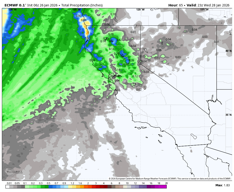
Tuesday Night – Wednesday Morning Snow Showers?
Over the last couple of weeks, we have been discussing a change in the pattern starting around the 28th and lasting through about the 1st-2nd of February, where large storms will be spinning up in the eastern Pacific, but with not much success in pushing inland as they encounter the high-pressure ridge over the West.
Looking at the latest model runs, some continue to show a little bit of precipitation reaching the mountain later Tuesday night into Wednesday morning. Others keep us dry. Snow levels look to dip near the base Tuesday night, so if showers reach us, they should be snow showers.
As of Monday morning, I’m still not expecting more than a dusting of snow near the base, and a coating up to an inch or two up top, at best.
Thursday into the Weekend:
The storms are close to the West Coast into the weekend, but the latest model runs continue to keep precipitation just offshore. All we are expecting right now is the chance for some clouds, with partly to mostly sunny skies each day. Highs warming to near 50 degrees down at the base, 40s on the mountain, and 30s for the highest peaks.
Continued Dry Pattern Next Week:
Heading into the week of the 2nd, the long-range models continue to show high pressure strengthening over the West Coast. That will continue the dry pattern with sunny days and mild temperatures likely through the end of next week.
Long-Range Outlook:
Beyond the 7th, the longer-range models suggest that the ridge over the West Coast starts to weaken and shift NW away from the coast. That allows for a cooler pattern, but high pressure is still in the eastern Pacific, blocking and weakening storms trying to move towards the West Coast.
Some models have the ridge a bit farther north and try to start undercutting precipitation under the ridge into CA during the 2nd week of February, but nothing impressive, and we’ll have to see if that is even plausible as we get closer.
Some of the extended range forecast models continue to show the ridge backing farther NW by mid-February, with troughing backing over the West Coast. It has been showing this for a while now. That may open the storm door a bit more with storms spinning up off the coast and bringing a wetter pattern to the Pacific NW and possibly the northern Sierra into the 3rd week of February.
We continue to grasp at straws during this 5-week dry pattern. I do like the consistency of the European model, and I do like the forecast for the active phase of the MJO to be in the Indian Ocean by the 2nd week of February, and the forecast for a -PNA (West Coast trough) pattern mid-February into March.
But this is all speculative, as it is more than two weeks from now. The only reason we are looking that far out is that, currently, there is nothing significant showing up until then. Hopefully that changes soon…
BA
