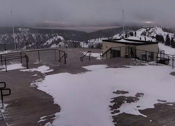
Skip to content
Palisades Tahoe Logo Palisades Tahoe Logo Palisades Tahoe Logo
Explore
Main Menu
  • Explore Palisades Tahoe
  • Base to Base Gondola
  • Our New Name
  • Explore Legendary Lifts
  • Palisades Tahoe Blog
  • About Lake Tahoe
Plan Your Visit
Main Menu
  • Tickets & Passes
  • Lodging
  • Lessons & Guides
  • Deals & Packages
  • Rentals & Demos
  • Travel Here
  • Getting Around
Mountain Information
Main Menu
  • Snow and Weather
  • Lift and Grooming Status
  • Webcams
  • Hours of Operation
  • Trail Maps
  • Parking & Road Conditions
  • Snowfall Tracker
Events & Activities
Main Menu
  • Events Calendar
  • Aerial Tram
  • Activities
  • Dining & Apres
  • Shopping
  • Groups, Meetings & Weddings
  • Ski & Snowboard Teams
Winter Lodging Exteriors of the Village at Palisades Tahoe
Book Winter Early

Ikon Pass holders save up to 25% when you book with The Village at Palisades Tahoe this winter.

SAVE ON LODGING
Icon / FlashCreated with Sketch.
View All Offers

A Break Thu-Fri, More Weekend Snow

  • By Bryan Allegretto
  • Weather
  • Mar 2, 2023

Thursday – Friday:

We will see a break in the active pattern from Thursday into Friday, with mostly sunny skies and highs into the 30s along with lighter winds. We maybe hit 40 degrees in the village Thursday. It should be beautiful!

Weekend Snowstorm:

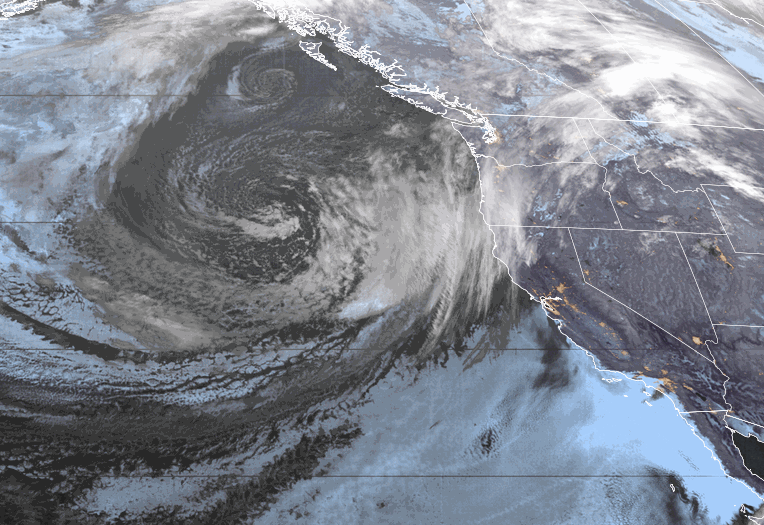
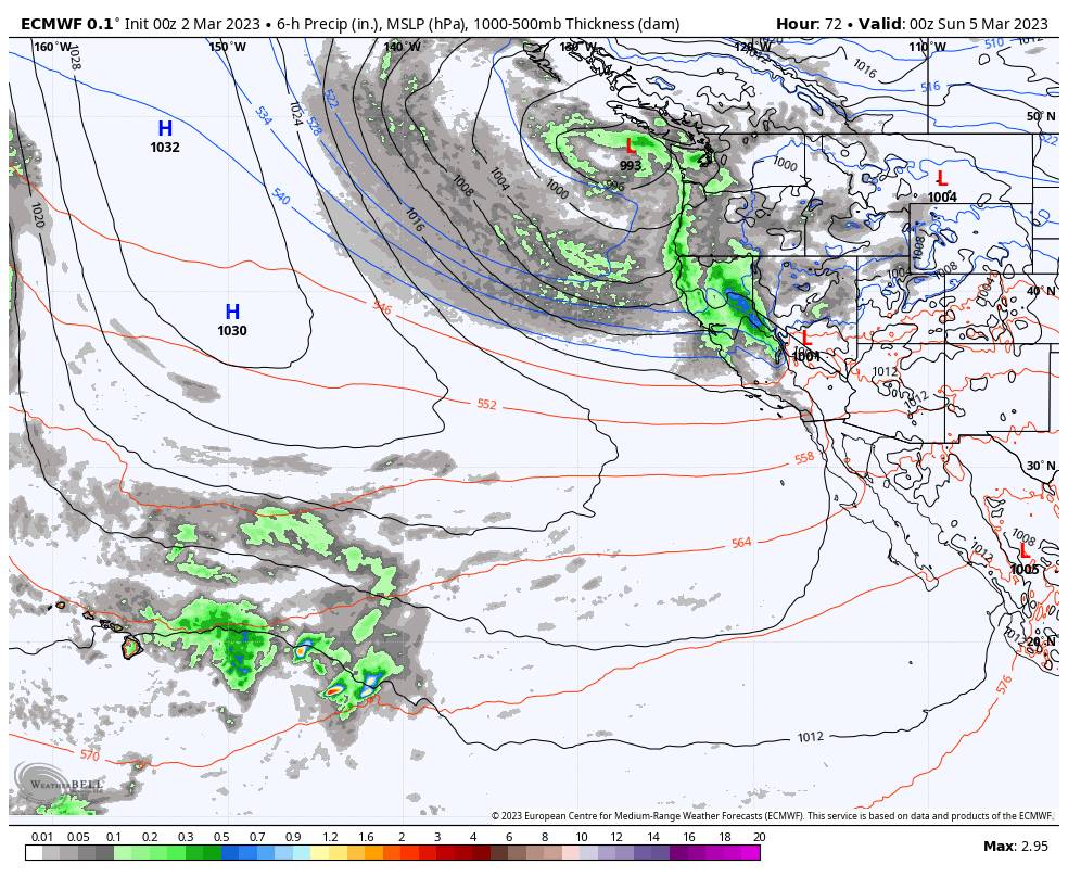
Another cold trough digs into the West Coast Saturday into next week. That will reopen the door to more cold storms Saturday into early next week.

We may see light snow showers move in by early Saturday morning with heavier snow by afternoon and into Sunday. We also expect ridgetop winds to increase to 80-90+ mph Saturday and may only drop to 60-70+ mph Sunday, which will likely close some lifts. Highs drop back down into the 20s for the weekend.

The snow intensity should could down later Sunday into Sunday night but snow showers continue. By early Monday morning here are the expected snowfall totals for the 2-day period.

  • 23-31 inches at the base.
  • 29-36 inches at mid-mountain elevations.
  • 33-41 inches up top.

Monday – Tuesday:

Additional weaker waves continue the snow showers Monday and Tuesday with temperatures remaining in the 20s for highs. We could see a few to several more inches of snow on both days. The winds should not be lighter as well.

Here is a look at the potential snowfall totals for the 2-day period.

  • 3-7 inches at the base.
  • 4-8 inches at mid-mountain elevations.
  • 5-10 inches up top.

Long-Range:

The latest forecast model runs are split on whether or not we could see snow showers continue into Wednesday or if we see a break in the storms.

The latest model runs are also split on whether or not a strengthening Pacific jet stream extends into CA from the 9th-15th bringing us a wet pattern, or if it will stop short of the West Coast and help to pump high pressure over CA bringing us a drier pattern finally. 

We’ll continue to watch the trends with more details as we get closer.

BA

Share this article
lake tahoe weather palisades tahoe weather forecast snowfall forecast
Bryan Allegretto
Bryan Allegretto

Recent Posts

  • Weather ·
  • December 8, 2023·

A Drier Pattern, Possible Storm Next Weekend

Drier Pattern Ahead: We have a cold morning Friday with temperatures in the 20s and teens which is good news…
Read more
  • Weather ·
  • December 7, 2023·

5-15 Inches of New Snow!

Snowfall Report: The wetter model forecasts were right as we saw over an inch of liquid fall on over the…
Read more
  • Weather ·
  • December 6, 2023·

Snow Later Wednesday into Thursday

Windy Wednesday: We will start the day with mostly sunny skies and gusty winds with ridgetop gusts up to 60-70+…
Read more

Social

Instagram Twitter Facebook Youtube

Contact

   Email Us
   1.800.403.0206

Our Partners

U.S. Forest Service Logo
1960 Olympic Valley Road
Olympic Valley, CA 96146

©2022 Palisades Tahoe

Alterra Mountain Company
  • Privacy Policy
  • Terms of Service
  • Photo Upload Terms of Use
  • Accessibility
  • Do Not Sell My Personal Information
  • Privacy Policy
  • Terms of Service
  • Photo Upload Terms of Use
  • Accessibility
  • Do Not Sell My Personal Information