

Snowfall Reports:
The weak system, which basically bumped into the northern Sierra briefly on Monday morning before pulling away, dropped 1-3 inches of additional snow on the mountain. That brings the 5-day total to 44 inches on the upper mountain, and the season total to 146 inches. That is right about the average for the date.
Tuesday Weather:
Mostly sunny and cold for Tuesday with highs in the 30s for the lower elevation and 20s for the higher elevations.
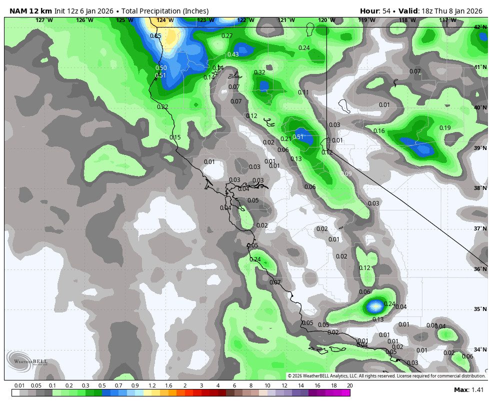
Wednesday Snow Showers:
A pair of quick-moving weak systems will move through to our north on Wednesday and Wednesday night, brushing the northern Sierra with some snow showers.
The snow levels are expected to hover around 5500-6000 ft. during the day on Wednesday, and then drop Wednesday night down below 4000 ft. by early Thursday morning. Some gusty winds over the ridges with highs in the 30s for the lower elevations and 20s for the higher elevations.
We expect all snow to the base with these systems. There is still a bit of a question of how far south the steadier precipitation reaches. We could see a dusting up to 3 inches near the base by Thursday morning, and 2-5 inches on the upper mountain.
Thursday Conditions:
It may not be a lot of new snow, but it will be cold on Thursday as the sun comes out, with highs only in the 20s down to the base. You may want to ski the refresh, as it could be our last for a while.
The Weekend:
High pressure begins to build in over the West Coast through the weekend. Mostly sunny days with highs in the 30s on Friday and then 40s for the lower elevations over the weekend. Much nicer weather than last weekend, and we have a decent base after all of the snow over the past week.
Long-Range Outlook:
The high-pressure ridge is expected to strengthen and sit over the West Coast through the middle of next week. That will bring us a continuation of the sunny days and milder temperatures, along with overnight inversions.
The long-range models continue to show the ridge axis shifting NW towards western Alaska beyond the 15th. Through the 3rd week of January, that may not be enough of a shift for storms to return, other than the chance for weak/cold systems to drop down from the north if any. It’s currently expected to be dry from the 8th through the 3rd week of the month.
As the ridge shifts NW, it will help to build colder air in Canada and push that south into the West during the 3rd week of the month. Highs warm into the 40s next week and maybe back down into the 30s beyond the 15th. I know that temperature forecasts are boring, but they tend to be the only thing to talk about during dry spells.
The longer-range models continue to suggest that the ridge/trough pattern backs a bit more west during the last 7-10 days of January, with the trough more centered over the West Coast, possibly opening the door back up to storms moving into northern CA. Let’s hope…
BA
